Ferreira Gomes | |
|---|---|
Municipality | |
| Municipio de Ferreira Gomes | |
 | |
 Flag  Seal | |
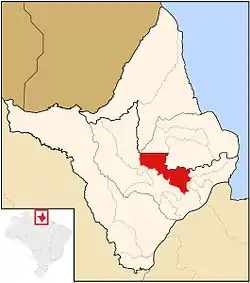
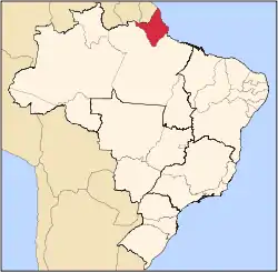
 Location of Ferreira Gomes in the State of Amapá | |
| Coordinates: 00°51′28″N 51°10′48″W / 0.85778°N 51.18000°W | |
| Country | Brazil |
| Region | North |
| State | |
| Founded | 1 January 1989 |
| Government | |
| • Mayor | João Álvaro Rocha Rodrigues (PATRI) |
| Area | |
| • Total | 5,047 km2 (1,949 sq mi) |
| Population (2020) | |
| • Total | 7,967 |
| • Density | 1.6/km2 (4.1/sq mi) |
| Time zone | UTC−3 (BRT) |
Ferreira Gomes (Portuguese pronunciation: [feˈʁejɾɐ ˈɡomis]) is a municipality located in the center of the state of Amapá in Brazil. Its population is 7,967[1] and its area is 5,047 square kilometres (1,949 sq mi).[2] The town began as the military headquarters of Pedro II and was founded by João Ferreira Gomes. In 1989, it became an independent municipality.[3]
Nature
The municipality contains 3.64% of the 2,369,400 hectares (5,855,000 acres) Amapá State Forest, a sustainable use conservation unit established in 2006.[4] It also contains 44.07% of the 460,353 hectares (1,137,560 acres) Amapá National Forest, a sustainable use conservation unit created in 1989.[5]
Economy
.jpg.webp)
The economy is mainly based on agriculture and livestock in particular cattle and buffalo. The main agricultural products are cassava, corn and bananas.[6] In the 1970s, pine plantations were established for the pulp industry.[7] Ferreira Gomes is located on the BR-156 highway.[6]
Hydroelectric Plant
The Coaracy Nunes Hydroelectric Plant (Usina Hidrelétrica Coaracy Nunes) is a hydroelectric power plant located on the Araguari River.[8] It is near Vila do Paredão.[9] Construction started in the 1960s, and was completed in 1978. The plant consists of a 24.9 km2 dam. Originally it only supplied to cities of Macapá and Santana, but was later expanded for the whole region.[8] In 2015, the output was 78 MW.[9]
References
- ↑ IBGE 2020
- ↑ "Ferreira Gomes" (in Portuguese). Brasília: Instituto Brasileiro de Geografia e Estatística. 2014. Retrieved 31 August 2014.
- ↑ "Ferreira Gomes". IBGE (in Portuguese). Retrieved 1 April 2021.
- ↑ FES do Amapá (in Portuguese), ISA: Instituto Socioambiental, retrieved 6 July 2016
- ↑ FLONA do Amapá (in Portuguese), ISA: Instituto Socioambiental, retrieved 6 July 2016
- 1 2 "Historico". Municipality of Ferreira Gomes (in Portuguese). Retrieved 1 April 2021.
- ↑ "Ferreira Gomes". Government of Amapá (in Portuguese). Retrieved 1 April 2021.
- 1 2 "ENERGY SUPPLY AND DEMAND IN AMAPÁ" (PDF). REGMPE. 2017. pp. 2–3.
- 1 2 "Usina Coaracy Nunes completa 39 anos de funcionamento". Diário do Amapá (in Portuguese). Retrieved 1 April 2021.
External links
- Official site (in Portuguese)
 Media related to Ferreira Gomes at Wikimedia Commons
