| Electric Peak | |
|---|---|
 Electric Peak | |
| Highest point | |
| Elevation | 10,969 ft (3,343 m)[1] |
| Prominence | 3,389 ft (1,033 m)[1] |
| Coordinates | 45°00′19″N 110°50′15″W / 45.00528°N 110.83750°W[2] |
| Geography | |
 Electric Peak | |
| Parent range | Gallatin Range |
| Topo map | USGS Electric Peak |
| Climbing | |
| First ascent | 1872 in Henry Gannett and party |
| Easiest route | Hike |
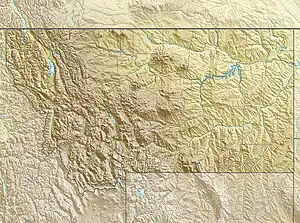
Electric Peak is the tallest mountain in the Gallatin Range of southern Montana, close to the Wyoming border and rising to an altitude of 10,969 feet (3,343 m). The peak has some of the greatest physical relief in Yellowstone National Park, rising 3,389 ft (1,033 m) above its base.
Electric Peak was named during the first ascent in 1872 by the United States Geological Survey. Members of the Hayden Survey led by Henry Gannett[3] experienced electrical discharges from their hands and hair after a lightning event on the summit.[4][5]
Climate
| Climate data for Electric Peak 45.0101 N, 110.8423 W, Elevation: 10,325 ft (3,147 m) (1991–2020 normals) | |||||||||||||
|---|---|---|---|---|---|---|---|---|---|---|---|---|---|
| Month | Jan | Feb | Mar | Apr | May | Jun | Jul | Aug | Sep | Oct | Nov | Dec | Year |
| Mean daily maximum °F (°C) | 22.5 (−5.3) |
21.9 (−5.6) |
26.7 (−2.9) |
32.2 (0.1) |
41.6 (5.3) |
51.6 (10.9) |
63.0 (17.2) |
62.7 (17.1) |
52.9 (11.6) |
39.3 (4.1) |
27.5 (−2.5) |
21.5 (−5.8) |
38.6 (3.7) |
| Daily mean °F (°C) | 14.1 (−9.9) |
12.6 (−10.8) |
16.8 (−8.4) |
21.4 (−5.9) |
30.2 (−1.0) |
39.5 (4.2) |
49.3 (9.6) |
48.9 (9.4) |
40.2 (4.6) |
28.5 (−1.9) |
19.2 (−7.1) |
13.5 (−10.3) |
27.9 (−2.3) |
| Mean daily minimum °F (°C) | 5.8 (−14.6) |
3.4 (−15.9) |
6.8 (−14.0) |
10.7 (−11.8) |
18.9 (−7.3) |
27.3 (−2.6) |
35.6 (2.0) |
35.2 (1.8) |
27.4 (−2.6) |
17.7 (−7.9) |
10.8 (−11.8) |
5.4 (−14.8) |
17.1 (−8.3) |
| Average precipitation inches (mm) | 4.02 (102) |
3.74 (95) |
3.97 (101) |
4.78 (121) |
4.90 (124) |
4.63 (118) |
2.27 (58) |
2.27 (58) |
2.55 (65) |
3.64 (92) |
3.80 (97) |
4.20 (107) |
44.77 (1,138) |
| Source: PRISM Climate Group[6] | |||||||||||||
Gallery
 Electric Peak, ca 1890
 Electric Peak, westside, 1967
- Electric Peak and Rescue Creek, 2012
 Electric Peak from Sepulcher Mountain, November 2020
See also
Notes
- 1 2 "Electric Peak, Montana". Peakbagger.com. Retrieved 2007-03-18.
- ↑ "Electric Peak". Geographic Names Information System. United States Geological Survey, United States Department of the Interior. Retrieved 2009-02-15.
- ↑ Jerry Penry (October 27, 2007). "The Father of Government Mapmaking: Henry Gannett". The American Surveyor. Retrieved 2007-10-28.
- ↑ "Electric Peak". SummitPost.org. Retrieved 2007-03-18.
- ↑ Gannett, Henry (1905). The Origin of Certain Place Names in the United States. Govt. Print. Off. pp. 116.
- ↑ "PRISM Climate Group, Oregon State University". PRISM Climate Group, Oregon State University. Retrieved October 14, 2023.
To find the table data on the PRISM website, start by clicking Coordinates (under Location); copy Latitude and Longitude figures from top of table; click Zoom to location; click Precipitation, Minimum temp, Mean temp, Maximum temp; click 30-year normals, 1991-2020; click 800m; click Retrieve Time Series button.
External links
- Electric Peak Webcam (Struck by lightning and retired in 2016)
This article is issued from Wikipedia. The text is licensed under Creative Commons - Attribution - Sharealike. Additional terms may apply for the media files.
