Vega Alta | |
|---|---|
Village [1] | |
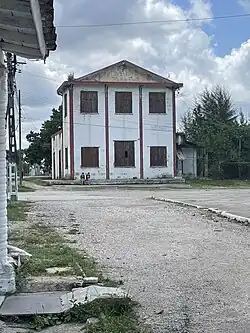 The back of the Railstation in Vega Alta, 2023 | |
.png.webp) Map of Vega Alta (Red) in Camajuaní (Orange) in Villa Clara (Yellow) | |
.svg.png.webp) Vega Alta Map of where Vega Alta is in Cuba 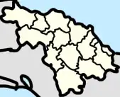 Vega Alta Vega Alta (Villa Clara Province) 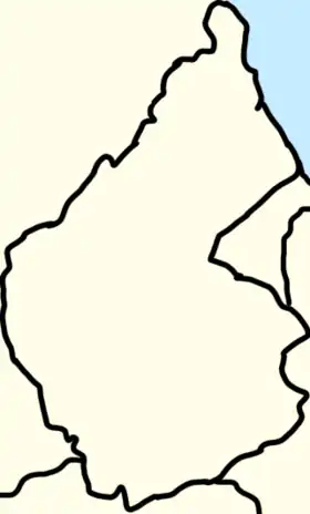 Vega Alta Vega Alta (Camajuaní) | |
| Coordinates: 22°32′59″N 79°49′08″W / 22.54972°N 79.81889°W | |
| Country | Cuba |
| Province | Villa Clara |
| Municipality | Camajuaní |
| Foundation | 1883 |
| Government | |
| • President [2] | Fidel Fernández Mederos |
| Area | |
| • Total | 0.3700 km2 (0.1429 sq mi) |
| Population | |
| • Total | 1,061 |
| • Density | 2,900/km2 (7,400/sq mi) |
| Demonym | Vegaltense |
| Postal Code [4] | 52500 |
Vega Alta is a small town in Camajuaní, Villa Clara, Cuba and a ward (consejo popular). It is in the vicinity of the Sagua la Chica River, with neighboring towns such as Canoa, Chicharón, Rincón, La Levisa, La Luz, La Catalina, La Doncella, and El Cubano.[5]
”Vega Alta” translates to “high valley” in English, referring to the tabaco valleys in the region.
Geography
Ward of Vega Alta
 Map of Vega Altas Ward
 Sign welcoming you to the ward
The Vega Alta’s ward is a local body of Vega Alta and towns nearby.

Legally recognized settlements (aka circunscripciónes) in Vega Alta’s ward include:
- Vega Alta (largest village)
- Benito Ramírez
- Guerrero
- Guajén Camajuaní (part of the settlement of Guajén)

Non-legally recognized settlements in the ward:
- Rincón
- La Levisa (La Lebisa in Spanish)
- El Cubano
- Ibarra
.jpg.webp)
Roads of Vega Alta include the 3 main roads of the town being Calle Gloria (east), Calle Juan Bruno Zayas (middle), and Calle Cornel Casallas (west). In the rural part of the road is the Camino Vega Alta - El Rincón, which goes to the Camino del Guajén in the north and to the south is the continuation of the Calle Juan Bruno Zayas going to the Camino el Cubano by the Curva Verá and the Camino La Luz - Vega Alta by the Curva del CPA, if you go straight you’ll end up in Guerrero.
Town of Vega Alta
Nearby places that are north, northeast, east, southeast, south, southwest, west, and northwest of the town are:
CCS Raúl Torres Acosta
Canoa ![]()
![]()
![]() Rincón
Rincón
Farmland ![]()
![]() Farmland
Farmland
Farmland ![]()
![]()
![]() La Luz
La Luz
Carmita
In 2018, Villa Clara was flooded through out the entire province, in Camajuaní the places that were flooded were El Rincón, El Guajén, Sagua la Chica, Macagual, Guerrero, Floridano, Vega Alta, and Vega de Palma.[6]
Park Vega Alta

The Park of the town of Vega Alta (Parque del poblado de Vega Alta) shorten to Park Vega Alta[7] is the only park in Vega Alta, is it about 850 m2. It's one of 4 places in Camajuani which has free WiFi.[8]
.jpg.webp) Statue of Juan Bruno Zayas
Statue of Juan Bruno Zayas Statue of José Martí
The park contains a statue of José Martí at the front and a statue of Juan Bruno Zayas in the center.
El Cubano

El Cubano also known as La Flora is a hamlet[9] in Vega Alta’s ward. El Cubano is located on the Camino el Cubano, to the south is Luis Arcos Bergnes, to the north is Vega Alta, to the west is the Sagua La Chica River and to the east is the Loma de Juan Ramón (hills of Juan Ramón) and after La Luz.
History
Three months after the Ten Years' War started fighting broke out in Remedios. On February 14, 1869, a Venezuelan named Salomé Hernández, who was working for Dos Hermanos de los Fusté Suger Mill, got armed and took some slaves from the Ingenio. Salomé and her troops were aimed at burning sugar mills in El Cubano and other towns nearby.[10]
El Cubano used to be a part of the barrio of Vega Alta, where it was called “Finca el Cubano” or “Farm El Cubano”.[11]
In 2021, the Government of Camajuaní stated that it’s pending to rearrange the Camino del Cubano in the Segundo Proceso de Rendición de cuenta del XVII Período de Mandato (Second Accountability Process of the XVII Mandate Period),[12] but it appears to be the same as of 2023.
Government
Camajuaní has multiple Constituency Delegate (Delegado Circunscripción) for every ward, Vega Alta’s ward has:[13] (as of April 5, 2023)
- Constituency Delegate #58 Isoel González Quintanal
- Constituency Delegate #59 Santos Rodríguez González
- Constituency Delegate #60 Rafael Gómez Rodriguez
- Constituency Delegate #61 Fidel Fernández Mederos (president of Vega Alta [2])
- Constituency Delegate #66 Luis Antonio Castillo Mesa
Education
 Wilfredo Cabrera Portal Secondary
 Juan Francisco Aro Primary
Schools in Vega Alta include:
- Benito Ramírez Rodríguez Primary in CPA Benito Ramírez
- Juan Francisco Aro, in Gloria Road [14]
- Serafín Sánchez Valdivia Primary in Guerrero
- Boris Luis Santa Coloma Primary in La Lorenza
- Wilfredo Cabrera Portal Primary in El Rincón
- Wilfredo Cabrera Portal Secondary in Gloria Road

Vega Alta also has one public library being “Biblioteca publica Juan Bruno Zayas” or Juan Bruno Zayas Public Library in English.[15] The library is also called the “Biblioteca Vegaltense”, or “Vegaltense Library”.[16]
History
Foundation
Vega Alta was founded in 1883 when the families of Rafael Pérez Borroto, Don Vicente Revuelta and Manuela Rodríguez settled there.
It was named "Vega Alta" due to the avenues of the Sagua la Grande river which flooded the nearby land without ever reaching Vega Alta.[17]
Juan Bruno Zayas
At the end of 1892, Juan Bruno Zayas moved to the town of Cifuentes, and began to practice there under the protection of Dr. Plazaola, a friend of the Zayas family. He later went to the town of La Quinta and finally settled in Vega Alta, where he settled permanently in partnership with his partner.[18]
Attack of Vega Alta
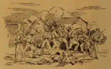
During the Cuban War of Independence on a afternoon, the ESDE of Camajuani notified General Luque, military governor of the Santa Clara Province, of a large insurgent party of Vega Alta that wanted to take over the town according to reports,[19] : page 723 the attack was the first “patriotic” uprising of Las Villas against the "colonial government".[20]
General Luque then ordered the administrator of the Sagua la Grande's railway to have a train ready in Camajuaní to lead troops to Vega Alta. He also ordered the military commander of the battle. They have sent a total of a column of 230 infantry men and some horses, under the command of lieutenant colonel Alfonso XITI, Mr. Velarde to the battle.[19] : page 723
During the wait for the train to follow orders, insurgents advanced on Vega Alta and shot at the town, being stopped by a detachment of thirty men, under the command of the second lieutenant, garrisoned a fort (without defensive positions) that was in the town. Later the train arrived that took the troops of lieutenant colonel Senor Velarde to Tunicú and Canoa, where the troops dismounted, and marched towards Vega Alta, in anticipation that the enemy had cut the bridge that exists over the Sagua la Chica River, before reaching Tuinicú, and could of caused a catastrophe for the troops. The troops reached Vega Alta in the critical moment where the enemy was ready to enter the assault, with insurgents fleeing at first shots (mostly volunteers and fifths).[19] : page 724 [10]
Fearing that there was an advanced party waiting for the train to attack, Luque ordered to stop the train and go attack the rebels. On both sides there was a fire, where they all went to the direction of El Salto. As they were leaving, another train going from Camajuani to Sagua when learning of what was happening, left Vega Alta back to Camajuani, which caused an alarm in the population.[19] : page 725
Lieutenant colonel military commander of Remedios, Mr. Devós, arrived shortly after to Camajuani, and when finding out what was happening, he ordered all the volunteer force that he gathered and reconcentrated immediately go to the freight train, preceded by a scanning machine of the Caibarién line, to Vega Alta. Upon his arrival he found the column of Lieutenant Colonel Señor Velarde, who informed him of the dispersion and flight of the enemy and he returned to Camajuaní on the same train. Mr. Velarde then go to find the enemy.[19] : page 725
The parties that have attacked Vega Alta are said to have been commanded by Pole Roloff who is accompanied by the leaders Serafín Sánchez and Ramón Cabrera (commander), the latter from the United States. With over 1,000 people fighting with the rebels.[19] : page 726
After Juan Bruno Zayas and the rebels left Vega Alta, the first town he encountered was Guerrero.[18]
Barrio of Vega Alta
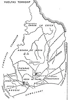
Until 1976 Vega Alta was a barrio of the former San Antonio de las Vueltas Municipality.[17][21] : page 48 Settlements that used to be a part of the barrio of Vega Alta were Vega Alta (main town), El Cubano, La Luz, Luis Arcos Bergens (called Carmita at the time), and more.
The barrio included the hills (lomas) and L.V. of Loma Sinaloa, LV El Mogote, LV Loma El Hacha, LV El Hoyón, Loma Sola, and LV La Sierra.[22]
Transportation
.jpg.webp)
Vega Alta is on a railine starting in Santa Clara, going to Crucero Margot, to Luis Arcos Bergnes, Vega Alta, Canoa, Tuinicu, Constancia, Encrucijada, Mata, El Vaquerito, Aguada la Piedra, Cifuentes, San Diego del Valle, Conyedo, and finally back to Santa Clara.[23][24]
There two trains of the Vega Alta rail station, one going from Camajuani to Vega Alta and one going from Vega Alta to Santa Clara.[25]
The state public transportation in Camajuaní has a route going from Camajuaní to Vega Alta.[26]
The current railway station isn’t in use, with it formerly being a home at one point. The Government of Camajuaní stated that it’s pending to fix the roof of the building, under the Second Accountability Process of the XVII Mandate Period. [12]
Demographics
| Historical population | |||
|---|---|---|---|
| 1909 | 2500 | ||
| 1919 | 3462 | ||
| 1931 | 4147 | ||
| 1943 | 4732 | ||
| 2002 | 1149 | ||
| 2009 | 1149 | ||
| 2012 | 1061 | ||
| Source: Guije, CityPopulation.de, and Oficina Municipal de Estadística (page 77), Military notes on Cuba, 1909 | |||
Economy
According at the DMPF (Departamento de control de la Dirección Municipal de Planificación Física or Management Control Department Municipal Physical Planning in English) of Camajuani, Vega Alta is a settlement linked to sources of employment or economic development.[21] : page 67
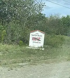
Vega Alta has the CCS - which are farmlands home to many private farms with one leader governoring the CCS and with most the products going to the national and local governments - of CCS Raúl Torres Acosta in La Lebisa and CCS Mártires de Vueltas in Guerrero. It has the CPA of CPA Benito Ramirez
Culture

Vega Alta celebrates the Parrandas, a celebration throughout central Cuba, every year.
Resources
Vega Alta, Sagua la Chica, and Crecencio Valdés are the only towns in Camajuani that make clay.[21] : page 77
Vega Alta has the collections of Urocoptis villarensis, also known as Centralia villarensis, of the Urocoptidae family, of the Carnegie Museum of Natural History are one in the main town of Vega Alta found in 1931, and one in La Sinaloa. Of the Field Museum of Natural History Invertebrates it has 2 in the main town and 9 in La Sinaloa. Of the Florida Museum of Natural History it has one in Loma Sinaloa and 2 in Loma Murcielagos. Of the Museum of Comparative Zoology of Harvard it has 3 in Rincon, 30 in Loma Murcielagos, 10 in El Hacha, 13 in Vereda del Abra, 50 in La Sinaloa, 20 in Loma Sinaloa, 3 in El Guajen, and 13 in Loma Sola. Of the Illinois Natural History Survey it has 2 in the main town. Of the SDNHM Marine Invertebrate Collection it has 5 in the main town and 4 in Loma La Sinaloa.[27]
Sports
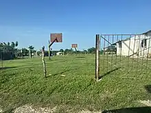
Vega Alta has 3 sports fields, 1 volleyball and 1 basketball field owned by the Secondary and Primary schools, and one baseball/kickball field which is public.
See also
References
- ↑ "Node: Vega Alta (1546398655)".
- 1 2 "Crecen los intercambios con el pueblo de los candidatos a Diputados por Camajuaní". Telecubana (in Spanish).
- ↑ "Camajuaní (Municipality, Villa Clara Province, Cuba) - Population Statistics, Charts, Map and Location".
- ↑ "Vega Alta Villa Clara Postal / ZIP Codes". getpostalcodes.com.
- ↑ "List of Cities near Vega Alta in Villa Clara, Cuba". www.gomapper.com. Retrieved 2022-06-27.
- ↑ "Francisnet Díaz Rondón". www.facebook.com. Retrieved 2023-07-18.
- ↑ "Park Vega Alta". ETECSA.
- ↑ EPP. "Villa_Clara - Áreas WIFI Camajuaní". Villa_Clara (in European Spanish). Retrieved 2023-01-04.
- ↑ "Claro de luna: el bar surgido en las ruinas de un mítico central villaclareño - CubaNet". www.cubanet.org. Retrieved 2023-04-14.
- 1 2 "Portal del Ciudadano en Camajuaní - Un poco de historia".
- ↑ Aires, Club Universitario de Buenos (1954-08-26). Gaceta Oficial (in Spanish).
- 1 2 AMPP, Comunicadora Social (2022-02-16). "Portal del Ciudadano en Camajuaní - Informe Rendición de Cuenta a la AMPP sobre la Gestión del Consejo de la Administración Municipal durante el año 2021". Portal del Ciudadano en Camajuaní (in European Spanish). Retrieved 2024-01-11.
- ↑ "Portal del Ciudadano en Camajuaní - Consejo Popular Vega Alta". www.soycamajuani.gob.cu. Retrieved 2022-12-24.
- ↑ "Portal del Ciudadano en Camajuaní - Educación". www.soycamajuani.gob.cu. Retrieved 2022-12-23.
- ↑ "Crecen los intercambios con el pueblo de los candidatos a Diputados por Camajuaní". Telecubanacán (in Spanish). 2023-03-09. Retrieved 2023-04-15.
- ↑ marelys.diazguerra (2021-04-26). "El renacer de la biblioteca vegaltense". Telecubanacán (in Spanish). Retrieved 2023-06-20.
- 1 2 "San Antonio de las Vueltas". www.guije.com. Retrieved 2022-08-27.
- 1 2 "Juan Bruno Zayas, general de brigada del Ejército Libertador ; Apuntes biográficos de Juan Bruno Zayas ; apuntes biográficos de este ilustre patriota - Francisco López Leiva - Libri digitali | openMLOL". open MLOL. Retrieved 2023-07-15.
- 1 2 3 4 5 6 Reverter Delmás, Emilio (1896). Cuba española; reseña histórica de la insurrección cubana en 1895. Ilustrada por Francisco Pons. Robarts - University of Toronto. Barcelona A. Martin.
- ↑ "- Nacionales". www.granma.cu. Retrieved 2023-05-31.
- 1 2 3 Barroso, Joel Jiménez; Figueroa Vidal, Dr. Arq. Carlos. R. "Diagnóstico estratégico de la situación habitacional del municipio de Camajuaní" (PDF).
- ↑ Técnica, Universidad de La Habana Centro de Información Científica y (1975). Ciencias: Ciencias bioloǵicas. Serie 4 (in Spanish). The Center.
- ↑ lezumbalaberenjena (2017-11-09), Composed road map from a tour guide (1980's), retrieved 2023-04-12
- ↑ "Road guides of Cuba" (PDF). 2019.
- ↑ Mi peor VIAJE CASI no la CONTAMOS viaje a VEGA ALTA #cuba #youtubercuba, retrieved 2023-07-06
- ↑ "Dayron Perez Urbano". www.facebook.com. Retrieved 2023-07-18.
- ↑ "STRI Marine Portal Collection Search Parameters". invertebase.org. Retrieved 2023-06-09.