Drieborg | |
|---|---|
 Drieborg | |
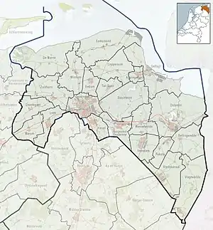
 Drieborg Location in province of Groningen in the Netherlands  Drieborg Drieborg (Netherlands) | |
| Coordinates: 53°12′22″N 7°10′51″E / 53.2061°N 7.1808°E | |
| Country | Netherlands |
| Province | Groningen |
| Municipality | Oldambt |
| Area | |
| • Total | 19.90 km2 (7.68 sq mi) |
| Elevation | 0 m (0 ft) |
| Population (2021)[1] | |
| • Total | 470 |
| • Density | 24/km2 (61/sq mi) |
| Time zone | UTC+1 (CET) |
| • Summer (DST) | UTC+2 (CEST) |
| Postal code | 9688 |
| Dialing code | 0597 |
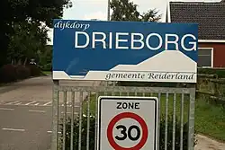
Drieborg (Dutch pronunciation: [ˈdribɔrx]; also: Stocksterhorn;[3] Gronings: Drijbörg [ˈdrɛːɪ̯bœːχ]) is a dike village in the Dutch province of Groningen. It is a part of the municipality of Oldambt.
History
The village started along a dike on the Dollart as Stocksterhorn.[3] In 1656, the dike was extended to Nieuweschans.[3] Due to the proximity to the border, a redoubt was constructed in Stocksterhorn. In 1673, the Bishop of Münster conquered the redoubt.[4] On 26 August 1818, the village was first referred to as Drieborg in the Provincial Council of Groningen.[5]: 1 The origin of the name is unclear. The most likely explanation is "three boroughs" (fortified settlements), which however cannot be correct.[6] The village used to be a part of the municipality of Beerta.[3]

Drieborg was mainly inhabited by farm workers. During the 20th century, Drieborg was a stronghold of the Communist Party of the Netherlands.[7][8] In 1929, a widespread farmers' strike was organised in Drieborg. After World War II, 60 of the 170 houses in the village were demolished.[3]
In 1903, a church was built in Drieborg, but was demolished in 1928.[3] Drieborg still has a school.[5]: 4 The population of the village is steadily decreasing, but the average income is increasing, although still near the poverty line.[9]
In 1990, the municipality was merged into Reiderland which in turn was merged into Oldambt in 2010.[3]
References
- 1 2 "Kerncijfers wijken en buurten 2021". Central Bureau Statistics. Retrieved 2 March 2022.
- ↑ "Postcodetool for 9688RA". Actueel Hoogtebestand Nederland (in Dutch). Het Waterschapshuis. Retrieved 2 March 2022.
- 1 2 3 4 5 6 7 "Drieborg". Plaatsengids (in Dutch). Retrieved 2 March 2022.
- ↑ W.E. van Dam van Isselt (1931). De verdediging van Friesland in 1672-1673 (in Dutch). The Hague: Nijhoff. p. 163.
- 1 2 "Dorpsvisie Drieborg" (PDF). Municipality of Oldambt (in Dutch). Retrieved 2 March 2022.
- ↑ "Drieborg - (geografische naam)". Etylomogie Bank (in Dutch). Retrieved 2 March 2022.
- ↑ "Voor het partijcongres van de CPN". Het volksdagblad (in Dutch). 26 March 1938. Retrieved 2 March 2022.
The village of Drieborg (~500 people) had raised more money for the Communist Party than the city of The Hague (~500,000 people)
- ↑ "Beerta". Nieuwsblad van het Noorden (in Dutch). 1 June 1978. Retrieved 2 March 2022.
The Communist Party had an absolute majority in Beerta, and two of the six communist councillors were from Drieborg
- ↑ "Drieborg Centrum Oldambt". Alle Cijfers (in Dutch). Retrieved 2 March 2022.