Didaur
Dedaur | |
|---|---|
Village | |
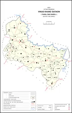
 Map showing Dedaur (#402) in Sataon CD block | |
 Didaur Location in Uttar Pradesh, India | |
| Coordinates: 26°14′37″N 81°10′28″E / 26.243702°N 81.17456°E[1] | |
| Country India | |
| State | Uttar Pradesh |
| District | Raebareli |
| Area | |
| • Total | 9.83 km2 (3.80 sq mi) |
| Population (2011)[2] | |
| • Total | 4,781 |
| • Density | 490/km2 (1,300/sq mi) |
| Languages | |
| • Official | Hindi |
| Time zone | UTC+5:30 (IST) |
| Vehicle registration | UP-33 |
Didaur, also spelled Dedaur, is a village in Sataon block of Rae Bareli district, Uttar Pradesh, India.[2] It is located 8 km from Raebareli[3] on the road to Unnao, just east of the intersection with the road to Lalganj.[4] It is near the right bank of the Sai river.[4] As of 2011, Didaur has a population of 4,781 people, in 900 households.[2] The village hosts two annual festivals: one is the Badhwapur-ka-Mela, which is dedicated to the worship of Nag Devta and is held on Bhadra Sudi 5, and the other is the Jhurhapur-ka-Mela, which is dedicated to worship of Rama and falls on Phalguna Sudi 8.[5]
History
At the turn of the 20th century, Didaur was described as a large but otherwise unremarkable village, held in taluqdari tenure by the Raja of Birsinghpur as part of the Simarpaha estate.[4] The population in 1901 was 2,224, more than half of whom were Kurmis, and there was an aided school in the village.[4]
The 1961 census recorded Didaur (as "Dedaur") as comprising 3 hamlets, with a total population of 2,125 people (1,119 male and 1,006 female), in 512 households and 496 physical houses.[5] The area of the village was given as 2,475 acres and it had a post office and medical practitioner at that point.[5] It also had one grain mill, one small miscellaneous food processing establishment, and one manufacturer/repairer of items not assignable to any group.[5] Average attendance of the Badhwapur-ka-Mela and Jhurhapur-ka-Mela festivals was about 400 people each then.[5]
The 1981 census recorded Didaur (as "Dedaur") as having a population of 3,406 people, in 609 households, and having an area of 1,012.96 hectares.[3] The main staple foods were given as wheat and rice.[3]
References
- ↑ "Geographic Names Search WebApp". Search for "Didaur" here.
- 1 2 3 4 "Census of India 2011: Uttar Pradesh District Census Handbook - Rae Bareli, Part A (Village and Town Directory)" (PDF). Census 2011 India. pp. 202–18. Retrieved 9 August 2021.
- 1 2 3 Census 1981 Uttar Pradesh: District Census Handbook Part XIII-A: Village & Town Directory, District Rae Bareli (PDF). 1982. pp. 102–3. Retrieved 9 August 2021.
- 1 2 3 4 Nevill, H.R. (1905). Rai Bareli: A Gazetteer, Being Volume XXXIX Of The District Gazetteers Of The United Provinces Of Agra And Oudh. Allahabad: Government Press. pp. 172–3. Retrieved 9 August 2021.
- 1 2 3 4 5 Census 1961: District Census Handbook, Uttar Pradesh (39 - Raebareli District) (PDF). Lucknow. 1965. pp. 168–9, xl-xli of section "Rae Bareli Tahsil", cxxii, cxxv–cxxvi. Retrieved 9 August 2021.
{{cite book}}: CS1 maint: location missing publisher (link)