De Veenhoop
De Feanhoop | |
|---|---|
Village | |
 | |
 Flag  Coat of arms | |
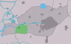
 Location in Smallingerland municipality | |
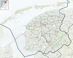
 De Veenhoop Location in the Netherlands  De Veenhoop De Veenhoop (Netherlands) | |
| Coordinates: 53°5′49″N 5°56′59″E / 53.09694°N 5.94972°E | |
| Country | |
| Province | |
| Municipality | |
| Area | |
| • Total | 9.75 km2 (3.76 sq mi) |
| Elevation | −1.0 m (−3.3 ft) |
| Population (2021)[1] | |
| • Total | 260 |
| • Density | 27/km2 (69/sq mi) |
| Postal code | 9215[1] |
| Dialing code | 0512 |
De Veenhoop (West Frisian: De Feanhoop) is a village in Smallingerland municipality in the province of Friesland, the Netherlands. It had a population of around 245 in January 2017.[3]
History
The village was first mentioned between 1851 and 1855 as De Veenhoop, and means "place where peat is excavated".[4] De Veenhoop developed in the late 19th century at the intersection of the Polderhoofdkanaal and the Grietmansrak as a peat excavation village.[5]
Nature
The Petgatten de Feanhoop is a nature area on the edge of De Alde Feanen National Park. The 200 hectares (490 acres) area of lakes and swamp forest attracted a large variety of bird life, and is a protected area since 1996.[6][5]
Gallery
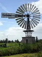
 Windmotor Herkules
_67.jpg.webp) Draw bridge Polderhuis
Draw bridge Polderhuis_61.jpg.webp) Sluice
Sluice_48.jpg.webp) Hotel
Hotel
References
- 1 2 3 "Kerncijfers wijken en buurten 2021". Central Bureau of Statistics. Retrieved 3 April 2022.
- ↑ "Postcodetool for 9215MA". Actueel Hoogtebestand Nederland (in Dutch). Het Waterschapshuis. Retrieved 3 April 2022.
- ↑ Bevolkingscijfers Archived 2017-11-07 at the Wayback Machine - Smallingerland
- ↑ "Veenhoop - (geografische naam)". Etymologiebank (in Dutch). Retrieved 3 April 2022.
- 1 2 "De Veenhoop". Plaatsengids (in Dutch). Retrieved 3 April 2022.
- ↑ "Petgatten de Feanhoop". It Fryske Gea (in Dutch). Retrieved 3 April 2022.
External links
![]() Media related to De Veenhoop at Wikimedia Commons
Media related to De Veenhoop at Wikimedia Commons
This article is issued from Wikipedia. The text is licensed under Creative Commons - Attribution - Sharealike. Additional terms may apply for the media files.