De Steeg | |
|---|---|
 Catholic church | |
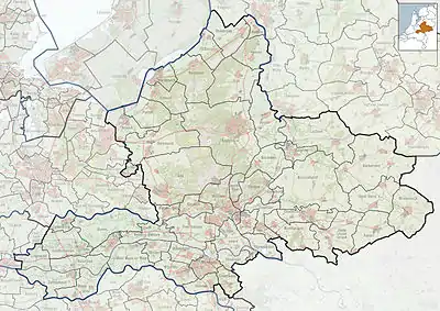
 De Steeg Location in the Netherlands  De Steeg De Steeg (Netherlands) | |
| Coordinates: 52°01′N 6°04′E / 52.017°N 6.067°E | |
| Country | Netherlands |
| Province | Gelderland |
| Municipality | Rheden |
| Area | |
| • Total | 9.63 km2 (3.72 sq mi) |
| Elevation | 21 m (69 ft) |
| Population (2021)[1] | |
| • Total | 1,005 |
| • Density | 100/km2 (270/sq mi) |
| Time zone | UTC+1 (CET) |
| • Summer (DST) | UTC+2 (CEST) |
| Postal code | 6994[1] |
| Dialing code | 026 |
De Steeg is a Dutch village within the municipality of Rheden. Due to its central location within the municipality, it houses the town hall.
Middachten Castle is located near the village. Several De Steeg buildings once belonged to the Middachten estate. These buildings, including the Post office in De Steeg, can be recognized by the red and white color scheme.
History
It was first mentioned in 1648 as Opde Steegh, and means path.[3] The village developed around Middachten Castle. The castle was first mentioned in 1315. The current building dates from between 1354 and 1357. It was restored in 1643, and enlarged between 1694 and 1697. Rhederoord is a manor house from the 17th century which was enlarged in 1745.[4] In 1840, De Steeg was home to 545 people.[5] In 1885, it became an independent parish.[4]
Gallery
 Former town hall
 Monumental hotel building at the Hoofdstraat
 Huize Rhederpark
 Monumental building at the Oversteeg 14
_-_20265114_-_RCE.jpg.webp)
.jpg.webp) Statue Simon Carmiggelt and his wife Tiny
Statue Simon Carmiggelt and his wife Tiny
References
- 1 2 3 "Kerncijfers wijken en buurten 2021". Central Bureau of Statistics. Retrieved 24 March 2022.
two entries
- ↑ "Postcodetool for 6994AA". Actueel Hoogtebestand Nederland (in Dutch). Het Waterschapshuis. Retrieved 24 March 2022.
- ↑ "Steeg - (geografische naam)". Etymologiebank (in Dutch). Retrieved 24 March 2022.
- 1 2 Ronald Stenvert & Sabine Broekhoven (2000). "De Steeg" (in Dutch). Zwolle: Waanders. ISBN 90 400 9406 3. Retrieved 23 March 2022.
- ↑ "De Steeg". Plaatsengids (in Dutch). Retrieved 24 March 2022.