| Clayton | |
|---|---|
 Church of St. John the Baptist and surroundings | |
 Clayton Location within West Sussex | |
| OS grid reference | TQ300139 |
| • London | 41 miles (66 km) N |
| Civil parish | |
| District | |
| Shire county | |
| Region | |
| Country | England |
| Sovereign state | United Kingdom |
| Post town | HASSOCKS |
| Postcode district | BN6 |
| Dialling code | 01273 |
| Police | Sussex |
| Fire | West Sussex |
| Ambulance | South East Coast |
| UK Parliament | |
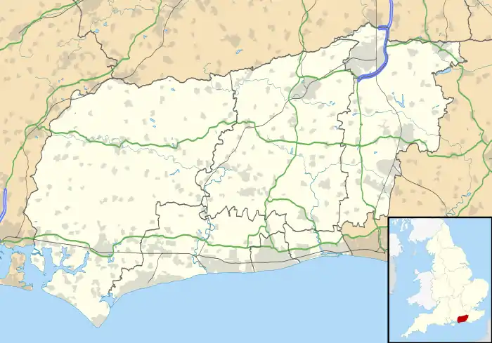
Clayton is a small village and former civil parish, now in the parish of Hassocks, in the Mid Sussex district, in the county of West Sussex, England.[1] It lies at the foot of the South Downs, 41 miles (66 km) south of London, 6 miles (10 km) north of Brighton, and 28 miles (45 km) east northeast of the county town of Chichester. Other nearby towns include Burgess Hill to the north and Lewes, the county town of East Sussex east southeast. The Clayton Windmills, known as "Jack and Jill", sit on the hill above the village. In 1961 the parish had a population of 1548.[2] On 1 April 2000 the parish was abolished and merged with Hassocks, Burgess Hill and Pyecombe.[3]
The village gives its name to the nearby Clayton railway tunnel on the Brighton Main Line, although the tunnel itself is actually situated in the neighbouring parish of Pyecombe.
Parish church

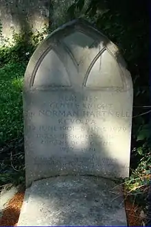
The little parish church of St. John the Baptist is an Anglo-Saxon church that has a squat bell turret of shingles with a wrought iron weather vane dated 1781. The church has some magnificent wall murals, for example the Last Judgement, from the mid-12th century (1150–1200). These murals, unique in England for their date and extent, were first brought to light during repair work in 1893 and were probably painted by artists from St Pancras Priory in Lewes.[4][5] Sir Norman Hartnell, who designed Queen Elizabeth II's wedding gown and coronation dress and served as couturier to Elizabeth II (and previously to The Queen Mother) is buried in the churchyard.
Clayton Down

On the south side of the village, begins the Downs and the start of the Clayton to Offham Escarpment Site of Special Scientific Interest (SSSI), which stretches east almost as far as Lewes. The scarp slope below Clayton's windmills (TQ 305 136) and as far east as Clayton Holt, has been described by David Bangs, a Sussex field naturalist, as "one of nature's self-grown orchards".[6] Few sites on this part of the Downs can match its richness. There are blackberries, crab apple, four species of Rose, including the apple-scented sweet briar. There are is also sloe berries, pink and orange spindle berries and buckthorn. There may be as many at least twenty-five scrub species, eighteen of which have fleshy and colourful fruits and eleven of which of are members of the rose family.[6] Robin's pincushion can be seen on the roses and dogwood.
Clayton Holt
On the scarp is Clayton Holt (TQ 310 134), a downland wood with at least thirteen ancient woodland indicator species, including two big hybrid large-leaved/small-leaved limes growing at the base of slope. Up until 1838 there was a large-leaved lime there, a true relic of past forests.[7] The wood is also one of the best places on the Downs to see veteran beeches. The lesser butterfly orchid, which is much rarer than its ‘greater’ cousin, has also been found there.[6] Fungi are mostly found along the base of slope or on the rotting trunks of fallen beech. Under the beech there are several earthstar fungi.
Recreation
For the size of village there is a large recreation ground located at the west end of the village with a village hall, children's play area and two football pitches.
Dame Vera Lynn and her husband bought the twenty two room house, Clayton Holt in 1944 with its 198 acres of land after her return from entertaining troops in Burma.
Notable people
Katie Johnson, an actress best known for her acclaimed performance as the elderly Mrs Wilberforce in the 1955 film The Ladykillers, was born here in 1878.
Sir Edward Michelborne, a soldier and adventurer, who also held a seat in Parliament lived at Hammonds Place.
London to Brighton Way Roman road
The London to Brighton Way is thought to have passed close to Clayton as it climbed the South Downs escarpment.
New Road
New Road between Ditchling and Clayton (part of the B2112) was a branch of the turnpike road from Newchapel (in Surrey) to Brighton, via Ditchling. It was authorised by an act of parliament passed in 1830:
- An Act for more effectually repairing and maintaining the Road from New Chappel in the County of Surrey to Ditcheling Bost Hills in the County of Sussex, and from thence to the Town of Brighthelmston in the same County; and also for making and maintaining a Branch of Road from the town of Ditcheling to Clayton in the County of Sussex (11 Geo. IV. c. xviii)[8]
References
- ↑ Clayton, West Sussex
- ↑ "Population statistics Clayton CP/AP through time". A Vision of Britain through Time. Retrieved 10 May 2023.
- ↑ "Haywards Heath Registration District". UKBMD. Retrieved 10 May 2023.
- ↑ All About Sussex Archived 16 June 2011 at the Wayback Machine
- ↑ Medieval Paintings of Christ in Majesty at Clayton, West Sussex
- 1 2 3 Bangs, Dave (2008). A freedom to roam Guide to the Brighton Downs : from Shoreham to Newhaven and Beeding to Lewes. Brighton: David Bangs. ISBN 978-0-9548638-1-4. OCLC 701098669.
- ↑ Abraham, Frances and Rose, Francis (Dec 2000) ‘Large-leaved Limes on the South Downs’, British Wildlife, Vol. 12, No. 2, page 87.
- ↑ The Statutes of the United Kingdom of Great Britain and Ireland: 11 Geo. IV. & 1 Will. IV. 1830. London, Printed by His Majesty's Printers, 1830. Page 470
Gallery
 Clayton village
 Village hall.
.jpg.webp) Church interior
Church interior Norman Hartnell's grave