  | |
| Overview | |
|---|---|
| Coordinates | 37°52′17″N 122°13′13″W / 37.8714°N 122.2202°W |
| Status | Active |
| Operation | |
| Opened | 1929 |
| Owner | East Bay Municipal Utility District (EBMUD) |
| Character | water tunnel |
| Technical | |
| Length | 18,065 feet (5,506 m) long |
| Tunnel clearance | 9 feet (2.7 m) square |
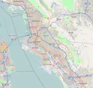
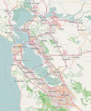
Claremont Tunnel, also known as the Claremont Water Tunnel is a utility tunnel in Alameda County, in the U.S. state of California[1] near the historic Claremont Hotel. The tunnel crosses the Hayward Fault and carries water for 800,000 EBMUD customers.
History
The Claremont Tunnel was built in 1929.[2]
After the Loma Prieta earthquake in 1989, EBMUD began studying the potential effect of a large seismic event along the Hayward Fault. In the worst-case scenario, slip along the fault would sever the tunnel, disrupting the water supply to approximately 50 to 70% (800,000) of EBMUD's customers for up to six months.[3][4][5] In response, EBMUD approved a $189 million Seismic Improvement Plan in 1994,[4] which included seismic upgrades to the Claremont Tunnel.[5] Seismic upgrades began in 2004 and completed in 2007.[2]
Design
The original tunnel connects the EBMUD treatment plant in Orinda with the distribution system west of the Oakland Hills.[6] It featured a bore 9 feet (2.7 m) square with a mostly unreinforced concrete lining 1-foot (0.30 m) thick.[7] At peak capacity, the tunnel can deliver 175,000,000 US gallons per day (460,000 L/min).[6]
The tunnel crosses the Hayward Fault at a nearly perpendicular angle 850 feet (260 m) from its western portal, and creep along the fault resulted in an offset of 13 inches (330 mm) by 2008.[6] The maximum credible earthquake (magnitude 7.0) predicted in studies would cause an offset of 7.5 feet (2.3 m).[3][8] For the seismic upgrade, a reinforced bypass tunnel was constructed across the Hayward Fault starting in 2004.[2] The seismic upgrade also injected grout to improve contact between the 1929 concrete tunnel and the surrounding earth.[9] For the bypass, first a 480-foot (150 m) access tunnel was bored into the fault zone.[10] Next, the space for the 1,570-foot (480 m) long bypass tunnel[7] was excavated using the New Austrian tunnelling method.[3]
A bypass tunnel was used to avoid disrupting service through the main tunnel and to minimize cost and time.[7] The bypass tunnel is 11 feet (3.4 m) in diameter, except for a reinforced section crossing the fault, where it takes on an oval cross-section 17 feet (5.2 m) wide for a length of 108 feet (33 m). In the reinforced section, the concrete liner of the tunnel is 2 feet (0.61 m) thick, instead of the 1-foot (0.30 m) thickness elsewhere in the bypass tunnel.[10] The reinforced section was excavated by first boring two drifts to either side of the planned section. The space between the two drifts was excavated, and then the drifts were filled with concrete so that if the reinforced section breaks, the water will not wash out the dirt surrounding the tunnel.[7]
In the reinforced section, the reinforcement is weakened every 11 feet (3.4 m) along its length to allow the reinforced section to shear predictably in the event of a slip along the fault. The reinforced section is fitted with a steel carrier pipe 3 inches (76 mm) thick with a 6 feet (1.8 m) inner diameter, capable of delivering 130,000,000 US gallons per day (340,000 L/min). Up to an 8.5 feet (2.6 m) offset can be accommodated without breaking the pipe or losing water delivery.[7][10] The bypass tunnel was designed by Jacobs Associates for EBMUD, and cost $38 million. It went into service on May 30, 2007.[7]
References
- ↑ U.S. Geological Survey Geographic Names Information System: Claremont Tunnel
- 1 2 3 "Claremont Tunnel Seismic Upgrade". Atkinson Construction. Retrieved 21 December 2017.
- 1 2 3 "Claremont Tunnel". EPC Consultants. Retrieved 21 December 2017.
- 1 2 Siegel, Max (16 May 2011). "After a quake, what will happen to the Bay Area's water supply?". Oakland North. Retrieved 21 December 2017.
- 1 2 "Case Study: Seismic Improvement Program, East Bay Municipal Utility District" (PDF). Earthquake Engineering Research Institute: Mitigation Center. Retrieved 21 December 2017.
- 1 2 3 "Of Tunnels and Earthquakes: Part I". Berkeley Seismology Lab. 15 December 2008. Retrieved 21 December 2017.
- 1 2 3 4 5 6 rockman (24 June 2008). "The Claremont Tunnel – Designed to Survive Fault Rupture on the Hayward Fault". GeoPrac. Retrieved 21 December 2017.
- ↑ Caulfield, R. John; Kieffer, D. Scott; Tsztoo, David F.; Cain, Bill (January 2005). "89". Seismic Design Measures for the Retrofit of the Claremont Tunnel (PDF). Rapid Excavation and Tunneling Conference. Society for Mining, Metallurgy & Exploration. pp. 1128–1138. ISBN 0873352432. Archived from the original (PDF) on 15 October 2006. Retrieved 21 December 2017. ResearchGate link
- ↑ 2004 2005 Progress Report: Seismic Improvement Program (PDF) (Report). EBMUD. 2005. Archived from the original (PDF) on 24 September 2008. Retrieved 21 December 2017.
- 1 2 3 "Of Tunnels and Earthquakes: Part II". Berkeley Seismology Lab. 19 December 2008. Retrieved 21 December 2017.
Wilson, S.H., R.J. Caulfield, and D.F. Tsztoo. 2006. Engineering geology of a tunnel through the Hayward Fault Zone. In Honor of Professor Edward L. Doheny, PG. Geological Society of America Abstracts with Programs 38(7).
Wilson, S.H., D.F. Tsztoo, C.R. Handford, and K. Rossi 2007. Excavation and support of a water tunnel through the Hayward Fault Zone Rapid Excavation and Tunneling Conference Proceedings, Toronto, Ontario, Canada.
Wilson, S.H., D.F. Tsztoo, C.R. Handford, and K. Rossi. 2008. Safeguarding a lifeline Civil Engineering Magazine 78(5).
External links
- "Claremont Tunnel Seismic Upgrade". EBMUD. 2008. Archived from the original on 24 September 2008. Retrieved 21 December 2017.
- "Claremont Tunnel receives prestigious award". Tunnel Talk. March 2009. Retrieved 22 December 2017.
Papers
- Caulfield, R. John; Kieffer, D. Scott; Tsztoo, David F.; Cain, Bill (January 2005). "89". Seismic Design Measures for the Retrofit of the Claremont Tunnel (PDF). Rapid Excavation and Tunneling Conference. Society for Mining, Metallurgy & Exploration. pp. 1128–1138. ISBN 0873352432. Archived from the original (PDF) on 15 October 2006. Retrieved 21 December 2017. ResearchGate link
- Holtz Wilson, S.; Tsztoo, D.F.; Handford, C.R.; Rossi, K. (May 2008). "Safeguarding a Lifeline". Civil Engineering Magazine. American Society of Civil Engineers. 78 (5): 58–63, 96–97. doi:10.1061/ciegag.0000173.
- Romero, V.S.; Caulfield, R.J. (2012). Improving the Seismic Resilience of Lifeline Tunnels (PDF). NZSEE. Retrieved 21 December 2017.

