Chumurkone
Chomorkhon | |
|---|---|
Town | |
| Chumurkone | |
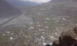
 View of the village | |
| Nickname: Chumren Khon | |
| Anthem: Anthem Of Pakistan | |
 Chumurkone  Chumurkone | |
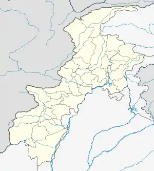
| Coordinates: 35°47′37.9″N 71°46′51.0″E / 35.793861°N 71.780833°E | |
| Country | Pakistan |
| Province | Khyber Pakhtunkhwa |
| District | Lower Chitral District |
| Founded by | Kalash Tribal Leader |
| Named for | Iron Rod |
| Government | |
| • Type | Elected Government |
| • Body | PTI |
| Dimensions | |
| • Length | 5 km (3 mi) |
| • Width | 3 km (2 mi) |
| Time zone | PST+5 |
| Website | www |
Chumurkone is a village in the Lower Chitral District of Pakistan. The population consists of more than 1500 houses, and it is located 13 km (8.1 mi) south of Chitral city.
History
The history of Chumurkone goes back 2000 years in history when Chinese ruled this place.[1]
People
Most of the population consists of Kho people but a small number of Gujat tribes also reside here.
Geography
It is located 13 km (8.1 mi) south of Chitral city. Orghoch village is located to the West, Jutilasht to the South, Bakarabad to the North, and the Chumurkone jungle to the East.
Towns
- Dok
- Muldeh
- Tordeh
- Darisht
- Koh
- Gulshan Abad
- Barandeh
- Dovlat Shahi
Schools
Roads
- Muldeh Road (Which Connects Dok With Muldeh)
- Darisht Road (Which Connect Muldeh With Darisht)
- Gulshan Abad Road (Which Connect Muldeh With Gulshan Abad)
- Dovlat Shahi road (Connects Muldeh And Dok With Dovlat Shahi
References
This article is issued from Wikipedia. The text is licensed under Creative Commons - Attribution - Sharealike. Additional terms may apply for the media files.