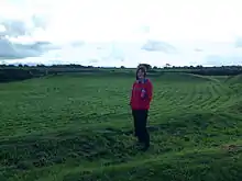
 Castell Bryn Gwyn, view south from the bank | |
| Location | Anglesey, Wales |
|---|---|
| Region | Great Britain |
| Coordinates | 53°10′42″N 4°17′52″W / 53.1784°N 4.2978°W |
| Type | enclosure |
| Width | 64m |
| Height | 1.5m |
| History | |
| Material | clay, gravel, dry stone |
| Founded | end Neolithic |
| Periods | Neolithic, Iron Age, Roman |
| Site notes | |
| Management | Cadw |
| Public access | Yes |
Castell Bryn Gwyn is a prehistoric site on the Isle of Anglesey, west of Brynsiencyn. It is a circular clay and gravel bank covered with grass, still some 1.5 metres (5') high and revetted externally by stone walls, which surround a level area some 54 metres (177') in diameter. Its name means "White Hill Castle".
Prehistoric origins
The original use of this site is uncertain although it may have been a religious sanctuary. Later Neolithic pottery indicates use in this period, and it may have been a henge monument at this time. The earliest bank and ditch belong to the end of the neolithic period (2500-2000 BC).[1][2][3]
Roman invasion
During the Iron Age, the present wall was built, and it was rebuilt in Roman times and later.[4]
Access
Car parking is minimal but the site is accessible from the A4080 by a footpath. Another path follows the low ridge, southwest over stiles to the Bryn Gwyn stones, or northeast, past the site of the former stone circle of Tre'r Dryw Bach, some ½ mile (800 metres) to Caer Lêb where it meets a minor road with limited car parking space.
See also
References
- ↑ Cadw sign at the site
- ↑ "Castell Bryn Gwyn, Neolithic Henge and Later Ringwork (93836)". Coflein. RCAHMW.
- ↑ "Castell Bryn Gwyn". cadw.gov.wales.
- ↑ Cyfeillion Ymddiriedolaeth Archaeolegol Gwynedd, Haf 2009. Friends of the Gwynedd Archaeological Trust, Summer 2009. Prehistoric Funerary and Ritual Survey, pp 32-33
