| Burley | |
|---|---|
 Looking east over Burley Model Allotments towards Leeds University | |
 Burley  Burley Location within West Yorkshire | |
| OS grid reference | SE279351 |
| • London | 170 mi (270 km) SSE |
| Metropolitan borough | |
| Metropolitan county | |
| Region | |
| Country | England |
| Sovereign state | United Kingdom |
| Post town | LEEDS |
| Postcode district | LS3, LS4, LS6 |
| Dialling code | 0113 |
| Police | West Yorkshire |
| Fire | West Yorkshire |
| Ambulance | Yorkshire |
| UK Parliament | |
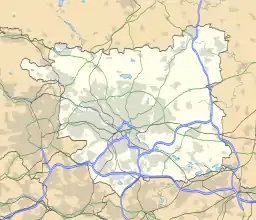
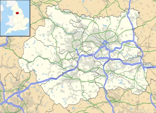
Burley is an inner city area of Leeds, West Yorkshire, England, 1 mile (1.6 km) north-west of Leeds city centre, between the A65 Kirkstall Road at the south and Headingley at the north, in the Kirkstall ward.
Etymology
The name is first attested in 1195 as "Burteg" and, around 1200, as "Burcheleia" which is more representative of other medieval attestations. The name derives from Old English burh, a 'fortification' and lēah an 'open space in woodland'.[1]
History

Burley grew from a village in the late industrial revolution, and there are several streets including the word 'village' including The Village Street. The area from The Village Street in the west to the railway line in the east, and north of Burley Road forms the Village Conservation Area.[2] Parts of the original village can still be seen at the junction of Burley Road and Haddon Road, and around Burley Lodge. Most houses constructed in Burley were of red-brick, but were generally smaller and largely back-to-backs. Industrial and commercial buildings were also largely brick-built. There are some larger stone-built buildings on Kirkstall Road such as the ornate Cardigan Arms public house—although this largely pre-dates most of the buildings in the area—which at the time of its construction only Burley Village existed, with the Arms somewhat outside.
Mills along the River Aire were built towards the end of the 19th century, some of which remain standing. Housing for mill workers and others in surrounding areas followed, and homes were built further up the bank. Other industries in the area included printing, clock-making,[3] dairies and chemicals.
Before 1904, local government was handled by the civil parish of Headingley-cum-Burley. Thereafter, the area was incorporated into the parish of Leeds.[4] The ecclesiastical parish of Burley still exists. The boundaries of the ecclesiastical parish are very close to those of the postcode area LS4, so LS4 is often used as an indicator of being in Burley, although LS4 also includes a small area that is in the ecclesiastical parish of Kirkstall.
The area remained working class for many decades but the growth of the University of Leeds and Leeds Metropolitan University in the late 20th century brought a growing student population to Burley and the surrounding areas of Hyde Park, and Headingley. In the mid- to late 2000s student halls were built along the lower parts of Burley Road.
The opening of the Leeds Studios in 1968 by Yorkshire Television provided the first major non-manufacturing employer. Yorkshire Television and Radio Aire broadcast studios, and the Home Office's Immigration offices, are on Kirkstall Road in Burley.
Community

St Matthias' Church is situated to the south-east of the old village. Built in 1854, it is a stone church with spire, and was designated a Grade II listed building on 5 August 1976.[5] St. Simon's Church, funded by Edmund Denison-Beckett MP, was located on Ventnor Street [6] but was closed as part of a clearance scheme in the 1960s.[7]
Burley public houses and members' clubs include The Cardigan Arms, Bridgewater Arms, The Merry Monk (now closed),[8] Burley Social Club and Burley Conservative Club. There are three gyms, a 5-aside football centre and a nine-hole golf course. Burley Branch Library was open on Cardigan Road between 1926 and 2016, closing due to the poor condition of the building.
The area is served by small supermarkets (Iceland, Asda, Co-op and Aldi), and small chains such as One-Stop, Costcutter and Premier. The main shopping area is on Kirkstall Road and Burley Hill, where there are shops and restaurants. Cardigan Fields leisure park complex contains a multi-screen cinema, a nightclub, a gymnasium, a 10-pin Bowling, a public house, and an ALDI supermarket. Restaurants include Pizza Hut, McDonald's and Nando's.
The Leeds and Liverpool Canal and River Aire form Burley's southern boundary, and are popular with walkers, cyclists and fishermen.
Burley Model Allotments, in what was once a quarry, has more than 100 plots and is bisected by Beechwood Crescent. The allotments have existed since 26 August 1892 when Leeds City Council acquired the site. It was replanned in 1956 and 1957 and on 26 June 1958 they were re-opened as Burley Model Allotments by the Lord Mayor of Leeds.
Local artists open their homes as galleries to display their work as part of Triangle Art Day.
Housing

Burley is characterised by red brick Victorian terraces including small back-to-back houses and through terraces. In the 20th century private houses were built including semi-detached houses around the Burley Wood. There are pockets of 20th-century council houses including a small estate of prefabricated concrete houses on Burley Road near the Yorkshire Television studios and an estate closer to Kirkstall.
Burley has a student population in private rented accommodation and in the mid- to late 2000s large scale student halls were built on Burley Road such as the former Opal Group now owned by CLV, Parklane Triangle, Unite Students and Iconinc.
Transport
Burley is linked to Leeds city centre by the A65 and Burley Roads. The railway came to Burley with the opening of the Harrogate Line in 1848 but Burley Park railway station was only opened in 1988; until then the nearest station was Headingley railway station. The station connects Burley with the city centre, Headingley, Horsforth, Harrogate, Knaresborough and York. First Leeds' 15, 19, 19A, 33, 33A, 49, 50 and 50A bus services link Burley with the city centre, Bradford, Farsley, Horsforth, Ireland Wood, Tinshill, Kirkstall, Headingley, Bramley, Garforth, Guiseley, Menston, Otley, St James' Hospital and Seacroft. Until 1959 the Leeds Tramway ran through Burley.
Sport
Queens ARLFC play in the Pennine League Premier Division and have headquarters at Burley Social Club. Burley United play their games at West Park football fields, playing in Division 1 of the Sunday League. Burley RUFC play in Yorkshire Division 3 and play their matches next to Kirkstall Abbey.
Filmography

Burley was the setting for the television drama Harry's Game, in which an estate (since demolished) in Burley was portrayed to be Belfast.[9] The Haddon Hall public house was used for filming in the Beiderbecke Tapes. Burley Park railway station is sometimes used as Hotton railway station in Yorkshire Television soap opera Emmerdale. Occasional scenes from Fat Friends were shot in Burley.
Notable people
- James Jepson Binns a pipe organ builder.[10]
- Melanie Brown (aka Scary Spice) from the girl band the Spice Girls was born in Harehills in 1975 and grew up in Burley.[11]
- Andrew Eldritch (born Andrew William Harvey Taylor), vocalist for the Sisters of Mercy lived at 7 Village Place in the 1980s.[12]
- The hardcore punk band the Flex are based in Burley.[13]
- Ben Gunn (born Benjamin Matthews), guitarist for the Sisters of Mercy lived at 7 Village Place in the 1980s.[12]
- Multiple of the members of hardcore punk band Higher Power have lived in Burley.[14]
- Gary Marx (born Mark Frederick Pearman), founding guitarist for the Sisters of Mercy lived at 7 Village Place in the 1980s.[12]
- Emma Mackey, actress known for her role as Maeve Wiley on Sex Education lived in a house on Burley Road while attending the University of Leeds.[15]
- John Smith (1797–1866), philanthropist, banker, and resident of Burley House, Burley 1841–1866.[16][17]
Location grid
See also
References
- ↑ A. H. Smith, The Place-Names of the West Riding of Yorkshire, English Place-Name Society, 30–37, 8 vols (Cambridge: Cambridge University Press, 1961–63), IV 140-41.
- ↑ "Burley - The Village Conservation Area" (PDF). www.leeds.gov.uk. Leeds City Council. 2010. Retrieved 14 October 2017.
- ↑ History of Potts of Leeds Archived 24 February 2018 at the Wayback Machine, accessed 24 February 2018
- ↑ 1911 Census of England and Wales, Table 13, 'Changes in the boundaries of civil parishes during the intercensal period 1901-11; effected under the provisions of the Local Government Acts of 1888 and 1894, and by Local Acts'.; LGBO 45137 via Vision of Britain. "Headingley Cum Burley Ch/CP over time". Retrieved 15 December 2019.
- ↑ "Church of St Matthias", British Listed Buildings
- ↑ History of St. Chad's, accessed 25 December 2017
- ↑ Leodis - a photographic archive of Leeds, St. Simon's Church of England School Rugby League Team, accessed 24 February 2018
- ↑ Housing plan for the Leeds Merry Monk pub site, 12 January 2018 accessed 24 February 2018
- ↑ Newton, Grace (16 March 2017). "Leeds musician 'Belfast Brian' dies". Yorkshire Evening Post. Retrieved 30 July 2018.
- ↑ "The Binns Family: James Jepson BINNS (I4059)". thebinnsfamily.org.uk. 1 August 2013. Retrieved 24 October 2013.
- ↑ "Leeds's Mel B has had the X-Factor for 20 years". Yorkshire Evening Post. 12 June 2014. Retrieved 30 July 2018.
- 1 2 3 Andrews, Mark. "Shine Like Thunder: The First Golden Age of The Sisters of Mercy". The Quietus. Retrieved 12 September 2020.
- ↑ Cussons, Max (2 August 2019). "Have Heart - The Stylus, Leeds 21.07.2019 Live Review". Contactmusic.com. Retrieved 27 October 2019.
- ↑ "Interview with Jimmy Wizard of HIGHER POWER" (Podcast). Retrieved 16 February 2020.
- ↑ Mussen, Maddy (27 January 2020). "These Leeds students lived in Maeve from Sex Education's old student house". Retrieved 26 October 2020.
- ↑ "Anniversary of St Matthias' Church, Burley". Leeds Times. British Newspaper Archive. 15 November 1856. p. 3 col.6. Retrieved 7 February 2023.
- ↑ "Burley House, Leeds, preliminary announcement". Yorkshire Post and Leeds Intelligencer. British Newspaper Archive. 20 July 1866. p. 2 col.4. Retrieved 9 February 2023.
External links
 Media related to Burley, Leeds at Wikimedia Commons
- The ancient parish of Leeds: historical and genealogical information at GENUKI (Burley was in this parish).
- Cardigan Fields website