Braskereidfoss | |
|---|---|
Village | |
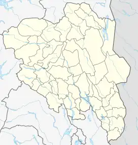
 Braskereidfoss Location of the village  Braskereidfoss Braskereidfoss (Norway) | |
| Coordinates: 60°43′29″N 11°48′07″E / 60.7247°N 11.80197°E | |
| Country | Norway |
| Region | Eastern Norway |
| County | Innlandet |
| District | Solør |
| Municipality | Våler Municipality |
| Area | |
| • Total | 1.03 km2 (0.40 sq mi) |
| Elevation | 181 m (594 ft) |
| Population (2021)[1] | |
| • Total | 229 |
| • Density | 223/km2 (580/sq mi) |
| Time zone | UTC+01:00 (CET) |
| • Summer (DST) | UTC+02:00 (CEST) |
| Post Code | 2435 Braskereidfoss |
Braskereidfoss is a village in Våler Municipality in Innlandet county, Norway. The village is located along the river Glomma, about 6 kilometres (3.7 mi) north of the village of Våler. The Norwegian National Road 2 and the Solørbanen railway line both run through the village.[3]
The 1.03-square-kilometre (250-acre) village has a population (2021) of 229 and a population density of 223 inhabitants per square kilometre (580/sq mi).[1]
Braskereidfoss Station lies along the Solørbanen railway line which is currently a freight-only railway line since 1994. This is the only operating station between Elverum Station in Elverum at the north end of the line and Kongsvinger Station in Kongsvinger at south end. This station is primarily used for the on-loading of lumber, used by the local forestry industry.[4]
The village is also close to an electricity generation dam on the river.[5]
References
- 1 2 3 Statistisk sentralbyrå (1 January 2021). "Urban settlements. Population and area, by municipality".
- ↑ "Braskereidfoss, Våler". yr.no. Retrieved 12 March 2022.
- ↑ Thorsnæs, Geir, ed. (1 November 2021). "Braskereidfoss". Store norske leksikon (in Norwegian). Kunnskapsforlaget. Retrieved 12 March 2022.
- ↑ Holøs, Bjørn, ed. (17 June 2018). "Solørbanen". Store norske leksikon (in Norwegian). Kunnskapsforlaget. Retrieved 12 March 2022.
- ↑ "Dam in Norway partially bursts after days of heavy rain". euronews. 9 August 2023. Retrieved 10 August 2023.