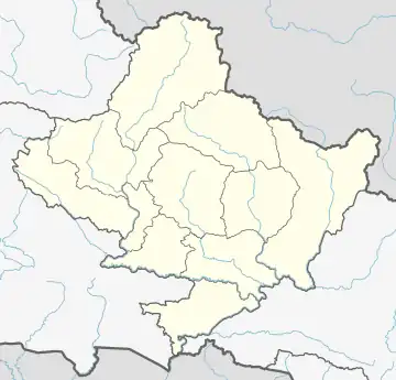
Barpak Sulikot
सुलिकोट | |
|---|---|
Rural Municipality | |
 | |
 Barpak Sulikot Location in Nepal  Barpak Sulikot Barpak Sulikot (Nepal) | |
| Coordinates: 28°08′N 84°43′E / 28.14°N 84.72°E | |
| Country | |
| Province | Gandaki Province |
| District | Gorkha District |
| Area | |
| • Total | 200.63 km2 (77.46 sq mi) |
| Population (2011) | |
| • Total | 25,389 |
| • Density | 130/km2 (330/sq mi) |
| 2011 Nepal census | |
| Time zone | UTC+5:75 (Nepal Time) |
| Website | barpaksulikotmun |
Barpak Sulikot is a Rural Municipality in Gorkha District in the Gandaki Province of northern-central Nepal.[1] After the merging of 7 village development committee, it's called Barpak Sulikot. [2][3]
Demographics
At the time of the 2011 Nepal census, Barpak Sulikot Rural Municipality had a population of 25,399. Of these, 63.4% spoke Nepali, 22.9% Gurung, 7.8% Ghale, 3.2% Bajjika, 1.0% Magar, 0.9% Tamang, 0.5% Newar, 0.1% Urdu and 0.2% other languages as their first language.[4]
In terms of ethnicity/caste, 39.0% were Gurung, 10.3% Brahmu/Baramo, 9.8% Hill Brahmin, 8.3% Chhetri, 8.1% Ghale, 5.5% Kami, 5.3% Magar, 5.0% Sarki, 3.4% Tamang, 2.5% Newar, 1.4% Damai/Dholi, 0.4% Gharti/Bhujel, 0.4% Thakuri, 0.2% Sanyasi/Dasnami, 0.1% Badi, 0.1% Musalman and 0.2% others.[5]
In terms of religion, 52.0% were Hindu, 42.0% Buddhist, 3.4% Christian, 2.4% Prakriti and 0.1% Muslim.[6]
In terms of literacy, 60.8% could both read and write, 3.0% could read but not write and 36.1% could neither read nor write.[7]
References
- ↑ "Sulikot".
- ↑ "गोरखामा ११ वटा स्थानीय तह रहने, वारपाकीको असन्तुष्टि". ujyaaloonline.com. Archived from the original on 2016-11-10.
- ↑ "You are being redirected..." thehimalayantimes.com. Archived from the original on 2017-05-06.
- ↑ NepalMap Language
- ↑ NepalMap Caste
- ↑ NepalMap Religion
- ↑ NepalMap Literacy
