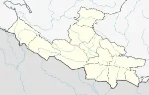
Wangla, Nepal
वाङ्ला Sandhikharka Municipality 4-5 | |
|---|---|
City | |
 Wangla, Nepal Location in Lumbini Province  Wangla, Nepal Wangla, Nepal (Nepal) | |
| Coordinates: 27°59′N 83°10′E / 27.983°N 83.167°E | |
| Country | |
| Zone | Lumbini Zone |
| District | Arghakhanchi District |
| Population (2001) | |
| • Total | 5,380 |
| • Religions | Hindu |
| Time zone | UTC+5:45 (Nepal Time) |
Wangla is a Market Center in Sandhikharka Municipality of Arghakhanchi District in the Lumbini Zone of southern Nepal. The former village development committee (VDC) was converted into a municipality on 18 May 2014 by merging the existing Sandhikharka, Wangla, Narapani, Khanchikot, Keemadada, Argha and Dibharna VDCs.[1][2] At the time of the 1991 Nepal census, the town had a population of 5,142 living in 1,033 houses.[3] At the time of the 2001 Nepal census, the population was 5,380, of which 66% was literate.[3]
References
- ↑ "72 new municipalities announced". My Republica.com. Archived from the original on 2014-06-18. Retrieved 2014-06-10.
- ↑ "Government announces 72 new municipalities". The Kathmandu Post. Archived from the original on 2014-10-06. Retrieved 2014-06-10.
- 1 2 "Nepal Census 2001". Nepal's Village Development Committees. Digital Himalaya. Archived from the original on 2008-10-12. Retrieved 2013-02-08.
This article is issued from Wikipedia. The text is licensed under Creative Commons - Attribution - Sharealike. Additional terms may apply for the media files.