Bakreswar Thermal Power Plant Township | |
|---|---|
Industrial Town | |
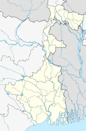
 Bakreswar Thermal Power Plant Township Location in West Bengal, India | |
| Coordinates: 23°50′07″N 87°27′48″E / 23.8353°N 87.4633°E | |
| Country | |
| State | West Bengal |
| District | Birbhum |
| Languages | |
| • Official | Bengali, English |
| Time zone | UTC+5:30 (IST) |
| PIN | 731102 (Bhurkuna) |
| Telephone/STD code | 0346 |
| Lok Sabha constituency | Birbhum |
| Vidhan Sabha constituency | Suri |
| Website | birbhum |
Bakreswar Thermal Power Plant Township is an industrial township in Suri I block in Suri Sadar subdivision of Birbhum district in the Indian state of West Bengal
Geography
M: municipal city/ town, CT: census town, R: rural/ urban centre, B: Barrage.
Owing to space constraints in the small map, the actual locations in a larger map may vary slightly
Location
Bakreshwar Thermal Power Station, along with the industrial township, are spread across parts of Suri I and Dubrajpur blocks. Small villages, such as Bangaon and Sadaipur, are located in the area. Larger villages, such as Chinpai and Kachujor, are located nearby.[1][2]
Police station
Sadaipur police station has jurisdiction over Suri I block.[3][4]
Neel Nirjan
The reservoir, formed by erecting a dam in the Bakreshwar River, named Neel Nirjan (meaning blue solitude), for providing water to the thermal power plant, is gaining in popularity as a tourist spot.[5]{It can be seen on the map alongside, but it is not marked.)
Economy
The 1,050 MW Bakreshwar Thermal Power Station of West Bengal Power Development Corporation Limited, was commissioned between 1999 and 2009.[6]
Transport
NH 14 (old numbering NH 60), running from Moregram (in Murshidabad district) to Kharagpur (in Paschim Medinipur district), passes through the area. The portion of the highway passing through this area was earlier known as Panagarh-Morgram Highway[2]
The Andal-Sainthia branch line passes through this area. There are stations at Chinpai and Kachujor.[7]
Education
BKTPP Prabir Sengupta Vidyalaya is a co-ed higher secondary school located in the township. Established in 1997, the school follows the course curricula of West Bengal Board of Secondary Education (WBBSE) and West Bengal Council of Higher Secondary Education (WBCHSE) for Standard 10th and 12th Board examinations respectively.[8]
References
- ↑ Sarajit Pramanick, Birbhumer Ahankar:Bakreshwar Tapbidyut Kendra, Paschim Banga, Birbhum special issue, pp. 189–192, (in Bengali), February 2006, Information and Culture Department, Government of West Bengal
- 1 2 Google maps
- ↑ "District Statistical Handbook 2008, Birbhum" (PDF). Table 2.1. Bureau of Applied Economics and Statistics, Government of West Bengal. Retrieved 30 January 2018.
- ↑ "Birbhum Police". Police Stations. West Bengal Police. Archived from the original on 12 February 2018. Retrieved 30 January 2018.
- ↑ Sarkar, Joydeep, Paryatan Boichitre Birbhum Jela, Paschim Banga, Birbhum special issue, page 200, (in Bengali), February 2006, Information and Culture Department, Government of West Bengal.
- ↑ "Bakreswar Thermal Power Project". The West Bengal Power Development Corporation Limited. Archived from the original on 27 January 2018. Retrieved 30 January 2018.
- ↑ "53535 => 63535 Andal-Sainthia Memu". Time Table. Indiarailinfo. Retrieved 30 January 2018.
- ↑ "Bktpp Prabir Sengupta Vidyalaya - Suri-I, Birbhum - Reviews, Fee Structure, Admission Form, Address, Contact, Rating - Directory". EduGorilla Listings. Retrieved 24 December 2021.