Březová | |
|---|---|
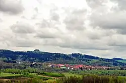
 View from the north | |
 Flag  Coat of arms | |
 Březová Location in the Czech Republic | |
| Coordinates: 50°8′46″N 12°38′52″E / 50.14611°N 12.64778°E | |
| Country | |
| Region | Karlovy Vary |
| District | Sokolov |
| First mentioned | 1353 |
| Government | |
| • Mayor | Jaroslav Bělíček |
| Area | |
| • Total | 59.59 km2 (23.01 sq mi) |
| Elevation | 487 m (1,598 ft) |
| Population (2023-01-01)[1] | |
| • Total | 2,638 |
| • Density | 44/km2 (110/sq mi) |
| Time zone | UTC+1 (CET) |
| • Summer (DST) | UTC+2 (CEST) |
| Postal codes | 356 01, 358 03 |
| Website | www |
Březová (German: Prösau) is a town in Sokolov District in the Karlovy Vary Region of the Czech Republic. It has about 2,600 inhabitants.
Administrative parts
The villages of Arnoltov, Kamenice, Kostelní Bříza, Lobzy, Rudolec and Tisová are administrative parts of Březová.
Etymology
The name is derived from the Czech word bříza, i.e. 'birch'.[2]
Geography
Březová is located about 3 kilometres (2 mi) south of Sokolov and 17 km (11 mi) southwest of Karlovy Vary. It lies mostly in the Slavkov Forest, only the northern part of the municipal territory with half of the town proper lies in the Sokolov Basin. The highest point is near the top of the Lazský vrch hill at 847 m (2,779 ft) above sea level. North of the town is Lake Silvestr, created by reclaiming a mine dump.
History
The first written mention of Březová is from 1353. The most significant owners of the settlement were the Nostitz family, who acquired it in the first half of the 17th century. Part of the population was ethnic German, but after World War II most of them were expelled.[2]
From 1939 to 1979, lignite was mined next to the town. In 1954, the municipalities of Kamenice and Lobzy and the area of the extinct village of Paseka were annexed to Březová. In 1960, Tisová was annexed to Březová and the municipality obtained the title of a town. In 1976, Kostelní Bříza (including its parts of Arnoltov and Rudolec) were annexed to the town.[2]
Demographics
|
|
| ||||||||||||||||||||||||||||||||||||||||||||||||||||||
| Source: Censuses[3][4] | ||||||||||||||||||||||||||||||||||||||||||||||||||||||||
Transport
The D6 motorway (the section from Karlovy Vary to Cheb and the Czech-German border, here part of the European routes E48 and E49) runs north of the town.
Sights
.jpg.webp)
The most important monument is the Church of Saints Peter and Paul, located in Kostelní Bříza. It was built in the late Baroque style in 1802 on the site of an older church.[5]
In Kostelní Bříza is a Baroque castle, rebuilt to its present form in 1767. Today it is dilapidated and unused. Next to the castle is a dendrologically significant park.[6]
A valuable building, also located in Kostelní Bříza, is a manor house from the second half of the 18th century. It is one of the best-preserved half-timbered buildings in the region.[7]
Twin towns – sister cities
 Pausa-Mühltroff, Germany
References
- ↑ "Population of Municipalities – 1 January 2023". Czech Statistical Office. 2023-05-23.
- 1 2 3 "Historie" (in Czech). Město Březová. Retrieved 2023-11-09.
- ↑ "Historický lexikon obcí České republiky 1869–2011 – Okres Sokolov" (in Czech). Czech Statistical Office. 2015-12-21. pp. 1–2.
- ↑ "Population Census 2021: Population by sex". Public Database. Czech Statistical Office. 2021-03-27.
- ↑ "Kostel sv. Petra a Pavla" (in Czech). National Heritage Institute. Retrieved 2023-11-09.
- ↑ "Zámek" (in Czech). National Heritage Institute. Retrieved 2023-11-09.
- ↑ "Jiná správní stavba – panský dům" (in Czech). National Heritage Institute. Retrieved 2023-11-09.
- ↑ "Partnerschaften" (in German). Pausa-Mühltroff. Retrieved 2020-07-25.