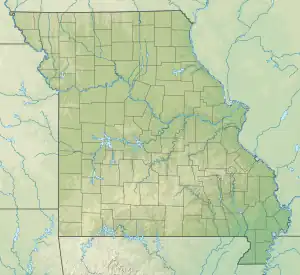
| Adair Creek Tributary to Logan Creek | |
|---|---|
 Location of Adair Creek mouth  Adair Creek (the United States) | |
| Location | |
| Country | United States |
| State | Missouri |
| County | Reynolds |
| Physical characteristics | |
| Source | Jayhawker Hollow divide |
| • location | about 5 miles southeast of Bunker, Missouri |
| • coordinates | 37°25′00″N 091°09′44″W / 37.41667°N 91.16222°W[1] |
| • elevation | 1,260 ft (380 m)[2] |
| Mouth | Logan Creek |
• location | about 3 miles southwest of Corridon, Missouri |
• coordinates | 37°21′26″N 091°07′19″W / 37.35722°N 91.12194°W[1] |
• elevation | 955 ft (291 m)[3] |
| Length | 5.74 mi (9.24 km)[4] |
| Basin size | 7.44 square miles (19.3 km2)[5] |
| Discharge | |
| • location | Logan Creek |
| • average | 10.11 cu ft/s (0.286 m3/s) at mouth with Logan Creek[5] |
| Basin features | |
| Progression | Logan Creek → Black River → White River → Mississippi River → Gulf of Mexico |
| River system | Black River |
| Tributaries | |
| • left | unnamed tributaries |
| • right | unnamed tributaries |
| Bridges | Unnamed Road, Highway B |
Adair Creek is a stream in western Reynolds County in the Ozarks of southeast Missouri.[1] It is a tributary of Logan Creek.
The source area lies just south of the junction of Missouri Route 72 and Missouri Route P about three miles southeast of Bunker. The stream flows south to southeast to its confluence with Logan Creek along Missouri Route B about 3.5 miles southwest of Reynolds. About one mile upstream from its confluence the stream has been blocked with a dam and filled by mine tailings from the Adair Creek Mine (Sweetwater Mine).[6][7]
Adair Creek has the name of one Mr. Adair, a local judge.[8]
Course
Adair Creek rises about 5 miles southeast of Bunker, Missouri, in Reynolds County and then flows generally southeast to join Logan Creek about 3 miles southwest of Corridon.[3]
Watershed
Adair Creek drains 7.44 square miles (19.3 km2) of area, receives about 46.1 in/year of precipitation, has a wetness index of 404.02, and is about 77% forested.[5]
See also
References
- 1 2 3 U.S. Geological Survey Geographic Names Information System: Adair Creek
- ↑ "Get Maps". USGS Topoview. US Geological Survey. Retrieved 13 June 2021.
- 1 2 "Get Maps". USGS Topoview. US Geological Survey. Retrieved 13 June 2021.
- ↑ "ArcGIS Web Application". epa.maps.arcgis.com. US EPA. Retrieved 13 June 2021.
- 1 2 3 "Adair Creek Watershed Report". US EPA Geoviewer. US EPA. Retrieved 13 June 2021.
- ↑ Bunker, Missouri, 1967 (1985 rev.) and Midridge, Missouri, 1966 (1985 rev.) 7.5 Minute Topographic Quadrangles, USGS
- ↑ Mindat.org Sweetwater Mine
- ↑ "Reynolds County Place Names, 1928–1945". The State Historical Society of Missouri. Archived from the original on June 24, 2016. Retrieved December 13, 2016.