09°49′40″S 66°52′58″W / 9.82778°S 66.88278°W
Acrelândia | |
|---|---|
Municipality | |
 | |
 Seal | |
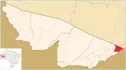
 Location of municipality in Acre State | |
 Acrelândia Location in Brazil | |
| Coordinates: 9°49′40″S 66°52′58″W / 9.82778°S 66.88278°W | |
| Country | |
| State | Acre |
| Area | |
| • Total | 1,808 km2 (698 sq mi) |
| Population | |
| • Total | 15,490 |
| 2020 est | |
| Time zone | UTC−5 (ACT) |
Acrelândia (Portuguese pronunciation: [akɾeˈlɐ̃dʒi.ɐ]) is a municipality located in the easternmost portion of the Brazilian state of Acre. Its population is 15,490 and its area is 1,808 km², which makes it the smallest municipality in that state.
This article is issued from Wikipedia. The text is licensed under Creative Commons - Attribution - Sharealike. Additional terms may apply for the media files.
