  | |
| Local date | November 22, 1815 |
|---|---|
| Local time | 22:00-23:00 WITA |
| Magnitude | Mw 7.0 [1] |
| Epicenter | 8°00′S 115°00′E / 8.0°S 115.0°E |
| Fault | Flores Back Arc Thrust Fault |
| Max. intensity | IX (Violent) [2] |
| Tsunami | Yes [3] |
| Casualties | 11,453 dead [4] |
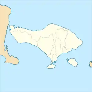
The 1815 Bali earthquake occurred on November 22 between 22:00 and 23:00 local time (WITA), affecting the Bali Kingdom. The estimated moment magnitude 7.0 earthquake struck off the north coast of Bali at a shallow depth. It was assigned a maximum intensity of IX (Violent) on the Mercalli intensity scale, causing severe damage in Buleleng and Tabanan. The earthquake caused a landslide and tsunami that killed 11,453 people.
Geology
Off the north coast of Bali is the Flores Back Arc Thrust Fault, located in the back-arc region. It formed due to the convergence between the Sunda and Australian plates, accommodating compression. The two plates converge northward at a rate of 80 mm (3.1 in)/yr, in which the Sunda megathrust takes 70 mm (2.8 in)/yr of the movement. The remaining 10 mm (0.39 in)/yr rate is accommodated by the Flores Back Arc Thrust Fault. It runs off the north coast of the Lesser Sunda Islands, in the Banda Sea.[5] The fault extends east–west for 800 km (500 mi) off the north coast of Bali to Wetar.[6] Geologists postulate the fault is divided into two segments; the 450 km (280 mi)-long Flores Thrust, and 450 km (280 mi)-long Wetar Thrust. Its origin has been attributed to several causes proposed by researchers; magmatic intrusion, gravitational sliding, reverse subduction or active spreading in the back-arc.[6] It is a complex zone of thrust faults that are connected at depth.
Earthquake characteristics
The earthquake and tsunami is thought to be the result of a thrust fault rupture on the Flores Back Arc Thrust Fault.[7] The fault was the source of approximately 26 magnitude 6.0+ earthquakes since 1960. These earthquakes were calculated to be at depths of up to 40 km (25 mi) beneath the crust. It was also the source of the 1992 and 2018 earthquakes that caused many fatalities.[6] The 1815 event is the oldest documented earthquake along the fault.[8] Modelling of a moment magnitude 7.3 earthquake at 10 km (6.2 mi) depth could produce Modified Mercalli intensity VIII–IX along the north central and eastern parts of Bali. Modified Mercalli intensity V in Surabaya corresponded to the historical descriptions of the event.[9] On Lombok, the earthquake was felt VII.
Damage
The earthquake occurred at 22:00 local time. In Buleleng shaking was described as violent. A series of strong shocks followed and persisted for an hour. Shaking was felt in Bima, Surabaya, and Lombok. A massive "explosion" was observed along the coastal ranges. The explosion triggered a landslide which buried Singaraja and Buleleng, resulting in at least 10,253 fatalities. A large fissure was observed running through Lake Tamblingan, from Buleleng to Tabanan. It agitated the lake and caused flooding.[2] A destructive tsunami washed onto the Balinese coast, killing an additional 1,200 people.[3][4]
See also
References
- ↑ "Katalog Gempabumi Signifikan dan Dirasakan". bmkg.go.id. Meteorology, Climatology, and Geophysical Agency. Retrieved 16 October 2021.
- 1 2 "Significant Earthquake Information". ngdc.noaa.gov. NOAA National Centers for Environmental Information. Retrieved 16 October 2021.
- 1 2 "Tsunami Event Information". ngdc.noaa.gov. NOAA National Centers for Environmental Information. Retrieved 16 October 2021.
- 1 2 Pebriansyah Ariefana (1 June 2021). "Bali Tsunami dan Gempa Besar Tengah Malam November 1815, Hancurkan Kerajaan Buleleng" [Bali Tsunami and Great Earthquake Midnight November 1815, Destroyed the Buleleng Kingdom]. SuaraBali.id. Retrieved 16 October 2021.
- ↑ Achmad F. N. Sarjan; Zulfakriza Zulfakriza; Andri D. Nugraha; Shindy Rosalia; Shengji Wei; Sri Widiyantoro; Phil R. Cummins; Muzli Muzl; David P. Sahara; Nanang T. Puspito; Awali Priyono; Haunan Afif (22 April 2021). Basilios, Tsikouras (ed.). "Delineation of Upper Crustal Structure Beneath the Island of Lombok, Indonesia, Using Ambient Seismic Noise Tomography" (PDF). Frontiers in Earth Science. 9: 269. Bibcode:2021FrEaS...9..269S. doi:10.3389/feart.2021.560428. Retrieved 16 October 2021.
- 1 2 3 Yang, Xiaodong; Singh, Satish C.; Tripathi, Anand (2020). "Did the Flores backarc thrust rupture offshore during the 2018 Lombok earthquake sequence in Indonesia?". Geophysical Journal International. 221 (2): 758–768. doi:10.1093/gji/ggaa018.
- ↑ Atika Syah (29 June 2018). "Brief History of Tsunami in Bali". factsofindonesia.com. Archived from the original on 16 October 2021. Retrieved 16 October 2021.
- ↑ Felix, Raquel P.; Judith A., Hubbard; Kyle E., Bradley; Karen H., Lythgoe; Linlin, Li; Adam D., Switzer (2022). "Tsunami hazard in Lombok and Bali, Indonesia, due to the Flores back-arc thrust". Natural Hazards and Earth System Sciences. 22 (5): 1665–1682. Bibcode:2022NHESS..22.1665F. doi:10.5194/nhess-22-1665-2022. S2CID 248899725.
- ↑ Nguyen, Ngoc; Griffin, Jonathan; Cipta, Athanasius; Cummins, Phil R. (2015). Indonesia's Historical Earthquakes Modelled examples for improving the national hazard map (Report). Geoscience Australia. doi:10.11636/Record.2015.023.