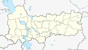
17 km
17 км | |
|---|---|
Settlement | |
 17 km | |
| Coordinates: 59°48′09″N 40°27′53″E / 59.8025°N 40.464722°E | |
| Country | Russia |
| Region | Vologda Oblast |
| District | Kharovsky District |
| Time zone | UTC+06:00 |
17 km (Russian: 17 км) is a rural locality (a settlement) in Semigorodneye Rural Settlement of Kharovsky District, Russia. The population was 37 as of 2002.[1]
Geography
17 km is located 107 km southeast of Kharovsk (the district's administrative centre) by road. Tomashka is the nearest rural locality.[2]
Streets
There are no streets with titles.[3]
References
- ↑ Данные переписи 2002 года: таблица 2С. М.: Федеральная служба государственной статистики, 2004.
- ↑ Расстояние от 17 км до Харовска
- ↑ Центр Регистрации и Сопровождения Бизнеса - www.regfile.ru. "17 км п - Харовский р-н, состав: улицы, почтовые индексы, ОКТМО, ОКАТО | ФИАС". ifias.ru. Retrieved 2018-08-08.
This article is issued from Wikipedia. The text is licensed under Creative Commons - Attribution - Sharealike. Additional terms may apply for the media files.