Čebine | |
|---|---|
 Čebine Location in Slovenia | |
| Coordinates: 46°10′10.89″N 15°0′8.39″E / 46.1696917°N 15.0023306°E | |
| Country | |
| Traditional region | Styria |
| Statistical region | Central Sava |
| Municipality | Trbovlje |
| Area | |
| • Total | 1.46 km2 (0.56 sq mi) |
| Elevation | 665.3 m (2,182.7 ft) |
| Population (2002) | |
| • Total | 24 |
| [1] | |
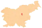
Čebine (pronounced [tʃɛˈbiːnɛ]) is a settlement in the Municipality of Trbovlje in central Slovenia. It lies in the hills west of the town of Trbovlje. The area is part of the traditional region of Styria. It is now included with the rest of the municipality in the Central Sava Statistical Region.[2]
Name
Čebine was attested in historical sources as Heyliges Crewtz in 1498 and heiliges Kreuz in 1535,[3] based on the name of the local church.
History
The Communist Party of Slovenia was established in the night from 17 to 18 April 1937 at the Barlič farm in Čebine.[4][5]
Church
The local church is dedicated to the Holy Cross and belongs to the Parish of Sveta Planina. It has a medieval core, but it was extensively rebuilt in the 18th century.[6]
References
- ↑ Statistical Office of the Republic of Slovenia
- ↑ Trbovlje municipal site
- ↑ "Čebine". Slovenska historična topografija. ZRC SAZU Zgodovinski inštitut Milka Kosa. Retrieved December 31, 2020.
- ↑ "Čebine – spomenik revolucije, boja in svobode". Dogovori. No. 7. April 1977. p. 1. Retrieved December 31, 2020.
- ↑ Repe, Božo (14 April 2007). "Delegati KPS, zbrani v cerkvi" [KPS Delegates Gathered in a Church]. Dnevnik.si (in Slovenian).
- ↑ Slovenian Ministry of Culture register of national heritage reference number ešd 2377
External links
This article is issued from Wikipedia. The text is licensed under Creative Commons - Attribution - Sharealike. Additional terms may apply for the media files.
