Çayırlı District | |
|---|---|
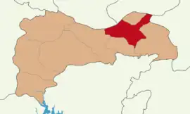
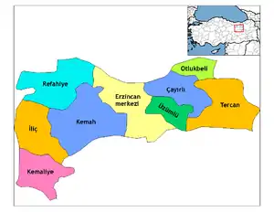
 Map showing Çayırlı District in Erzincan Province | |
 Çayırlı District Location in Turkey | |
| Coordinates: 39°48′N 40°02′E / 39.800°N 40.033°E | |
| Country | Turkey |
| Province | Erzincan |
| Seat | Çayırlı |
| Area | 1,062 km2 (410 sq mi) |
| Population (2021) | 8,383 |
| • Density | 7.9/km2 (20/sq mi) |
| Time zone | TRT (UTC+3) |
| Website | www |
Çayırlı District is a district of Erzincan Province in Turkey. The municipality of Çayırlı is the seat and the district had a population of 8,383 in 2021.[1][2] Its area is 1,062 km2.[3]
The district was established in 1954.[4]
Composition
The district encompasses one municipality (Çayırlı), forty-eight villages and thirty-one hamlets.[1]
The villages are:[1]
- Aşağıkartallı
- Balıklı
- Başköy
- Boybeyi
- Bozağa
- Bölükova
- Büyükgelengeç
- Büyük Yaylaköy
- Cennetpınar
- Coşan
- Çamurdere
- Çataksu
- Çaykent
- Çayönü
- Çilhoroz
- Çilligöl
- Doğanyuva
- Doluca
- Esendoruk
- Eşmepınar
- Gelinpınar
- Göller
- Harmantepe
- Hastarla
- Karataş
- Küçükgelengeç
- Mazlumağa
- Mirzaoğlu
- Oğultaşı
- Ortaçat
- Ozanlı
- Paşayurdu
- Pınarlı
- Saraycık
- Sarıgüney
- Saygılı
- Sırataş
- Toprakkale
- Tosunlar
- Turnaçayırı
- Verimli
- Yaylakent
- Yaylalar
- Yazıkaya
- Yeşilyaka
- Yukarıçamurdere
- Yukarıkartallı
- Yürekli
Religion
In 1989, anthropologist Andrews counted 64 villages in the district of which Alevis were present in 54 villages and Sunni Muslims in 13 villages.[5]
References
- 1 2 3 "Türkiye Mülki İdare Bölümleri Envanteri". T.C. İçişleri Bakanlığı (in Turkish). Retrieved 19 December 2022.
- ↑ "31 ARALIK 2021 TARİHLİ ADRESE DAYALI NÜFUS KAYIT SİSTEMİ (ADNKS) SONUÇLARI" (XLS). TÜİK (in Turkish). Retrieved 16 December 2022.
- ↑ "İl ve İlçe Yüz ölçümleri". General Directorate of Mapping. Retrieved 1 March 2023.
- ↑ "İl İdaresi ve Mülki Bölümler Şube Müdürlüğü İstatistikleri - İl ve İlçe Kuruluş Tarihleri" (PDF) (in Turkish). p. 32. Retrieved 27 December 2022.
- ↑ Andrews, Peter Alfred; Benninghaus, Rüdiger, eds. (1989). Ethnic Groups in the Republic of Turkey. p. 185.
This article is issued from Wikipedia. The text is licensed under Creative Commons - Attribution - Sharealike. Additional terms may apply for the media files.
