Wellerlooi | |
|---|---|
Village | |
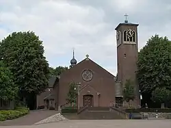
 Church of Wellerlooi | |
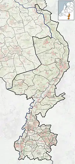
 Wellerlooi Location in the Netherlands  Wellerlooi Location in the province of Limburg in the Netherlands | |
| Coordinates: 51°32′N 6°8′E / 51.533°N 6.133°E | |
| Country | Netherlands |
| Province | Limburg |
| Municipality | Bergen |
| Area | |
| • Total | 22.27 km2 (8.60 sq mi) |
| Elevation | 16 m (52 ft) |
| Population (2021)[1] | |
| • Total | 1,185 |
| • Density | 53/km2 (140/sq mi) |
| Time zone | UTC+1 (CET) |
| • Summer (DST) | UTC+2 (CEST) |
| Postal code | 5856[1] |
| Dialing code | 0478 |
Wellerlooi (Dutch pronunciation: [ˈʋɛlərloːi]; Limburgish: De Loj [də ˈlɔj]) is a village in the Dutch province Limburg. It is part of the municipality Bergen. This church village is located between Nijmegen and Venlo, on the eastern side of the Maas
Wellerlooi lies in the heart of National Park De Maasduinen. The part of the national park that belongs to Wellerlooi is named De Hamert.[3]
History
The village was first mentioned in 1501 as "'t Welreloo", and means "open forest beloning to Well.[4] Wellerlooi started as a heath cultivation village in the 19th century.[5] Wellerlooi was home to 240 people in 1840.[6]
In 1894, it became an independent parish. The St Catharina Church was built between 1952 and 1953 in traditional style and a tower was added in 1961.[5]
See also
References
- 1 2 3 "Kerncijfers wijken en buurten 2021". Central Bureau of Statistics. Retrieved 23 April 2022.
- ↑ "Postcodetool for 5856AA". Actueel Hoogtebestand Nederland (in Dutch). Het Waterschapshuis. Retrieved 23 April 2022.
- ↑ Nature areas
- ↑ "Wellerlooi - (geografische naam)". Etymologiebank (in Dutch). Retrieved 23 April 2022.
- 1 2 Sabine Broekhoven, & Ronald Stenvert (2003). Wellerlooi (in Dutch). Zwolle: Waanders. ISBN 90 400 9623 6. Retrieved 23 April 2022.
- ↑ "Wellerlooi". Plaatsengids (in Dutch). Retrieved 23 April 2022.