Warrington Stone Bridge | |
 Warrington Stone Bridge over the Paulins Kill | |
   | |
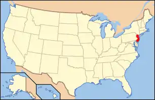
| Location | Brugler Road over the Paulins Kill, Warrington, New Jersey |
|---|---|
| Coordinates | 40°56′9″N 75°4′16.5″W / 40.93583°N 75.071250°W |
| Built | c. 1860 |
| Architectural style | Stone Arch |
| NRHP reference No. | 77000917[1] |
| NJRHP No. | 2769[2] |
| Significant dates | |
| Added to NRHP | December 16, 1977 |
| Designated NJRHP | March 28, 1977 |
The Warrington Stone Bridge is a historic stone arch bridge carrying Brugler Road over the Paulins Kill in the Warrington section of Knowlton Township in Warren County, New Jersey, United States. The bridge was built c. 1860 and added to the National Register of Historic Places on December 16, 1977, for its significance in transportation.[3]
History and description
The one-lane stone bridge was built in the mid 19th century, c. 1860, and has six barrel-vaulted arches. Its overall length is 183.25 feet (55.85 m) and width 16 feet (4.9 m). According to the nomination form, it is the "largest extant 19th century stone arch bridge in New Jersey" and "one of the most graceful and geometrically correct".[3] It was repaired in 1915 and 1990.[4]
See also
References
- ↑ "National Register Information System – (#77000917)". National Register of Historic Places. National Park Service. November 2, 2013.
- ↑ "New Jersey and National Registers of Historic Places – Warren County" (PDF). New Jersey Department of Environmental Protection – Historic Preservation Office. September 11, 2023. p. 6.
- 1 2 Karschner, Terry (November 1976). "National Register of Historic Places Inventory/Nomination: Warrington Stone Bridge". National Park Service. With accompanying 2 photos
- ↑ "Brugler Road over Paulins Kill" (PDF). New Jersey Historic Bridge Data: Warren County. New Jersey Department of Transportation: 40.
External links
 Media related to Warrington Stone Bridge at Wikimedia Commons
This article is issued from Wikipedia. The text is licensed under Creative Commons - Attribution - Sharealike. Additional terms may apply for the media files.
