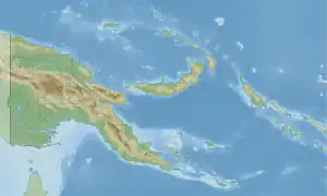
Wapenamanda Rural LLG | |
|---|---|
 Wapenamanda Rural LLG Location within Papua New Guinea | |
| Coordinates: 5°37′57″S 143°53′17″E / 5.632376°S 143.888049°E | |
| Country | Papua New Guinea |
| Province | Enga Province |
| Time zone | UTC+10 (AEST) |
Wapenamanda Rural LLG is a local-level government (LLG) of Enga Province, Papua New Guinea.[1][2]
Wards
- 01. Awas
- 02. Tubiakores
- 03. Aipanda
- 04. Kaiamanda
- 05. Tombes
- 06. Yalis
- 07. Yuk
- 08. Alumbalam
- 09. Elyaganda
- 10. Takaipos
- 11. Mambisanda
- 12. Kumbas Kau
- 13. Wares
- 15. Rauanda
- 16. Pina
- 17. Yaibos
- 18. Topakapos
- 19. Paus
- 20. Kuimamanda
- 21. Kangarapos
- 22. Pompabus
- 23. Kanamanda
- 24. Mondop
- 25. Pausa
- 26. Kumbu
- 27. Yaramanda
- 28. Tapend
- 29. Yakaendis
- 30. Unda
- 31. Anji
- 32. Nanai
- 33. Walya
- 34. Ipia
- 82. Wapenamanda Urban
References
- ↑ "Census Figures by Wards - Highlands Region". www.nso.gov.pg. 2011 National Population and Housing Census: Ward Population Profile. Port Moresby: National Statistical Office, Papua New Guinea. 2014.
- ↑ "Final Figures". www.nso.gov.pg. 2011 National Population and Housing Census: Ward Population Profile. Port Moresby: National Statistical Office, Papua New Guinea. 2014.
- OCHA FISS (2018). "Papua New Guinea administrative level 0, 1, 2, and 3 population statistics and gazetteer". Humanitarian Data Exchange. 1.31.9.
- United Nations in Papua New Guinea (2018). "Papua New Guinea Village Coordinates Lookup". Humanitarian Data Exchange. 1.31.9.
This article is issued from Wikipedia. The text is licensed under Creative Commons - Attribution - Sharealike. Additional terms may apply for the media files.