Tuni | |
|---|---|
.jpg.webp) | |
| Nickname: Mango City | |
.svg.png.webp) Tuni Location in Andhra Pradesh, India | |
| Coordinates: 17°21′N 82°33′E / 17.35°N 82.55°E | |
| Country | India |
| State | Andhra Pradesh |
| Region | Coastal Andhra |
| District | Kakinada |
| Government | |
| • MLA | Dadisetti Raja(YSRCP) |
| Area | |
| • Total | 63.02 km2 (24.33 sq mi) |
| Elevation | 140 m (460 ft) |
| Population (2021)[2] | |
| • Total | 254,448 |
| • Density | 4,000/km2 (10,000/sq mi) |
| Languages | |
| • Official | Telugu |
| Time zone | UTC+5:30 (IST) |
| PIN | 533401 |
| Telephone code | 91–08854 |
| Vehicle Registration | AP05 (Former) AP39 (from 30 January 2019)[3] |
| Currency | Indian Rupee, INR |
| Railway Station | Tuni railway station |
| Police | Andhra Pradesh Police |

Tuni is a city in Kakinada district of the Indian state of Andhra Pradesh. It is a second biggest city in Kakinada district. Freedom fighter Alluri Sitaramaraju studied here. It is a major commercial marketing centre for more than 200+ surrounding villages in the district. Tuni is a border point for the district of Kakinada. It is known for mango production, with nearly 250 varieties being exported from the area. Tuni City is also known as "Mango City". Tuni is also famous for the production of betel leaves and jute bags. A variety of cashew nuts are also produced in Tuni.
History
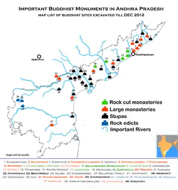
Tuni as a historical site may date back to the 1st century CE in connection with Buddhism, which flourished in the nearby hillocks and villages such as Gopalapatnam, Satyavaram and Kummarilova, near the city of Tuni on the banks of the Thandava River. The Buddhist monks would have resided in Kummarilova village (Kummararam) from the 2nd century CE to 6th century CE and propagated Buddhism. The Buddhist 'aramas' and 'stupas' found in the village are testimony for their presence, they said. This village is called 'Panchasheela Buddhist Centre' as five Buddhist 'stupas' have been found here. Archaeology authorities found a Buddhist site at Kummarilova during a general survey carried out recently in the area.
Under the Kshatriyas of Vatsavai Dynasty, it was a Pargana (a sub-division in 15th century) in Keemarseema. After the division it became the capital of Kottam Estate. Tuni has been a famous marketplace since the 19th century CE.
The Tuni Railway station had an important prominence on the Howrah-Madras railway line during the time of British India and after Independence.
Raja Kalasala is one of the oldest schools in Tuni, with a history of more than 100 years. A prominent guerrilla war fighter during the Indian independence movement, Alluri Sitarama Raju, studied here. A statue of him was built at a junction.
Demographics
The Tuni Municipality has population of 254,448 of which 106,020 are males whileand 148,428 are females as per report released by Census India 2021. The literacy rate within Tuni city is 77.40%, higher than the state average of 67.02%. The male literacy rate of 82.79%, while the female literacy rate is 72.38%.The schedule census of 2021 for Tuni city is postponed due to covid. We believe new population census for Tuni city will be conducted in 2024 and same will be updated once its done.
Geography
Tuni is at 17.35°N 82.55°E. It has an average elevation of 16 metres (46 ft)
Climate
| Climate data for Machilipatnam (1981–2010, extremes 1995–2012) | |||||||||||||
|---|---|---|---|---|---|---|---|---|---|---|---|---|---|
| Month | Jan | Feb | Mar | Apr | May | Jun | Jul | Aug | Sep | Oct | Nov | Dec | Year |
| Record high °C (°F) | 35.3 (95.5) |
38.8 (101.8) |
40.8 (105.4) |
40.3 (104.5) |
47.5 (117.5) |
47.5 (117.5) |
41.4 (106.5) |
39.5 (103.1) |
39.0 (102.2) |
38.8 (101.8) |
37.0 (98.6) |
34.3 (93.7) |
47.5 (117.5) |
| Mean daily maximum °C (°F) | 30.0 (86.0) |
32.0 (89.6) |
34.5 (94.1) |
35.8 (96.4) |
37.7 (99.9) |
35.9 (96.6) |
33.7 (92.7) |
33.3 (91.9) |
33.4 (92.1) |
32.5 (90.5) |
31.6 (88.9) |
30.2 (86.4) |
33.4 (92.1) |
| Mean daily minimum °C (°F) | 19.3 (66.7) |
20.9 (69.6) |
23.5 (74.3) |
25.9 (78.6) |
27.4 (81.3) |
27.1 (80.8) |
26.0 (78.8) |
25.8 (78.4) |
25.6 (78.1) |
24.3 (75.7) |
21.9 (71.4) |
19.1 (66.4) |
23.9 (75.0) |
| Record low °C (°F) | 12.6 (54.7) |
14.1 (57.4) |
17.2 (63.0) |
19.5 (67.1) |
18.4 (65.1) |
22.9 (73.2) |
22.1 (71.8) |
21.4 (70.5) |
22.8 (73.0) |
19.8 (67.6) |
16.0 (60.8) |
14.9 (58.8) |
12.6 (54.7) |
| Average rainfall mm (inches) | 7.3 (0.29) |
17.5 (0.69) |
17.8 (0.70) |
37.4 (1.47) |
52.6 (2.07) |
166.3 (6.55) |
158.8 (6.25) |
159.6 (6.28) |
233.6 (9.20) |
226.5 (8.92) |
54.7 (2.15) |
22.1 (0.87) |
1,154.3 (45.44) |
| Average rainy days | 0.5 | 0.8 | 1.1 | 2.3 | 3.3 | 8.1 | 10.9 | 10.7 | 10.8 | 9.2 | 2.6 | 0.8 | 61.0 |
| Average relative humidity (%) (at 17:30 IST) | 64 | 63 | 66 | 68 | 65 | 65 | 68 | 70 | 74 | 73 | 65 | 62 | 67 |
| Source: India Meteorological Department[4][5] | |||||||||||||
Economy
Tuni is a commercial hub for Kakinada and Anakapalli Districts. A famous, and one of the oldest, sugar factories of Andhra Pradesh "Tandava Sugars" is here. A large number of handloom industries, about 20 cashew nut industries, hetero industries, and 10 other chemical industries are in and around Tuni.
Assembly constituency
Tuni is an assembly constituency (consisting of mandals: Kotananduru, Tuni and Thondangi) in Andhra Pradesh. There were 163,024 registered voters in Tuni constituency in the 1999 elections.
Transport

Railways
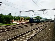
Tuni railway station is classified as an A category station, It is managed by vijayawada railway division in south central railway zone of indian railways. It is the 214th busiest station in the country.
Roads
Tuni is very well connected to the state and the rest of India with a network of state and national highways. NH 16 passes through the city. National Highway 16, a part of Golden Quadrilateral highway network, bypasses the City.[6] The Andhra Pradesh State Road Transport Corporation operates bus services from Tuni bus station.[7] Tuni is located on Howrah-Chennai main line. Rajahmundry Airport is located 95 km (59 mi) west-southwest of Tuni. Visakhapatnam Airport is situated approximately the same distance northeast of Tuni.
Education
Primary and secondary school education is imparted by government, aided and private schools, under the School Education Department of the state.[8][9] Instruction is available in both English and Telugu.
Schools and colleges
- Narayana Junior College
- Government Degree college
- Sri Prakash Junior College
- Siddhartha Junior College
- Government girls High school
- Sri Chaitanya College
- Bashyam school
- Aditya Degree College
- Sri Prakash vidhya Niketan
- Sri Prakash Engineering College
- Sri Prakash degree College
- Siddhartha Degree College
- Tagore Convet School
Notable people
- Alluri Sita Rama Raju, a freedom fighter
- Avasarala Ramakrishna Rao, a Telugu short story writer[10]
- Vempati Sadasiva Brahmam, a Telugu writer of film stories, dialogues and lyrics, in the early period of Telugu cinema.
- Chandra Sekhar Yeleti, Telugu film director
References
- ↑ "Municipalities, Municipal Corporations & UDAs" (PDF). Directorate of Town and Country Planning. Government of Andhra Pradesh. Archived from the original (PDF) on 28 January 2016. Retrieved 28 January 2016.
- ↑ "Census 2011". The Registrar General & Census Commissioner, India. Retrieved 9 July 2014.
- ↑ "New 'AP 39' code to register vehicles in Andhra Pradesh launched". The New Indian Express. Vijayawada. 31 January 2019. Retrieved 9 June 2019.
- ↑ "Station: Tuni Climatological Table 1981–2010" (PDF). Climatological Normals 1981–2010. India Meteorological Department. January 2015. pp. 761–762. Archived from the original (PDF) on 5 February 2020. Retrieved 19 February 2020.
- ↑ "Extremes of Temperature & Rainfall for Indian Stations (Up to 2012)" (PDF). India Meteorological Department. December 2016. p. M19. Archived from the original (PDF) on 5 February 2020. Retrieved 19 February 2020.
- ↑ "National Highways Development Project Map". National Highways Authority of India. Archived from the original on 22 April 2017. Retrieved 21 April 2017.
- ↑ "Bus Stations in Districts". Andhra Pradesh State Road Transport Corporation. Retrieved 9 March 2016.
- ↑ "School Education Department" (PDF). School Education Department, Government of Andhra Pradesh. Archived from the original (PDF) on 7 November 2016. Retrieved 7 November 2016.
- ↑ "The Department of School Education - Official AP State Government Portal | AP State Portal". www.ap.gov.in. Archived from the original on 7 November 2016. Retrieved 7 November 2016.
- ↑ Staff Reporter (29 October 2011). "Writer Avasarala Ramakrishna Rao dead". The Hindu. Retrieved 1 March 2015.