| Tengiz | |
|---|---|
| Теңіз көлі | |
 2008 | |
 Tengiz | |
| Location | Kazakhstan |
| Coordinates | 50°26′23″N 68°54′0″E / 50.43972°N 68.90000°E |
| Type | Salt lake |
| Primary inflows | Nura, Kulanotpes |
| Basin countries | Kazakhstan |
| Surface area | 1,382 km2 (534 sq mi) |
| Average depth | 2.5 m (8 ft 2 in) |
| Max. depth | 6.7 m (22 ft) |
| Shore length1 | 470 km (290 mi) |
| Surface elevation | 305 m (1,001 ft) |
| Islands | Tengizi Islands |
| Official name | Kourgaldzhin and Tengiz Lakes |
| Designated | 11 October 1976 |
| Reference no. | 107 [1] |
| 1 Shore length is not a well-defined measure. | |
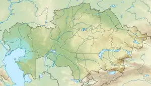
Tengiz Lake (Kazakh: Теңіз көлі, Teñız kölı; Russian: Тенгиз[2]) is a saline lake in Korgalzhyn District, Akmola Region, Kazakhstan.[3]
On 16 October 1976, the Soviet spacecraft Soyuz 23 unintentionally splashed down into the northern part of the lake, which was frozen, crashing through the ice. The crew was saved thanks to a very difficult but successful rescue operation.[4]
Geography
Tengiz is a shallow lake, subject to seasonal variations in water level. Its eastern shore is deeply indented and includes the Tengizi Islands.[5] The lake is located in an intermontane basin of the Kazakh Uplands and is the largest of the area.[6]
The Nura and Kulanotpes are the main rivers flowing into the lake. Lake Korgalzhyn is located in the eastern part, and Kypshak and Kerey to the southwest of lake Tengiz.[7]
Ecology
The lake Tengiz area is an important wetland site for birds. It is a part of a Ramsar wetland site of international importance, the Tengiz-Korgalzhyn Lake System, where 318 species of birds have been recorded, 22 of which are endangered.[8] Neighboring lake Korgalzhyn is the most northerly nesting site for the Greater flamingo; in the years 2006-2011 around 45,000 members of that species were noted. In 2015, however, the number dropped to less than 15,000. The lake is part of the Korgalzhyn Nature Reserve, for which it was nominated in 2008 together with the Naurzum Nature Reserve as the first natural UNESCO World Heritage Site in Kazakhstan (Saryarka — Steppe and Lakes of Northern Kazakhstan).

 Tengiz Lake with a relative low level,
3 September 2011, north-east part and lake margins dried up,
photo taken by Landsat 5 satellite.
References
- ↑ "Kourgaldzhin and Tengiz Lakes". Ramsar Convention Sites Information Service. Retrieved 25 April 2018.
- ↑ Tengiz, dengiz, deniz, etc. means "sea" in Turkic languages
- ↑ "Tengiz", a LakeNet profile
- ↑ Encyclopedia Astronautica, Soyuz 23
- ↑ Lake Tengiz - Britannica.com
- ↑ Казахский мелкосопочник (Kazakh Uplands) Great Soviet Encyclopedia in 30 vols. — Ch. ed. A.M. Prokhorov. - 3rd ed. - M. Soviet Encyclopedia, 1969-1978. (in Russian)
- ↑ "M-42 Topographic Chart (in Russian)". Retrieved 13 August 2022.
- ↑ "Tengiz Lake and Korgaljinski Lakes" Archived 30 March 2012 at the Wayback Machine
External links
 Media related to Lake Tengiz at Wikimedia Commons