| Tarraleah Tasmania | |||||||||||||||
|---|---|---|---|---|---|---|---|---|---|---|---|---|---|---|---|
 Tarraleah | |||||||||||||||
| Coordinates | 42°18′S 146°26′E / 42.300°S 146.433°E | ||||||||||||||
| Population | nil (2016 census)[1] | ||||||||||||||
| Established | 1934 | ||||||||||||||
| Postcode(s) | 7140 | ||||||||||||||
| Elevation | 630 m (2,067 ft) | ||||||||||||||
| Location |
| ||||||||||||||
| LGA(s) | Central Highlands | ||||||||||||||
| Region | Central | ||||||||||||||
| State electorate(s) | Lyons | ||||||||||||||
| Federal division(s) | Lyons | ||||||||||||||
| |||||||||||||||
| |||||||||||||||
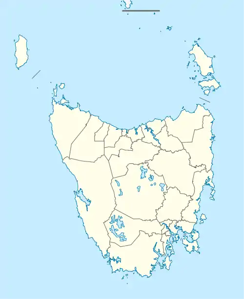
Tarraleah is a rural locality in the local government area (LGA) of Central Highlands in the Central LGA region of Tasmania. The locality is about 53 kilometres (33 mi) north-west of the town of Hamilton. The 2016 census has a population of nil for the state suburb of Tarraleah.[1]
The small town is 126 km north-west of the state capital Hobart, and slightly closer to Queenstown.
A large section of the town was purchased in 2023 by Hydro Tasmania for 11 million dollars.[2]
History
Tarraleah was gazetted as a locality in 1971.[3]
The township was built in the 1930s by the Hydro Electric Commission to house Tasmania's pioneering hydro electricity officers and management.[4][5][6][7]
Nive Road Post Office opened in 1934 and was renamed Tarraleah in 1935.[8]
Geography
The Derwent River flows through from west to south, where it forms part of the southern boundary. Lake Binney is contained within the locality, as is Tarraleah Power Station.[9]
Road infrastructure
Route A10 (Lyell Highway) passes through from south-east to north. Route C601 (Fourteen Mile Road) starts at an intersection with A10 and runs north-west until it exits.[3][10]
Amenities
The area is noted for its alpine lakes and mountains, and many hydro-electric dams, canals and giant steel pipeways. Tarraleah is located along the Lyell Highway, and is only a short distance from both Lake King William and Bronte Lagoon. Lake Lipootah and Bradys Lake are also close by.
After a multimillion-dollar redevelopment,[11] the former Hydro construction village has become an estate that comprises Tarraleah Lodge with accommodation, recreation, and dining options. Fresh water trout fishing, boating, bushwalking, mountain biking and kayaking are all popular activities in and around the township.
Tarraleah is also home to a high altitude golf course.
References
- 1 2 "2016 Census Quick Stats Tarraleah (Tas.)". quickstats.censusdata.abs.gov.au. Australian Bureau of Statistics. 23 October 2017. Retrieved 13 September 2020.
- ↑ "Hydro Workers Return to Tarraleah". Tasmanian Times. 7 May 2023. Retrieved 5 July 2023.
- 1 2 "Placenames Tasmania – Tarraleah". Placenames Tasmania. Select “Search”, enter "1270L", click “Search”, select row, map is displayed, click “Details”. Retrieved 13 September 2020.
- ↑ Tasmania. Hydro-Electric Commission (1938), Tarraleah power development, The Commission, retrieved 3 April 2012
- ↑ Felton, Heather; Hydro Tasmania (2008), Ticklebelly tales and other stories from the people of the Hydro, Hydro Tasmania, ISBN 978-0-646-47724-4 - see chapter 3 On the Upper Derwent - pp.76-101 regarding Tarraleah.
- ↑ Lawson, Julie; Tarraleah State School (2001), Tarraleah School : down the years 1935-2000, [J. Lawson], retrieved 3 April 2012
- ↑ Rackham, Sarah; Woodberry, Joan; Tasmania. Hydro-Electric Commission. Public Relations Dept (1981), Hydro construction villages. Volume one. Waddamana, Shannon, Tarraleah, Public Relations Department, Hydro-Electric Commission, ISBN 978-0-7246-1035-8
- ↑ "Post Office List". Premier Postal Auctions. Retrieved 21 September 2020.
- ↑ Google (13 September 2020). "Tarraleah, Tasmania" (Map). Google Maps. Google. Retrieved 13 September 2020.
- ↑ "Tasmanian Road Route Codes" (PDF). Department of Primary Industries, Parks, Water & Environment. May 2017. Archived from the original (PDF) on 1 August 2017. Retrieved 13 September 2020.
- ↑ "About Tarraleah Lodge". Archived from the original on 26 March 2023. Retrieved 5 July 2023.