Tano Station 田野駅 | |
|---|---|
 Tano Station in 2010 | |
| General information | |
| Location | Tano-chō, Aki-gun, Kōchi-ken 781-6410 Japan |
| Coordinates | 33°25′49.16″N 134°0′29.43″E / 33.4303222°N 134.0081750°E |
| Operated by | Tosa Kuroshio Railway |
| Line(s) | ■ Asa Line |
| Distance | 41.5 km from Gomen |
| Platforms | 2 side platforms |
| Tracks | 2 |
| Construction | |
| Structure type | Elevated |
| Bicycle facilities | Bike shed |
| Accessible | No - steps to platform |
| Other information | |
| Status | Unstaffed |
| Station code | GN22 |
| History | |
| Opened | 1 July 2002 |
| Passengers | |
| FY2011 | 138 daily |
| Location | |
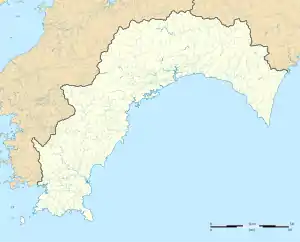
 Tano Station Location within Kochi Prefecture  Tano Station Tano Station (Japan) | |
Tano Station (田野駅, Tano-eki) is a passenger railway station located in the town of Tano, Aki District, Kōchi Prefecture, Japan. It is operated by the third-sector Tosa Kuroshio Railway with the station number "GN22".[1][2]
Lines
The station is served by the Asa Line and is located 41.5 km from the beginning of the line at Gomen.[3] All Asa Line trains, rapid and local, stop at the station except for those which start or end their trips at Aki.[4]
Layout
The station consists of two opposed side platforms serving two elevated tracks. There is no station building but both platforms have shelters for waiting passengers. Access to the each platform is by separate flights of steps. Another shelter and a bike shed have been built near the base of the steps.[2][3][5]
Adjacent stations
| « | Service | » | ||
|---|---|---|---|---|
| Asa Line | ||||
| Yasuda | Rapid | Nahari | ||
| Yasuda | Local | Nahari | ||
Station mascot
Each station on the Asa Line features a cartoon mascot character designed by Takashi Yanase, a local cartoonist from Kōchi Prefecture. The mascot for Tano Station is a samurai warrior named Tano Ishin-kun (田野 いしん君).[6]
History
The train station was opened on 1 July 2002 by the Tosa Kuroshio Railway as an intermediate station on its track from Gomen to Nahari.[7]
Passenger statistics
In fiscal 2011, the station was used by an average of 138 passengers daily.[7]
Surrounding area
- Tano Town Office
- Tano Elementary School
- Tano Town Tano Junior High School*
- Kochi Prefectural Junior High Schoo
See also
References
- ↑ "Shikoku Railway Route Map" (PDF). JR Shikoku. Retrieved 23 December 2017.
- 1 2 "田野" [Tano]. hacchi-no-he.net. Retrieved 20 February 2018.
- 1 2 Kawashima, Ryōzō (2013). 図説: 日本の鉄道 四国・九州ライン 全線・全駅・全配線・第1巻 四国東部エリア [Japan Railways Illustrated. Shikoku and Kyushu. All lines, all stations, all track layouts. Volume 1 Eastern Shikoku] (in Japanese). Kodansha. pp. 50, 87. ISBN 9784062951609.
- ↑ "時刻表 ごめん・なはり線" [Timetable Gomen-Nahari Line] (PDF). Tosa Kuroshio Railway. Retrieved 20 February 2018.
- ↑ "田野" [Tano]. nacl.sakura.jp. Retrieved 20 February 2018.
- ↑ "田野 いしん君" [Tano Ishin-kun]. gomen-nahari.com. Retrieved 20 February 2018.
- 1 2 Terada, Hirokazu (19 January 2013). データブック日本の私鉄 [Databook: Japan's Private Railways] (in Japanese). Japan: Neko Publishing. pp. 173, 303. ISBN 978-4-7770-1336-4.
External links
![]() Media related to Tano Station (Kochi) at Wikimedia Commons
Media related to Tano Station (Kochi) at Wikimedia Commons