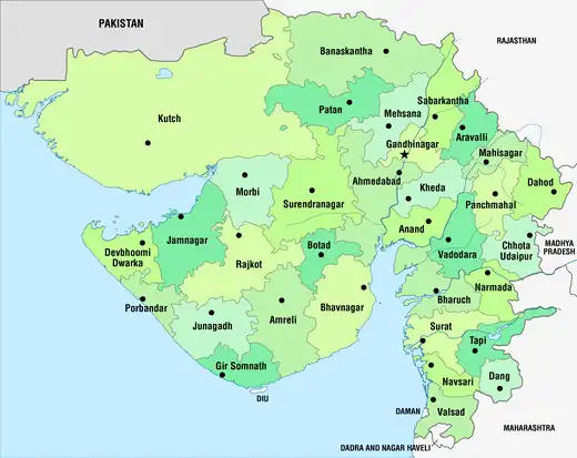
| Talukas of Gujarat | |
|---|---|
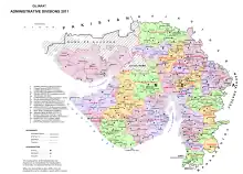 Talukas of Gujarat 2011 | |
| Category | Talukas |
| Location | Gujarat |
| Number | 252 Talukas[1] |
| Government | |
Gujarat has 252 talukas(tehsils,sub-districts).[2]
The urban status is listed for the headquarters town of the taluka, rural talukas are much larger. Urban status follows the census standard.
- M.Corp. = Municipal Corporation
- C.M.C. = City Municipal Council
- T.M.C. = Town Municipal Council
- T.P. = Town Panchayat
- G.P. = Gram Panchayat
Table
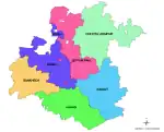
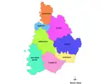
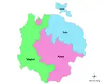
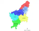
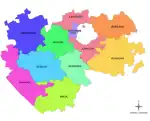
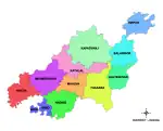
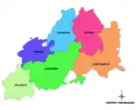
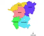
The table below lists all the talukas in the state of Gujarat, India, by district.[3][4][5][6]
Ahmedabad district
| Taluka Name[8] | Population | Area (in sq km) | Number of Villages | Number of Gram Panchayat | Literacy Rate | Map | |
|---|---|---|---|---|---|---|---|
| 2011 | 1991 | ||||||
| Ahmedabad City | 5,570,585 | 464.16 | 89.62% | 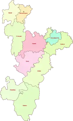 | |||
| Bavla | 124000 | 90408 | 414.80 | 48 | 48 | 77.12% | |
| Daskroi | 233925 | 175080 | 357.44 | 64 | 63 | 80.01% | |
| Detroj-Rampura | 76555 | 68734 | 450.00 | 51 | 46 | ||
| Dhandhuka | 74960 | 66103 | 46 | 40 | |||
| Dholera | 50821 | 9421 | 33 | 34 | |||
| Dholka | 166641 | 140113 | 828.58 | 71 | 65 | 72.45% | |
| Mandal | 58064 | 49977 | 325.29 | 37 | 36 | 76.20% | |
| Sanand | 195005 | 136777 | 443.52 | 67 | 69 | 83.91% | |
| Viramgam | 131680 | 93982 | 1,255.72 | 68 | 65 | 71.56% | |
Amreli district
| Taluka Name[9] | Population | Area (in sq km) | Number of Villages | Literacy Rate |
|---|---|---|---|---|
| Amreli | 398,651 | 2,564.89 | 121 | 76.12% |
| Lathi | 145,704 | 1,155.00 | 73 | 68.29% |
| Savarkundla | 206,147 | 1,141.20 | 76 | 72.51% |
| Babra | 87,156 | 656.70 | 35 | 71.05% |
| Bagasara | 110,127 | 679.43 | 47 | 72.08% |
| Dhari | 175,251 | 1,202.53 | 87 | 69.76% |
| Kunkavav Vadia | 74,738 | 425.50 | 32 | 65.84% |
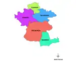
Anand district
| Taluka[10] | Population | Area (sq km) | Literacy Rate (%) |
|---|---|---|---|
| Anand | 226,026 | 240 | 85.60 |
| Petlad | 138,743 | 244 | 84.02 |
| Sojitra | 67,305 | 182 | 76.74 |
| Tarapur | 80,237 | 163 | 81.73 |
| Umreth | 98,747 | 201 | 83.78 |
Aravalli district
| Taluka Name[11] | Population | Area (in sq km) | Number of Villages | Literacy Rate |
|---|---|---|---|---|
| Modasa | 215,689 | 1,333.23 | 80 | 73.45% |
| Malpur | 76,423 | 714.06 | 40 | 65.81% |
| Dhansura | 60,841 | 401.81 | 35 | 69.05% |
| Bayad | 38,218 | 341.42 | 30 | 64.39% |
Banaskantha district
| Taluka Name[12] | Population | Area (in sq km) | Number of Villages | Literacy Rate |
|---|---|---|---|---|
| Palanpur | 595,891 | 2,922 | 130 | 68.78% |
| Deesa | 322,170 | 3,413 | 93 | 70.41% |
| Tharad | 224,987 | 2,546 | 81 | 64.93% |
| Dhanera | 185,688 | 2,286 | 70 | 66.31% |
| Vav | 94,846 | 1,129 | 38 | 56.19% |
| Amirgadh | 60,093 | 1,022 | 37 | 60.02% |
| Dantiwada | 98,515 | 1,602 | 52 | 64.22% |
| Vadgam | 78,142 | 1,339 | 40 | 56.83% |
| Bhabhar | 61,404 | 1,254 | 36 | 57.96% |
| Kankrej | 48,063 | 788 | 29 | 58.54% |
Bharuch district
| Taluka Name[13] | Population | Area (in sq km) | Number of Villages | Literacy Rate |
|---|---|---|---|---|
| Bharuch | 335,855 | 293.51 | 52 | 85.46% |
| Ankleshwar | 143,373 | 159.63 | 29 | 79.45% |
| Jambusar | 225,751 | 731.64 | 78 | 77.33% |
| Amod | 102,982 | 329.46 | 45 | 69.85% |
| Vagra | 97,087 | 618.64 | 67 | 72.57% |
| Hansot | 74,812 | 271.59 | 40 | 68.95% |
Bhavnagar district
| Taluka Name[14] | Population | Area (in sq km) | Number of Villages | Literacy Rate |
|---|---|---|---|---|
| Bhavnagar | 1,200,000 | 472.80 | 2 | 78.56% |
| Mahuva | 237,262 | 675.94 | 83 | 75.08% |
| Talaja | 168,216 | 624.98 | 71 | 72.91% |
| Sihor | 183,654 | 500.10 | 76 | 70.62% |
| Gariadhar | 97,596 | 342.22 | 52 | 72.38% |
| Ghogha | 73,287 | 340.16 | 28 | 75.84% |
| Umrala | 81,931 | 412.08 | 41 | 71.62% |
Botad district
| Taluka Name[15] | Population | Area (in sq km) | Number of Villages | Literacy Rate |
|---|---|---|---|---|
| Botad | 290,753 | 394.74 | 53 | 76.21% |
| Gadhada | 87,283 | 505.04 | 32 | 63.40% |
| Barwala | 71,479 | 295.53 | 25 | 66.88% |
| Ranpur | 92,019 | 503.22 | 55 | 67.92% |
Chhota Udaipur district
| Taluka Name[16][17] | Population | Area (in sq km) | Number of Villages | Literacy Rate |
|---|---|---|---|---|
| Chhota Udaipur | 179,066 | 1,338 | 124 | 66.89% |
| Jetpur Pavi | 57,329 | 587 | 46 | 64.76% |
| Kawant | 81,239 | 1,575 | 82 | 59.32% |
| Bodeli | 95,662 | 702 | 54 | 71.48% |
Dahod district
| Taluka Name[18] | Population | Area (in sq km) | Number of Villages | Literacy Rate |
|---|---|---|---|---|
| Dahod | 243,731 | 2,125 | 175 | 70.68% |
| Dhanpur | 95,874 | 1,150 | 61 | 67.52% |
| Fatepura | 137,438 | 1,358 | 97 | 68.29% |
| Garbada | 71,234 | 1,079 | 70 | 65.43% |
| Limkheda | 88,919 | 1,313 | 97 | 62.75% |
| Sanjeli | 70,144 | 1,123 | 78 | 65.88% |
Dang district
| Taluka Name[19][20] | Population | Area (in sq km) | Number of Villages | Literacy Rate |
|---|---|---|---|---|
| Ahwa | 81,054 | 504.71 | 44 | 64.52% |
| Subir | 37,468 | 344.46 | 23 | 63.16% |
| Waghai | 60,980 | 1,023.02 | 58 | 68.31% |
| Saputara | 15,794 | 200.17 | 14 | 72.79% |
| Dang total | 195,296 | 2,072.36 | 139 | 65.88% |
Devbhumi Dwarka district
| Taluka Name[21] | Population | Area (in sq km) | Number of Villages | Literacy Rate |
|---|---|---|---|---|
| Khambhalia | 191,672 | 885.33 | 90 | 70.85% |
| Dwarka | 176,335 | 6,694.25 | 139 | 80.64% |
| Bhanvad | 63,247 | 811.80 | 62 | 63.02% |
| Kalyanpur | 43,889 | 526.96 | 42 | 59.82% |
| Okhamandal | 63,338 | 564.84 | 56 | 68.17% |
| Jamnagar Rural | 51,906 | 298.06 | 37 | 77.33% |
Gandhinagar district
| Taluka[22] | Area (in sq. km) | Population (2011) | Literacy Rate (%) |
|---|---|---|---|
| Gandhinagar | 490.19 | 1,387,478 | 89.00 |
| Kalol | 625.29 | 441,074 | 83.43 |
| Mansa | 418.77 | 150,086 | 78.26 |
| Dehgam | 282.93 | 148,608 | 81.98 |
| Kheralu | 640.42 | 179,283 | 69.23 |
| Viramgam | 679.22 | 214,045 | 71.00 |
| Dholka | 392.31 | 191,911 | 81.03 |
Gir Somnath district
| Taluka Name[23] | Population | Area (in sq. km) | Literacy Rate | Major Villages |
|---|---|---|---|---|
| Veraval | 191,594 | 552 | 82.35% | Somnath, Talala, Kodinar, Sutrapada |
| Una | 188,905 | 890 | 76.55% | Una, Delvada, Keshod, Manavadar |
| Gir-Gadhada | 119,625 | 1,147 | 72.02% | Gadhada, Dhari, Khambhalia, Jafarabad |
| Talala | 73,711 | 436 | 81.75% | Talala, Sutrapada, Kodinar, Veraval |
Jamnagar district
| Taluka Name[24] | Population | Area (sq km) | Literacy Rate (%) |
|---|---|---|---|
| Jamnagar | 792,036 | 10,443 | 78.31 |
| Dhrol | 112,965 | 1,580 | 71.23 |
| Kalavad | 107,877 | 1,422 | 76.81 |
| Jodiya | 72,119 | 1,262 | 74.11 |
| Lalpur | 84,712 | 912 | 70.38 |
| Jamjodhpur | 66,557 | 998 | 70.59 |
| Khambhalia | 54,090 | 941 | 69.56 |
| Kalyanpur | 50,023 | 864 | 68.28 |
| Bhanvad | 45,290 | 646 | 72.54 |
| Jhadeshwar | 32,911 | 346 | 73.16 |
Junagarh district
| Taluka Name[25] | Population | Area (in sq km) | Number of Villages | Literacy Rate |
|---|---|---|---|---|
| Junagarh City | 319,462 | 40.00 | 1 | 88.35% |
| Bhesan | 146,980 | 646.46 | 69 | 73.25% |
| Manavadar | 128,654 | 337.15 | 49 | 77.89% |
| Visavadar | 114,925 | 612.29 | 56 | 73.18% |
| Keshod | 125,366 | 276.92 | 43 | 80.11% |
| Mangrol | 144,232 | 483.91 | 43 | 72.92% |
| Vanthali | 82,441 | 200.92 | 29 | 74.82% |
| Sutrapada | 62,035 | 1,160.56 | 43 | 68.09% |
| Kodinar | 119,609 | 496.27 | 65 | 66.27% |
Kheda district
| Taluka Name[26] | Population | Area (in sq km) | Number of Villages | Literacy Rate |
|---|---|---|---|---|
| Nadiad | 421,967 | 444.68 | 90 | 87.44% |
| Kapadvanj | 206,148 | 685.15 | 70 | 78.59% |
| Mahudha | 95,381 | 333.34 | 39 | 83.16% |
| Thasra | 120,584 | 548.19 | 60 | 79.23% |
| Balasinor | 88,596 | 398.53 | 60 | 68.75% |
| Virpur | 44,119 | 221.27 | 34 | 76.01% |
| Matar | 115,673 | 429.28 | 69 | 82.09% |
Kutch district
| Taluka Name[27] | Population | Area (in sq km) | Number of Villages | Literacy Rate |
|---|---|---|---|---|
| Bhuj | 412,735 | 11,822 | 82 | 75.23% |
| Anjar | 113,579 | 620 | 48 | 73.58% |
| Mandvi | 177,139 | 6,000 | 85 | 73.82% |
| Mundra | 101,485 | 1,058 | 53 | 76.43% |
| Abdasa | 81,985 | 1,213 | 76 | 62.43% |
| Lakhpat | 5,782 | 2,927 | 5 | 61.20% |
| Rapar | 110,641 | 5,902 | 58 | 58.27% |
| Nakhatrana | 108,952 | 4,437 | 55 | 63.22% |
Mahisagar district
| Taluka Name[28] | Population | Area (in sq km) | Number of Villages | Literacy Rate |
|---|---|---|---|---|
| Balasinor | 118,912 | 557.98 | 63 | 67.52% |
| Kadana | 62,345 | 670.44 | 31 | 61.81% |
| Lunawada | 560,835 | 2056.98 | 63 | 64.59% |
| Santrampur | 125,743 | 853.94 | 64 | 65.87% |
Mehsana district
| Taluka Name[29] | Population | Area (in sq km) | Number of Villages | Literacy Rate |
|---|---|---|---|---|
| Mehsana | 464,829 | 796.66 | 78 | 83.02% |
| Vijapur | 246,087 | 964.90 | 85 | 75.56% |
| Satlasana | 98,540 | 519.96 | 60 | 72.45% |
| Kadi | 172,026 | 410.00 | 60 | 78.61% |
| Becharaji | 65,382 | 239.69 | 22 | 81.43% |
| Jotana | 60,120 | 244.24 | 45 | 70.11% |
| Unjha | 86,459 | 45.23 | 1 | 86.23% |
Morbi district
| Taluka Name[30] | Population | Area (in sq km) | Number of Villages | Literacy Rate |
|---|---|---|---|---|
| Morbi | 342,947 | 1,586 | 97 | 80.73% |
| Tankara | 77,118 | 506 | 32 | 70.21% |
| Wankaner | 292,977 | 1,554 | 72 | 78.95% |
| Maliya | 61,639 | 498 | 22 | 71.83% |
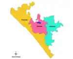
Narmada district
| Taluka Name[31] | Population | Area (in sq km) | Number of Villages | Literacy Rate |
|---|---|---|---|---|
| Nandod | 122,317 | 1,422.70 | 63 | 64.25% |
| Tilakwada | 63,481 | 1,228.20 | 70 | 63.97% |
| Sagbara | 97,894 | 1,108.50 | 77 | 68.72% |
| Garudeshwar | 54,686 | 469.39 | 36 | 70.12% |
Navsari district
| Taluka Name[32] | Population | Area (in sq km) | Number of Villages | Literacy Rate |
|---|---|---|---|---|
| Navsari | 382,505 | 319.69 | 95 | 84.52% |
| Gandevi | 144,826 | 234.76 | 42 | 74.61% |
| Jalalpore | 214,256 | 294.10 | 58 | 80.57% |
| Vansda | 130,094 | 670.34 | 96 | 70.09% |
| Chikhli | 191,962 | 394.35 | 83 | 77.06% |
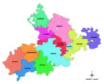
Panchmahal district
| Taluka Name[33][34] | Population | Area (in sq km) | Number of Villages | Literacy Rate |
|---|---|---|---|---|
| Godhra | 344,408 | 1,573.47 | 69 | 77.19% |
| Kalol | 208,828 | 611.22 | 38 | 76.51% |
| Halol | 120,839 | 392.47 | 28 | 73.29% |
| Morwa | 98,376 | 354.06 | 29 | 70.15% |
| Ghoghamba | 96,735 | 451.51 | 36 | 72.90% |
| Jambughoda | 52,468 | 713.38 | 32 | 66.24% |
Patan district
| Taluka Name[35] | Population | Area (in sq km) | Number of Villages | Literacy Rate |
|---|---|---|---|---|
| Patan City | 131,511 | 112.84 | 1 | 85.23% |
| Chanasma | 98,904 | 736.24 | 63 | 72.81% |
| Sidhpur | 98,987 | 118.66 | 1 | 82.37% |
| Harij | 73,452 | 399.28 | 32 | 65.24% |
| Sami | 57,548 | 394.25 | 24 | 70.09 |
Porbandar district
| Taluka Name[36] | Population | Area (in sq km) | Number of Villages | Literacy Rate |
|---|---|---|---|---|
| Porbandar City | 251,187 | 21.26 | 1 | 85.73% |
| Kutiyana | 129,014 | 1,100.07 | 67 | 73.62% |
| Ranavav | 72,460 | 769.86 | 44 | 67.89% |
| Bhanvad | 53,890 | 662.48 | 38 | 68.42% |
| Kalyanpur | 29,942 | 450.19 | 18 | 70.21% |
Rajkot district
| Taluka Name[37] | Population | Area (in sq km) | Number of Villages | Literacy Rate |
|---|---|---|---|---|
| Rajkot City | 1,390,640 | 104.86 | 1 | 89.82% |
| Dhoraji | 177,558 | 722.47 | 70 | 71.85% |
| Gondal | 293,254 | 1,143.23 | 94 | 79.86% |
| Jamkandorna | 88,779 | 314.15 | 42 | 72.03% |
| Jasdan | 118,725 | 584.35 | 68 | 71.02% |
| Jetpur | 189,870 | 320.58 | 64 | 73.49% |
| Kotda Sangani | 59,046 | 327.35 | 27 | 68.89% |
| Lodhika | 72,541 | 322.14 | 27 | 75.04% |
| Paddhari | 107,425 | 398.12 | 50 | 70.94% |
| Upleta | 153,952 | 553.28 | 68 | 69.96% |
| Tankara | 87,466 | 778.46 | 90 | 65.92% |
Sabarkantha district
| Taluka Name[38] | Population | Area (in sq km) | Number of Villages | Literacy Rate |
|---|---|---|---|---|
| Himatnagar | 297,120 | 474.95 | 44 | 84.91% |
| Idar | 4,811 | 875.57 | 85 | 78.56% |
| Bhiloda | 192,878 | 1,320.05 | 65 | 69.37% |
| Prantij | 159,455 | 482.09 | 34 | 79.22% |
| Talod | 115,643 | 798.07 | 46 | 65.84% |
| Vadali | 82,334 | 624.18 | 43 | 63.17% |
| Khedbrahma | 69,142 | 1,585.29 | 75 | 65.49% |
Surat district
| Taluka Name[39][40] | Population | Area (in sq km) | Number of Villages | Literacy Rate |
|---|---|---|---|---|
| Surat City | 6,106,189 | 326.515 | 1 | 89.03% |
| Chorasi | 342,398 | 258.41 | 49 | 77.21% |
| Kamrej | 311,543 | 334.16 | 54 | 72.89% |
| Bardoli | 385,428 | 417.32 | 75 | 74.22% |
| Mahuva | 177,764 | 174.06 | 22 | 64.08% |
| Mandvi | 132,764 | 491.70 | 42 | 69.65% |
| Palsana | 236,213 | 247.35 | 49 | 72.83% |
| Umarpada | 161,840 | 533.72 | 70 | 71.04% |
| Valod | 97,485 | 322.35 | 53 | 62.56% |
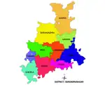
Surendranagar district
| Taluka Name[41] | Population | Area (in sq km) | Number of Villages | Literacy Rate |
|---|---|---|---|---|
| Chotila | 117,518 | 499.05 | 52 | 73.56% |
| Chuda | 68,356 | 196.04 | 38 | 68.29% |
| Dasada | 79,261 | 619.48 | 65 | 68.48% |
| Dhrangadhra | 220,649 | 1,218.39 | 87 | 74.16% |
| Lakhtar | 70,252 | 291.81 | 30 | 68.97% |
| Limbdi | 188,011 | 906.94 | 70 | 74.97% |
| Muli | 41,457 | 293.55 | 29 | 69.12% |
| Sayla | 78,744 | 579.73 | 68 | 73.06% |
| Surendranagar | 1,693,162 | 7,134.22 | 413 | 70.69% |
| Thangadh | 105,522 | 249.36 | 38 | 76.25% |
| Wadhwan | 166,271 | 92.00 | 1 | 76.41% |
Tapi District
| Taluka Name[42] | Population | Area (in sq km) | Number of Villages | Literacy Rate |
|---|---|---|---|---|
| Vyara | 233,309 | 530.30 | 92 | 74.69% |
| Songadh | 95,503 | 388.38 | 57 | 72.83% |
| Uchhal | 76,085 | 245.59 | 53 | 69.62% |
| Nizar | 53,824 | 273.14 | 46 | 66.08% |
Vadodara district
| Taluka Name[43] | Population | Area (in sq km) | Number of Villages | Literacy Rate |
|---|---|---|---|---|
| Vadodara City | 2,065,771 | 235.24 | 1 | 89.50% |
| Padra | 186,516 | 603.89 | 76 | 81.49% |
| Savli | 166,497 | 804.22 | 70 | 75.10% |
| Karjan | 164,556 | 694.77 | 76 | 70.45% |
| Waghodia | 149,213 | 433.16 | 70 | 75.68% |
| Dabhoi | 122,456 | 1,424.60 | 104 | 67.18% |
| Shinor | 66,714 | 358.08 | 42 | 67.10% |
| Desar | 60,861 | 278.87 | 25 | 69.12% |
Valsad district
| Taluka Name[44] | Population | Area (in sq km) | Number of Villages | Literacy Rate |
|---|---|---|---|---|
| Valsad | 306,155 | 452.70 | 90 | 84.03% |
| Pardi | 133,285 | 253.73 | 52 | 78.19% |
| Umbergaon | 65,563 | 77.42 | 25 | 75.69% |
| Kaprada | 40,567 | 1,042.32 | 97 | 70.05% |
| Dharampur | 77,536 | 1,157.30 | 110 | 70.98% |
| Vapi | 247,849 | 29.76 | 14 | 88.05% |
| Sanjan | 116,469 | 196.86 | 30 | 76.50% |
References
- ↑ "Gujarat | District Portal". gujarat.s3waas.gov.in. Retrieved 2023-03-02.
- ↑ Speak, Hindi (2023-03-02). "गुजरात के तालुके कितने हैं ? | Gujarat ke Taluka Kitne Hai". HindiSpeak. Retrieved 2023-03-03.
- ↑ "District and Taluka Panchayats". Gstfc.gujarat.gov.in. Archived from the original on 18 October 2018. Retrieved 27 December 2018.
- ↑ pankaj (2022-06-02). "Gujarat Taluka List 2023 - PDF Download". AIEMD. Retrieved 2023-03-24.
- ↑ "Gujarat Village map". Revenue department of Gujarat.
- ↑ "Gujarat Talukas" (PDF).
- ↑ "Village & Panchayats | Ahmedabad District, Government Of Gujarat | India". Retrieved 2023-02-09.
- ↑ "Village & Panchayats | Ahmedabad District, Government Of Gujarat | India". Retrieved 2023-03-24.
- ↑ "Village & Panchayats | District Amreli, Government of Gujarat | India". Retrieved 2023-03-24.
- ↑ "Anand District Village & Panchayats | District Anand, Government of Gujarat | India". Retrieved 2023-03-24.
- ↑ "Anand District Village & Panchayats | District Anand, Government of Gujarat | India". Retrieved 2023-03-24.
- ↑ "Village & Panchayats | District Banaskantha, Government of Gujarat | India". Retrieved 2023-03-24.
- ↑ "Demography | District Bharuch, Government Of Gujarat | India". Retrieved 2023-03-24.
- ↑ "Villages & Panchayats | District Bhavnagar, Government of Gujarat | India". Retrieved 2023-03-24.
- ↑ "Villages & Panchayats | District Botad, Government of Gujarat | India". Retrieved 2023-03-24.
- ↑ "Talukas | District Chhotaudepur,Government of Gujarat | India". Retrieved 2023-03-24.
- ↑ "Demography | District Chhotaudepur,Government of Gujarat | India". Retrieved 2023-03-24.
- ↑ "Village & Panchayats | District Dahod, Government of Gujarat | India". Retrieved 2023-03-24.
- ↑ "Village & Panchayats | District Dang, Government of Gujarat | India". Retrieved 2023-03-24.
- ↑ "Demography | District Dang, Government of Gujarat | India". Retrieved 2023-03-24.
- ↑ "Gram Panchayat | District Devbhumi Dwarka, Government of Gujarat | India". Retrieved 2023-03-24.
- ↑ "Village & Panchayats | District Gandhingar,Govt. of Gujarat | India". Retrieved 2023-03-24.
- ↑ "Village & Panchayats | District Gir Somnath, Government of Gujarat | India". Retrieved 2023-03-24.
- ↑ "Village Panchayats | District Jamnagar, Government of Gujarat | India". Retrieved 2023-03-24.
- ↑ "Village & Panchayats | District Gandhingar,Govt. of Gujarat | India". Retrieved 2023-03-24.
- ↑ "Village & Panchayats | District Kheda, Government Of Gujarat | India". Retrieved 2023-03-24.
- ↑ "Gram Panchayats | District Kachchh, Government of Gujarat | India". Retrieved 2023-03-24.
- ↑ "Gram Panchayat And Villages | District Mahisagar, Gujarat, India | India". Retrieved 2023-03-24.
- ↑ "Tehsil | District Mahesana, Government of Gujarat | India". Retrieved 2023-03-24.
- ↑ "Village & Panchayats | District Morbi, Government of Gujarat | India". Retrieved 2023-03-24.
- ↑ "Village & Panchayats | District Narmada, Government of Gujarat | India". Retrieved 2023-03-24.
- ↑ "Village & Panchayats | District Navsari, Government of Gujarat | India". Retrieved 2023-03-24.
- ↑ "Tehsil | Panchmahals, Gujarat, India | India". Retrieved 2023-03-24.
- ↑ "Village & Panchayats | Panchmahals, Gujarat, India | India". Retrieved 2023-03-24.
- ↑ "Village & Panchayats | Patan, Gujarat, India | India". Retrieved 2023-03-24.
- ↑ "Village & Panchayats | District Porbandar, Government of Gujarat | India". Retrieved 2023-03-24.
- ↑ "Village & Panchayats | District Rajkot, Government of Gujarat | India". Retrieved 2023-03-24.
- ↑ "Village & Panchayats | District Sabarkantha, Government of Gujarat | India". Retrieved 2023-03-24.
- ↑ "Taluka | District Surat, Government of Gujarat | India". Retrieved 2023-03-24.
- ↑ "Revenue Villages | District Surat, Government of Gujarat | India". Retrieved 2023-03-24.
- ↑ "Surendranagar Village List | District Surendranagar, Government of Gujarat | India". Retrieved 2023-03-24.
- ↑ "Village & Panchayats | District Tapi, Government of Gujarat | India". Retrieved 2023-03-24.
- ↑ "Village & Panchayats | District Vadodara,Government of Gujarat | India". Retrieved 2023-03-24.
- ↑ "Village & Panchayats | District Valsad, Government of Gujarat | India". Retrieved 2023-03-24.
External links
Gram Panchayat Election District Wise List : View District Results
This article is issued from Wikipedia. The text is licensed under Creative Commons - Attribution - Sharealike. Additional terms may apply for the media files.
.svg.png.webp)
.svg.png.webp)
.svg.png.webp)
.svg.png.webp)
.svg.png.webp)
.svg.png.webp)
.svg.png.webp)

.svg.png.webp)

.svg.png.webp)
.svg.png.webp)
.svg.png.webp)
.svg.png.webp)

.svg.png.webp)

.svg.png.webp)

.svg.png.webp)
.svg.png.webp)
.svg.png.webp)

.svg.png.webp)
.svg.png.webp)
.svg.png.webp)

.svg.png.webp)
.svg.png.webp)
.svg.png.webp)

.svg.png.webp)

.svg.png.webp)

.svg.png.webp)
.svg.png.webp)
.svg.png.webp)

.svg.png.webp)

.svg.png.webp)
.svg.png.webp)

.svg.png.webp)
.svg.png.webp)

