South Carthay | |
|---|---|
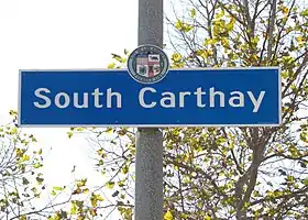
 South Carthay neighborhood sign located at 1025 S. Crescent Heights Boulevard (just south of Olympic Boulevard) | |
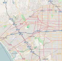
 South Carthay Location within Los Angeles | |
| Coordinates: 34°03′41″N 118°22′11″W / 34.0613272°N 118.3696349°W | |
| Country | |
| State | |
| County | |
| Time zone | Pacific |
| Zip Code | 90048 |
| Area code | 323 |
South Carthay is a neighborhood in Central Los Angeles, California. Located south of Carthay Circle,[1] South Carthay was developed in the 1930s by Spyros George Ponty.
Geography
The neighborhood is bounded by Olympic Boulevard on the north, La Cienega Boulevard on the west, Pico Boulevard on the south, and Crescent Heights Boulevard on the east.[2] The neighborhood of Carthay Circle is to the north.
History
The South Carthay area became a portion of the City of Los Angeles on February 28, 1922.[3] Residential development in the area began during the early 1930s on land that previously grew produce for Ralphs markets.[4] Greek developer Spyros George Ponty worked with architect Alan Ruoff[5] to design 147 modest Mediterranean-style homes in the area.[6] While the builder's influence is found in Westwood, Norwalk, Beverly Hills, South-Central Los Angeles and the San Fernando Valley, South Carthay's Spanish Colonial Revival homes represents one of his earliest legacies.[7] All of the 147 homes designed by Ponty share red-tiled roofs and stucco exterior walls, wrought iron and glazed-tile detailing. Yet each home was built slightly differently from the next, with flipped floor plans and doors and windows in different places.[7] South Carthay remains an architecturally cohesive community, with few intrusions from the succeeding decades.[2]
Historic Preservation Overlay Zone
In 1984, South Carthay became the second neighborhood in the city to receive the designation of Historic Preservation Overlay Zone (HPOZ).[7] The South Carthay preservation plan was adopted by the City of Los Angeles on December 9, 2010. Objectives of the HPOZ include: Safeguarding the character of historic buildings and sites and recognizing and protecting the historic streetscape and development patterns.[8] The HPOZ boundaries exclude the commercial thoroughfares of Pico Boulevard and La Cienega Boulevard.[9]
References
- ↑ The Thomas Guide, 2008, page 633
- 1 2 Winkler, Robert (September 2009). An Arch Guidebook to Los Angeles. p. 163. ISBN 9781423608936.
- ↑ "Los Angeles City Office of Historic Resources" (PDF). p. 17.
- ↑ Stein, Jeannine. "The Quest for a Sense of Place". Los Angeles Times.
- ↑ "The History of South Carthay". South Carthay Neighborhood Association.
- ↑ Heeger, Susan. "STYLE / Garden : REAL GREEN ROOMS". Los Angeles Times.
- 1 2 3 Mothner, Linda Beth. "City With Sense of History and Direction : South Carthay".
- ↑ "Los Angeles City Office of Historic Resources" (PDF). p. 5.
- ↑ "Los Angeles City Office of Historic Resources" (PDF). p. 22.
