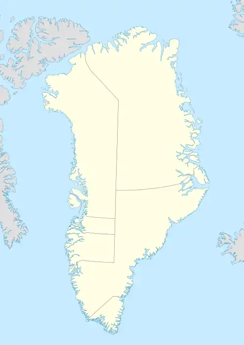
Native name: Appat | |
|---|---|
 Saunders Island | |
| Geography | |
| Location | Baffin Bay, Greenland |
| Coordinates | 76°34′N 69°50′W / 76.567°N 69.833°W |
| Area | 103 km2 (40 sq mi)[1] |
| Length | 15 km (9.3 mi) |
| Width | 7 km (4.3 mi) |
| Highest elevation | 391 m (1283 ft) |
| Administration | |
Greenland | |
| Municipality | Avannaata |
| Demographics | |
| Population | uninhabited |
Saunders Island (Greenlandic: Appat; Danish: Saunders Ø) is an island in North Star Bay, Baffin Bay in the Avannaata municipality of northwest Greenland.[2] The island is named after Commander James Saunders of the British Royal Navy.
Geography
The island lies off the southern shore of the mouth of Wolstenholme Fjord, north of Wolstenholme Island. Geologically it is composed of stratified rock. It is the largest island in the bay, flat-topped and with steep sides, with a landspit in the northeast.[3] Its highest point is 391 m (1,283 ft).[4] The channel to the south, between Saunders Island and the mainland is known as Bylot Sound.[5]
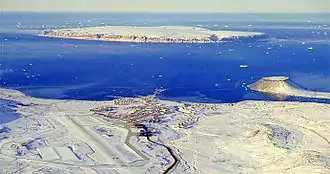
 View of North Star Bay with Pituffik Space Base in the foreground, Saunders Island in the background and the Uummannaq tombolo on the right. |
 View of Saunders Island with the Bylot Sound on the left and Wolstenholme Island in the background. |
Important Bird Area
The island has been designated an Important Bird Area (IBA) by BirdLife International because it supports a breeding population of some 143,000 pairs of thick-billed murres, as well as other seabirds, including northern fulmars and black guillemots.[6]
History
Under Commander James Saunders, HMS North Star sailed to the Arctic in 1849 in the spring on a venture to search and resupply Captain Sir James Clark Ross' expedition, who in turn had sailed in 1848 trying to locate the whereabouts of Sir John Franklin's expedition.[7]
Failing to find Franklin or Ross, Saunders's mission aboard North Star consisted in depositing stores along several named areas of the Canadian Arctic coast and returning to England before the onset of winter. However, James Saunders's ship became trapped by ice off the coast of northwest Greenland in North Star Bay. During the winter 1849–50 Saunders named numerous landmarks in that area, including Saunders Island, while wintering in the frozen bay.[8]
The Literary Expedition led by Ludvig Mylius-Erichsen wintered in 1903–1904 on the island. Its aim was to make ethnographic research of the local Inuit. Knud Rasmussen, Harald Moltke and Jørgen Brønlund were also part of this venture.[9]
See also
References
- ↑ UNEP
- ↑ GoogleEarth
- ↑ Clements R. Markham, William Alexander, Life of Admiral Sir Leopold McClintock, p. 90
- ↑ 1:1,000,000 scale Operational Navigation Chart, Sheet B-8, 3rd edition
- ↑ Eriksson, Mats (April 2002). "On Weapons Plutonium in the Arctic Environment (Thule, Greenland)" (PDF). Lund University. p. 11. Archived from the original (PDF) on 2009-03-27. Retrieved 2009-03-23.
- ↑ "Saunders Island". BirdLife Data Zone. BirdLife International. 2021. Retrieved 28 November 2021.
- ↑ Icy Imprisonment: The 1849 Voyage of the HMS North Star
- ↑ The Nautical Magazine and Naval Chronicle, Simpkin, Marshall & Co. London 1850, p. 588
- ↑ Den Litterære Ekspedition. In Den Store Danske Encyklopædi
External links
 Media related to Saunders Island, Greenland at Wikimedia Commons
- NASA - IceBridge Survey Flight Over Saunders Island and Wolstenholme Fjord