Sanchore
Satyapur City, Punjab of Rajasthan | |
|---|---|
city | |
| Sanchore | |
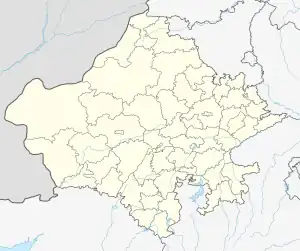
 Sanchore Location in Rajasthan, India | |
| Coordinates: 24°45′13″N 71°46′17″E / 24.75361°N 71.77139°E | |
| Country | |
| State | Rajasthan |
| District | Sanchore |
| Government | |
| • Type | Member of the Rajasthan Legislative Assembly |
| • Body | Sukhram Bishnoi |
| Elevation | 52 m (171 ft) |
| Population (2011)[1] | |
| • Total | 32,875 |
| Time zone | UTC+5:30 (IST) |
| PIN | 343041 |
| Vehicle registration | (RJ46) |
| Website | sanchore |
Sanchore is a city in the Indian state of Rajasthan. It will serve as headquarters of Sanchore district. The town is located on National Highway 68 and also on Amritsar–Jamnagar Expressway (NH-754). Sanchore was once known as Satyapur.
Economy
As of 2012 many infrastructure projects were in progress in Sanchor. Oil exploration company Cairn Energy, discovered 480,000,000 tonnes (1.06×10¹² lb) of crude oil in the Barmer-Sanchore basin in 2010.[2] The Narmada Canal, which begins in Gujarat, enters Rajasthan state near the village Silu in Sachore tehsil, after passing through 458 kilometres (285 mi) in Gujarat.
Pathmeda village near Sanchore has Gopal Govardhan Gaushala, the largest Gaushala in India. Spread over 200 acres (0.81 km2), the gaushala takes care of more than 18,000 cattle.[3]
Demographics
As of 2011, Sanchore had a population of 487458 (254057 Males constitute the population and 233401 are females. Males constituted 52.1% of the population. Sanchore has an average literacy rate of 56.18%, lower than the average literacy rate of Rajasthan is 66.11%. Male literacy is 58.77% and female literacy is 32.18%. 15.98 percent of Sanchore's population is under six years of age.
Transport
Road Transport
National Highway 68
The highway starting from its junction with NH-70 near Tanot connecting Ramgarh, Bhadasar, Jaisalmer, Barmer, Sanchor in the State of Rajasthan, Tharad, Bhabar, Radhanpur, Kamalpur, Khakhal, Roda, Dunawada, Patan, Chanasma, Mahesana, Kherva, Gojariya, Sama, Churada, Kuvadara and terminating at its junction with NH-48 near Prantij in the State of Gujarat.
Narmada Canal
The Narmada Canal in Rajasthan is 74 km (46 mi) long and has nine major distributaries. The main canal, major and secondary distributaries supply an area of 1,477 square kilometres (570 sq mi) serving 124 villages in the Sanchore and Barmer districts.
Railways
The stations nearest to Sanchore are Raniwara, 47 km (29 mi) on State Highway 11; Dhanera, 42 km (26 mi) on MRD No 108; Bhinmal, 65 km (40 mi) on State Highway No 11.
References
- ↑ "Census of India Search details". censusindia.gov.in. Retrieved 10 May 2015.
- ↑ Special Correspondent (16 October 2010). "480-million tonnes oil found in Barmer basin". The Hindu. Archived from the original on 20 October 2010. Retrieved 10 May 2012.
- ↑ Gupta, Abhinav (13 April 2016). "Shri Pathmeda Godham Mahatirth: World's largest cowshed". www.indiatvnews.com. Retrieved 28 October 2020.