Saint-Hubert | |
|---|---|
|
Flag | |
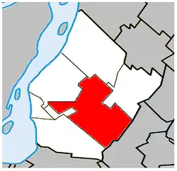
 Location within Urban Agglomeration of Longueuil. | |
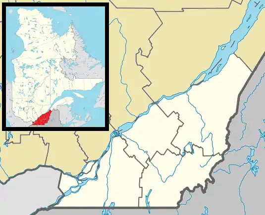
 Saint-Hubert Location in southern Quebec. | |
| Coordinates: 45°28′57″N 73°25′11″W / 45.48250°N 73.41972°W | |
| Country | |
| Province | |
| City | Longueuil |
| Established | 1860 |
| Merger with Longueuil | January 1, 2002 |
| Electoral Districts Federal | Saint-Bruno—Saint-Hubert |
| Provincial | Laporte Vachon |
| Government | |
| • Type | Borough |
| • Federal MP(s) | Denis Trudel |
| • Quebec MNA(s) | Nicole Ménard (PLQ) Martine Ouellet (PQ) |
| Area | |
| • Land | 65.98 km2 (25.48 sq mi) |
| Population (2006)[4] | |
| • Total | 77,028 |
| • Density | 1,167.5/km2 (3,024/sq mi) |
| • Change (2001-06) | |
| • Dwellings | 30,284 |
| Time zone | UTC-5 (EST) |
| • Summer (DST) | UTC-4 (EDT) |
| Postal code(s) | |
| Area code | 450 |
| Access Routes[5] | |
| Website | Webpage |
Saint-Hubert (/- ˈhjuːbərt/ - HEW-bərt, French pronunciation: [sɛ̃t‿ybɛʁ] ⓘ, locally [sẽɪ̯̃t͡s‿ybaɛ̯ʁ]) is a borough in the city of Longueuil, located in the Montérégie region of Quebec, Canada. It had been a separate city prior to January 1, 2002, when it along with several other neighbouring south shore municipalities were merged into Longueuil. Saint-Hubert had a population of 78,336 in 2006. The area of the borough is 65.98 km2 (25.48 sq mi). Longueuil's city hall is now located in Saint-Hubert. Saint-Hubert is located about 14 kilometres (8.7 mi) from downtown Montreal.
The borough has a wide array of commercial, industrial and agricultural enterprises. The aerospace industry is arguably the most important of these enterprises. Pratt & Whitney Canada designs and manufactures jet engines at a plant near Saint-Hubert Airport. The Canadian Space Agency has its head office in the borough. The École nationale d'aérotechnique, a school that teaches aeronautics is located in the borough and operated by Collège Édouard-Montpetit.
History
The city's namesake is derived from Hubertus, who later became commonly known as St. Hubert. It was originally established as a parish in 1860, and was granted official city status in 1958.
In 1971, the former city of Laflèche (previously known as Mackayville), merged with the city of Saint-Hubert.
- October Crisis
At the height of the 1970 October Crisis, Quebec Labour Minister Pierre Laporte was kidnapped from his Saint-Lambert, Quebec home and held at Saint-Hubert Airport. The city of Saint-Hubert, like many other Quebec municipalities, named a park in his honour, Parc Pierre-Laporte.
- Recent history
In 1992, the city began work on the creation of a large park, to be known as Parc de la Cité. It is located in the heart of the city and includes a one-kilometre long man-made lake. Croydon - Was part of St-Hubert from 0 Montée St-Hubert to Orchard ( St. Andres st) to Grande Allée to Maricourt.
Politics
It is split between the Vachon and Laporte (Laflèche) provincial electoral districts. Vachon's Member of the National Assembly is Martine Ouellet of the Parti Québécois. Laporte's Member of the National Assembly is Nicole Ménard of the Quebec Liberal Party.
It is composed of five municipal districts, each with a city councillor. The borough president is Lorraine Guay-Boivin of Action Longueuil.
| District | Party | Councillor | |
|---|---|---|---|
| Iberville | Action Longueuil | Éric Beaulieu | |
| Laflèche | Independent | Jacques Lemire | |
| Maraîchers | Action Longueuil | Lorraine Guay-Boivin | |
| Parc-de-la-Cité | Action Longueuil | Jacques E. Poitras | |
| Vieux-Saint-Hubert-la Savane | Action Longueuil | Nathalie Boisclair | |
Economy
Pascan Aviation has its headquarters in Saint-Hubert.[6]
Neighbourhoods
Today, there are four distinct sectors of Saint-Hubert:
- Iberville
- Laflèche
- Laurendeau
- Maricourt
Historic neighbourhoods
The following is a list of localities[N 1] within the borough of Saint-Hubert.[7]
- Brentwood
Brentwood was located in between Rue Kimber and Chemin Chambly. Chemin Noble was among the main streets in the area, with Cousineau Boulevard becoming important much later on. Chemin Noble was named for Benjamin Noble, superintendent and resident of the area, upon its founding in the late 1910s.[8] Brentwood was considered a "summer hideaway" by many Montrealers. It had no streets, electricity or telephone service. A small "hut-like" train station was located next to the railroad tracks and provided service to Montreal via the Montreal and Southern Counties Railway.[9]
- Brookline
Brookline was also located in between Rue Kimber and Chemin Chambly. Mountainview Boulevard was the locale's main street, with Cousineau Boulevard becoming a major artery much later on. Brookline was an anglophone working-class area. The tramway station was located on the southwest part of the railroad tracks, between Rue Rideau and Rue Léonard.[8]
- Castle Gardens
Castle Gardens was the smallest of Saint-Hubert's neighbourhoods. It was located in between the CN railway line, and Grande-Allée (formerly known as Chemin de la Côte-Noire), in between Rue Canon and Rue Jonergin (originally known as Ireland Street).
- Croydon
Croydon, or St. Lambert Annex, was a large neighbourhood located along Montée Saint-Hubert from Grande Allée to Boulevard de Maricourt at the railroad tracks. Along the railroad tracks, it stretched from Montée Saint-Hubert to Rue Donat, while its borders became smaller closer to Grande Alleé. It was an English-speaking working-class area.[10] Croydon's limits expanded in 1935 to include Castle Gardens.[10]
- East Greenfield
East Greenfield was located in close proximity to what is today known as the Litchfield Industrial Park. It stretched from Grande-Allée to Boulevard de Maricourt. The following streets ran north–south: Cornwall, Westley, Quévillon, Kensington, Belmont, Nantel, Campbell. Perpendicular to these streets were Barlow, Milligan, Viateur, Lalande, Mcrae, Spriggs and Robinson.[8] In 1935, its boundaries were extended to the nearby municipality of Saint-Joseph de Chambly. The 1935 census indicated that the majority of residents along Grande-Allée were francophone, while the rest of the area had a substantial anglophone population.[8] The area was served by St. Stephen Anglican Church and Westley United Church.[8]
- Pinehurst
Pinehurst was located east of to East Greenfield, and could be accessed by Rue Cornwall. This area started to develop in the mid-1910s.[8]
- Springfield Park
Springfield Park was located in between Rue Kimber and Boulevard Cousineau.[10] It was originally an English-speaking rural area served by the Montreal and Southern Counties Railway. Today it is primarily a French-speaking suburban area. Springfield Street, now known as Prince Charles Street, was the neighbourhood's main street.[10]
Demographics
| Year | Pop. | ±% |
|---|---|---|
| 1901 | 963 | — |
| 1911 | 952 | −1.1% |
| 1921 | 2,225 | +133.7% |
| 1931 | 1,981 | −11.0% |
| 1941 | 2,457 | +24.0% |
| 1951 | 6,494 | +164.3% |
| 1961 | 14,380 | +121.4% |
| 1971 | 36,789 | +155.8% |
| 1981 | 60,573 | +64.6% |
| 1991 | 74,093 | +22.3% |
| 1996 | 77,042 | +4.0% |
| 2001 | 75,912 | −1.5% |
| 2006 | 77,028 | +1.5% |
| [11][12] | ||
| Language | Population | Pct (%) |
|---|---|---|
| French | 64,130 | 84.04% |
| English | 7,005 | 9.18% |
| Both English and French | 850 | 1.11% |
| Non Official language only | 4,145 | 5.43% |
Education
|
|
The South Shore Protestant Regional School Board previously served the municipality.[13]
Transportation

- Airport
The borough has a medium-sized airport known as Montréal/St-Hubert Airport. In terms of aircraft movements, it is among the busiest in Canada. The airport was once the location of a Canadian Air Force Base which ceased operation in 1995, but which continues to use the area. The airport includes a weather station, next to which stands the headquarters of the Canadian Space Agency.
- Rail
Saint-Hubert is served by the Longueuil–Saint-Hubert commuter rail station on the Réseau de transport métropolitain's Mont-Saint-Hilaire line.
- Important roads
- Grande-Allée
- Taschereau Boulevard
- Cousineau Boulevard
- Chemin Chambly
- Payer Boulevard
- Mountainview Boulevard
- Kimber / Maricourt Boulevards
- Gaëtan Boucher Boulevard
Sister cities
- Saint-Nazaire, France (1991)[14]
Notable people
- Gaétan Boucher, speedskater
- Jon Lajoie, comedian
- Irina Lazareanu, model
- Patrick Leduc, soccer player
- Kaytranada, DJ and producer
- Marie-Claude Molnar, paralympic cyclist
See also
- List of municipalities in Quebec
- Municipal reorganization in Quebec
- List of mayors of Longueuil, Quebec
- Longueuil City Council
Pratt, Michel Longueuil 1657-2007. Les Éditions Histoire Québec, collection Société historique et culturelle du Marigot, 2008
Pratt, Michel Dictionnaire historique de Longueuil, Les Éditions Histoire Québec, collection Société historique et culturelle du Marigot. 2012
Notes
References
- ↑ "Ministère des Affaires Municipales et Régions: Saint-Hubert". gouv.qc.ca.
- ↑ "History of Federal Ridings since 1867". www2.parl.gc.ca.
- ↑ "Chief Electoral Officer of Québec - 40th General Election Riding Results: LAPORTE". electionsquebec.qc.ca.
- 1 2 3 Canada, Government of Canada, Statistics (13 March 2007). "Statistics Canada: 2006 Community Profiles". www12.statcan.gc.ca.
{{cite web}}: CS1 maint: multiple names: authors list (link) - ↑ Gouvernement du Québec, Ministère des Transports, de la Mobilité durable et de l'Électrification des transports. "Québec 511 - Carte routière". quebec511.gouv.qc.ca.
{{cite web}}: CS1 maint: multiple names: authors list (link) - ↑ "Contact us." Pascan Aviation. Retrieved December 4, 2010.
- ↑ "Statistics Canada - 2458227 - Longueuil, geographical codes and localities, 2006". statcan.ca.
- 1 2 3 4 5 6 Pratt, Michel. "Les quartiers de Saint-Hubert (partie 2)". Le Journal de Saint-Hubert. Archived from the original on 2013-01-15. Retrieved 2010-05-17.
- ↑ Cameron, Norman James. "Memories of Brentwood and its Inhabitants". (from the memoirs of V.M. Manning). The Montreal & Southern Counties Railway. Archived from the original on 2011-09-28. Retrieved 2010-05-18.
- 1 2 3 4 Pratt, Michel. "Les quartiers de Saint-Hubert (partie 1)". Le Journal de Saint-Hubert. Archived from the original on 2013-01-15. Retrieved 2010-05-17.
- ↑ Pratt, Michel. "De la balkanisation des villes à leur fusion". Société historique et culturelle du Marigot. Archived from the original on 29 October 2013. Retrieved 24 October 2013.
- ↑ Statistics Canada: 1996, 2001, 2006, 2011 census
- ↑ King, M.J. (Chairperson of the board). "South Shore Protestant Regional School Board" (St. Johns, PQ). The News and Eastern Townships Advocate. Volume 119, No. 5. Thursday December 16, 1965. p. 2. Retrieved from Google News on November 23, 2014.
- ↑ "Chroniques de la Rive-Sud 1947-1997". michelpratt.quebec.
External links
- Official website for former city of Saint-Hubert (archives)
- The Montreal & Southern Counties Railway (from the memoirs of V.M. Manning)
- Publications en ligne (Société historique et culturelle du Marigot)