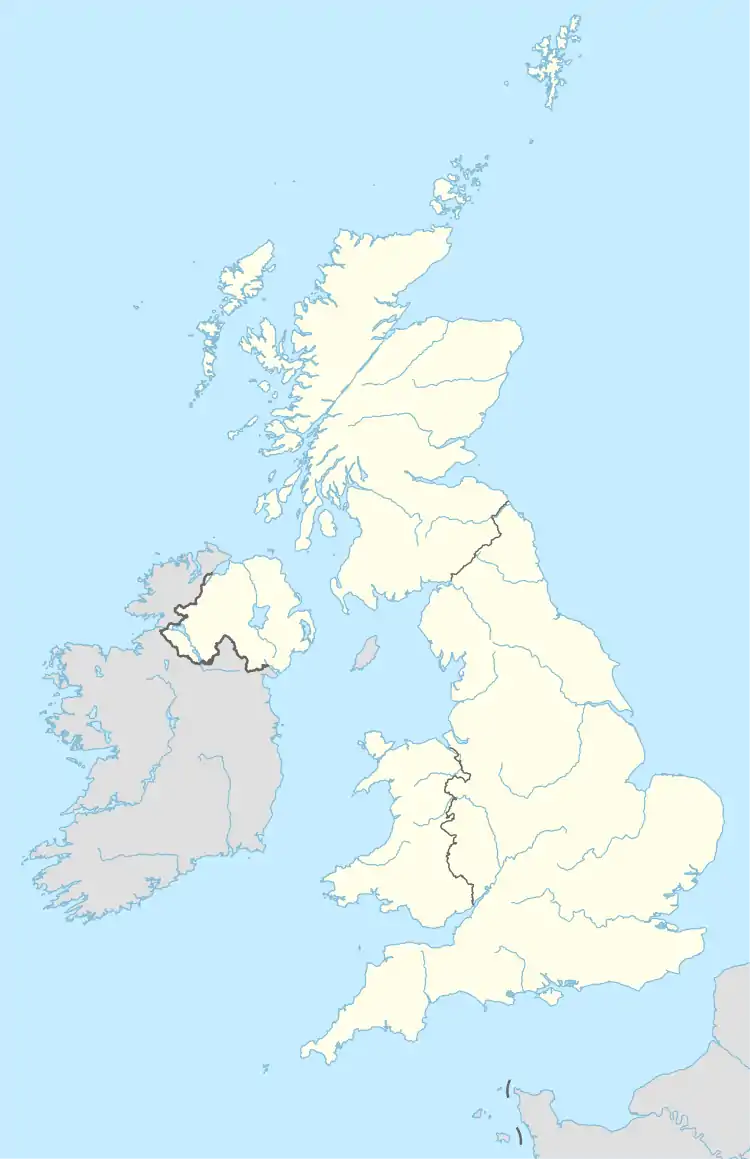
Template:Attached KML/SN postcode area
KML is from Wikidata
Swindon | |
|---|---|
 SN | |
| Coordinates: 51°29′53″N 1°54′29″W / 51.498°N 1.908°W | |
| Country | United Kingdom |
| Postcode area | SN |
| Postcode area name | Swindon |
| Post towns | 10 |
| Postcode districts | 23 |
| Postcode sectors | 113 |
| Postcodes (live) | 14,362 |
| Postcodes (total) | 21,374 |
| Statistics as at May 2020[1] | |
The SN postcode area, also known as the Swindon postcode area,[2] is a group of eighteen postcode districts in England, within ten post towns. These cover north Wiltshire (including Swindon, Chippenham, Calne, Corsham, Devizes, Malmesbury, Marlborough, Melksham and Pewsey), plus a small part of south-west Oxfordshire (including Faringdon) and a very small part of Gloucestershire.
Coverage
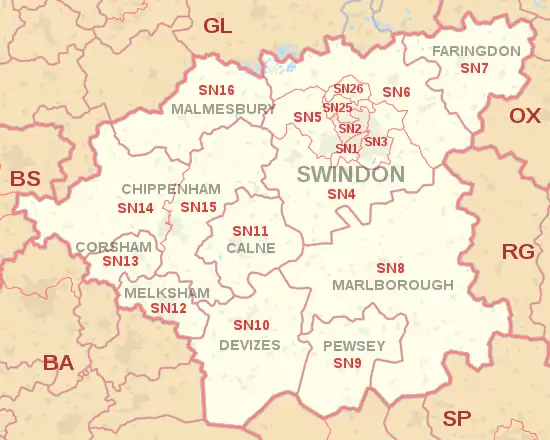
The approximate coverage of the postcode districts:
| Postcode district | Post town | Coverage | Local authority area(s) |
|---|---|---|---|
| SN1 | SWINDON | Swindon town centre south of the railway line, Old Town, southwest suburbs | Swindon |
| SN2 | SWINDON | Swindon town centre north of the railway line, inner suburbs to the north and northwest including Upper Stratton and Kingsdown | Swindon |
| SN3 | SWINDON | Swindon east suburbs, Stratton St Margaret, South Marston | Swindon |
| SN4 | SWINDON | Royal Wootton Bassett, Clyffe Pypard, Broad Town, Broad Hinton, Wroughton, Chiseldon, Liddington, Wanborough, Hinton Parva | Swindon, Wiltshire |
| SN5 | SWINDON | West Swindon, Lydiard Millicent, Purton | Swindon, Wiltshire |
| SN6 | SWINDON | Highworth, Cricklade, Shrivenham, Watchfield, Ashton Keynes, Ashbury, Bishopstone, Castle Eaton, Hannington, Idstone, Marston Meysey, Leigh | Swindon, Wiltshire, Vale of White Horse |
| SN7 | FARINGDON | Faringdon, Stanford in the Vale, Uffington, Longcot, Fernham, Buckland, Great Coxwell, Little Coxwell, Littleworth, Shellingford, Buscot | Vale of White Horse |
| SN8 | MARLBOROUGH | Marlborough, Ramsbury, Mildenhall, Aldbourne, Axford, Burbage, Baydon, Great Bedwyn | Wiltshire |
| SN9 | PEWSEY | Pewsey, Upavon, Enford | Wiltshire |
| SN10 | DEVIZES | Devizes, Market Lavington, Rowde | Wiltshire |
| SN11 | CALNE | Calne, Heddington, Hilmarton | Wiltshire |
| SN12 | MELKSHAM | Melksham, Bowerhill, Seend, Broughton Gifford | Wiltshire |
| SN13 | CORSHAM | Corsham, Box, Neston | Wiltshire |
| SN14 | CHIPPENHAM | Chippenham (west), Marshfield, Kington St Michael, Hullavington, Luckington, Grittleton, Yatton Keynell, Biddestone, Colerne | Wiltshire, South Gloucestershire |
| SN15 | CHIPPENHAM | Chippenham (east), Bromham, Sandy Lane, Lacock, Burleaze, Pewsham, Monkton Park, Foxham, Dauntsey, Seagry, Christian Malford, Bradenstoke, Sutton Benger, Lyneham, Draycot Cerne, Cleverton, Little Somerford, Langley Burrell, Great Somerford, Brinkworth[3] | Wiltshire |
| SN15 | CORSHAM | non-geographic[4] | |
| SN16 | MALMESBURY | Sherston, Malmesbury, Crudwell, Minety | Wiltshire |
| SN25 | SWINDON | Swindon outer north suburbs including Haydon Wick and Priory Vale; Blunsdon St Andrew | Swindon |
| SN26 | SWINDON | Blunsdon | Swindon |
| SN38 | SWINDON | Nationwide Building Society | non-geographic[5] |
| SN99 | SWINDON | non-geographic[5] |
The SN25 and SN26 districts were formed out of the SN2 district in 1999.[6]
Map
Template:Attached KML/SN postcode area
KML is from Wikidata
See also
References
- ↑ "ONS Postcode Directory Version Notes" (ZIP). National Statistics Postcode Products. Office for National Statistics. May 2020. Table 2. Retrieved 19 June 2020. Coordinates from mean of unit postcode points, "Code-Point Open". OS OpenData. Ordnance Survey. February 2012. Retrieved 21 April 2012.
- ↑ Royal Mail, Address Management Guide, (2004)
- ↑ "SN15 postboxes". edwardbetts.com. Retrieved 11 April 2018.
- ↑ "New sectors and localities to 14 December 2012" (PDF). Royal Mail Address Management Unit. 20 December 2012. Archived from the original (PDF) on 2 February 2015. Retrieved 20 December 2012.
- 1 2 "Non Geographic Codes" (PDF). Royal Mail Address Management Unit. July 2012. Archived from the original (PDF) on 16 September 2012. Retrieved 20 December 2012.
- ↑ "Royal Mail Postcode Update 30". Beacon Dodsworth. Retrieved 22 April 2017.
External links
This article is issued from Wikipedia. The text is licensed under Creative Commons - Attribution - Sharealike. Additional terms may apply for the media files.
