Redondo | |
|---|---|
.jpg.webp) | |
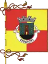
 Flag  Coat of arms | |
 | |
| Coordinates: 38°38′N 7°32′W / 38.633°N 7.533°W | |
| Country | |
| Region | Alentejo |
| Intermunic. comm. | Alentejo Central |
| District | Évora |
| Parishes | 2 |
| Government | |
| • President | António Recto (Ind.) |
| Area | |
| • Total | 369.51 km2 (142.67 sq mi) |
| Population (2016) | |
| • Total | 7,031 |
| • Density | 19/km2 (49/sq mi) |
| Time zone | UTC±00:00 (WET) |
| • Summer (DST) | UTC+01:00 (WEST) |
| Local holiday | Easter Monday date varies |
| Website | www |
Redondo (Portuguese pronunciation: [ʁɨˈðõdu] ⓘ) is a municipality in the District of Évora in Portugal. The population in 2016 was 6, 567,[1] in an area of 369.51 km2.[2]
Etymology
"Redondo" is a Spanish and Portuguese word that translates to "round" or "rounded" in English. It is derived from the Latin word "rotundus," which also means "round." The name "Redondo" is commonly used as a surname, place name, or in reference to various geographical features that exhibit a round or rounded shape.
In some cases, the name "Redondo" may refer to specific locations characterized by roundness, such as hills, mountains, or bodies of water. Additionally, it can be used to describe rounded architectural structures or objects.
It is worth noting that "Redondo" may have variations or similar names in other languages or regions, reflecting the shared etymology and concept of roundness.
History
Redondo is a municipality located in the Évora District of Portugal. Its history dates back centuries, with evidence of human presence in the area since prehistoric times. Here is a brief overview of the history of Redondo, Portugal:
Ancient and Roman Periods: The region around Redondo was inhabited by various prehistoric cultures, including the Neolithic and Chalcolithic peoples. The Romans also occupied the area, leaving behind archaeological remains such as the Villa of Tourega, which was an important Roman estate.
Medieval Era: During the Middle Ages, Redondo played a strategic role in the defense of the Portuguese territory. It was situated near the border with the Kingdom of Castile, and the castle of Redondo was built to protect the region from invasions. The castle, along with the town walls, served as a stronghold for the Portuguese against the Moors and other potential invaders.
Development and Expansion: Redondo grew over the centuries, expanding its agricultural and wine production. The town became known for its pottery and traditional crafts, with skilled artisans producing ceramics and earthenware.
Modern Era: In the 19th and 20th centuries, Redondo faced challenges associated with industrialization and economic changes. The decline of traditional crafts and rural agriculture affected the local economy. However, efforts have been made to preserve Redondo's cultural heritage, and the town continues to be recognized for its pottery and wine production.
Today, Redondo remains a small but charming town in Portugal, attracting visitors with its historical sites, picturesque landscapes, and cultural traditions. The castle of Redondo, along with the old town walls and the Church of São Salvador, are among the notable landmarks that reflect the town's rich history. The region's wineries and vineyards also contribute to the local economy and cultural identity.
Geography
Redondo is a municipality located in the Évora District of Portugal. It is situated in the Alentejo region, known for its vast plains, rolling hills, and agricultural landscapes. Here is an overview of the geography of Redondo:
Topography: Redondo is characterized by gently rolling hills and fertile plains. The terrain is predominantly composed of limestone and clay, which contributes to the agricultural productivity of the region.
Natural Features: The municipality of Redondo is surrounded by scenic natural landscapes. To the south lies the Serra d'Ossa, a mountain range that adds to the picturesque beauty of the area. The region is also intersected by several rivers, including the Degebe, Divor, and Aldeia rivers, which contribute to the irrigation of the agricultural fields.
Vegetation: The natural vegetation in Redondo and the wider Alentejo region is typical of Mediterranean climates. It consists of cork oak forests, holm oak groves, and scattered shrubs. The region is also known for its extensive vineyards, olive groves, and cereal crops.
Climate: Redondo experiences a Mediterranean climate with hot, dry summers and mild, relatively wet winters. Summers can be quite hot, with temperatures often reaching over 30°C (86°F). Winters are mild, with average temperatures ranging from 8°C to 15°C (46°F to 59°F).
Agriculture: The fertile soils and favorable climate of Redondo make it an ideal agricultural region. The area is known for its wine production, particularly red wines, and the cultivation of olives, cereals, and other crops. Traditional agricultural practices, such as extensive grazing and cork oak harvesting, also contribute to the local economy.
Overall, Redondo offers a scenic and picturesque landscape characterized by rolling hills, fertile plains, and a mix of agricultural and natural features. Its geographical features make it an attractive destination for those seeking to explore the natural beauty of the Alentejo region in Portugal.
Administration
The current Mayor is António José Recto, having been elected in 2013 as head of the same independent list his predecessor, Alfredo Falamino Barroso, previously commanded. The municipal holiday is Easter Monday.
Parishes
Administratively, the municipality is divided into 2 civil parishes (freguesias):[3]
- Montoito
- Redondo
Notable people
- Bruno Pires (born 1981) a Portuguese former professional road bicycle racer, who competed professionally between 2002 and 2016
- Vitorino (born 1942) a Portuguese singer-songwriter known for his work combining the music of his native Alentejo with urban popular song
See also
References
- ↑ Instituto Nacional de Estatística
- ↑ Áreas das freguesias, concelhos, distritos e país
- ↑ Diário da República. "Law nr. 11-A/2013, page 552 102" (pdf) (in Portuguese). Retrieved 29 July 2014.