The Tropical Cyclones Portal
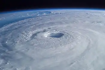
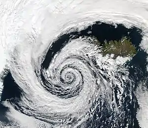
A tropical cyclone is a storm system characterized by a large low-pressure center, a closed low-level circulation and a spiral arrangement of numerous thunderstorms that produce strong winds and heavy rainfall. Tropical cyclones feed on the heat released when moist air rises, resulting in condensation of water vapor contained in the moist air. They are fueled by a different heat mechanism than other cyclonic windstorms such as Nor'easters, European windstorms and polar lows, leading to their classification as "warm core" storm systems. Most tropical cyclones originate in the doldrums, approximately ten degrees from the Equator.
The term "tropical" refers to both the geographic origin of these systems, which form almost exclusively in tropical regions of the globe, as well as to their formation in maritime tropical air masses. The term "cyclone" refers to such storms' cyclonic nature, with anticlockwise rotation in the Northern Hemisphere and clockwise rotation in the Southern Hemisphere. Depending on its location and intensity, a tropical cyclone may be referred to by names such as "hurricane", "typhoon", "tropical storm", "cyclonic storm", "tropical depression" or simply "cyclone".
Types of cyclone: 1. A "Typhoon" is a tropical cyclone located in the North-west Pacific Ocean which has the most cyclonic activity and storms occur year-round. 2. A "Hurricane" is also a tropical cyclone located at the North Atlantic Ocean or North-east Pacific Ocean which have an average storm activity and storms typically form between May 15 and November 30. 3. A "Cyclone" is a tropical cyclone that occurs in the South Pacific and Indian Oceans.
Selected named cyclone -
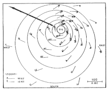
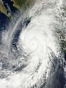
Hurricane Ava was the earliest forming Category 5 hurricane on record in the East Pacific basin. The storm is also tied with 2006's Hurricane Ioke as the fifth-strongest Pacific hurricane on record. It was the first named storm of the 1973 Pacific hurricane season. Forming in early June, Hurricane Ava eventually reached Category 5 intensity on the Saffir–Simpson hurricane scale, the first Pacific hurricane to do so in June and the earliest ever in a season. Its central pressure made it the most intense known Pacific hurricane at the time. Despite its intensity, Ava stayed at sea without significant impact.
Ava was given the most advanced measurement and reconnaissance available at the time. Recon flights were conducted and meteorological equipment was tested. The hurricane was also photographed from space by satellites and Skylab astronauts. (Full article...)Selected article -
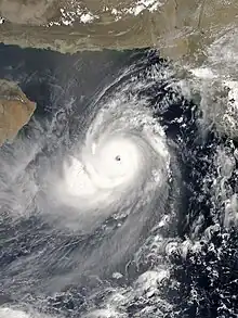
The 1999 Odisha cyclone (IMD designation BOB 06, JTWC designation 05B) was the most intense recorded tropical cyclone in the North Indian Ocean and among the most destructive in the region. The 1999 Odisha cyclone organized into a tropical depression in the Andaman Sea on 25 October, though its origins could be traced back to an area of convection in the Sulu Sea four days prior. The disturbance gradually strengthened as it took a west-northwesterly path, reaching cyclonic storm strength the next day. Aided by highly favorable conditions, the storm rapidly intensified, attaining super cyclonic storm intensity on 28 October, before peaking on the next day with winds of 260 km/h (160 mph) and a record-low pressure of 912 mbar (hPa; 26.93 inHg). The storm maintained this intensity as it made landfall on Odisha on 29 October. The cyclone steadily weakened due to persistent land interaction and dry air, remaining quasi-stationary for two days before slowly drifting offshore as a much weaker system; the storm dissipated on 4 November over the Bay of Bengal.
Although its primary effects were felt in a localized area of India, the outer fringes of the super cyclone impacted Myanmar and Bangladesh. Ten people were killed in the former, while two were killed in the latter by the storm's rainbands. The storm was the most severe to strike Odisha in the 20th century, raking the state and adjacent areas with high storm surge, powerful winds, and torrential rainfall. The storm's impacts exacerbated the damage caused by a very severe cyclone that struck the same region less than two weeks earlier. The 5–6 m (16–20 ft) surge brought water up to 35 km (20 mi) inland, carrying along with it coastal debris and inundating towns and villages. The surge combined with heavy rains to produce widespread flooding, damaging around 1.6 million homes and causing rivers to breach 20,005 flood embankments. The storm's effects destroyed numerous crops, including sugar cane, rice, and other winter-time harvests. Although estimates of the death toll varied significantly—at times suggesting 30,000 fatalities—the Government of India enumerated 9,887 fatalities in the country, of which a majority were caused by storm surge; over 8,000 deaths occurred in Jagatsinghpur. The total damage cost of the destruction wrought by the super cyclone amounted to US$4.44 billion. (Full article...)Selected image -

Selected season -
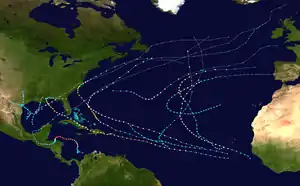
The 1998 Atlantic hurricane season was a catastrophic and deadly Atlantic hurricane season, featuring the highest number of storm-related fatalities in over 218 years and some of the costliest ever at the time. The season had above average activity, due to the dissipation of an El Niño event and transition to La Niña conditions. It officially began on June 1 and ended on November 30, dates which conventionally delimit the period during which most tropical cyclones form in the Atlantic Ocean. The season had a rather slow start, with no tropical cyclones forming in June. The first tropical cyclone, Tropical Storm Alex, developed on July 27, and the season's final storm, Hurricane Nicole, became extratropical on December 1.
Several storms made landfall or directly affected land. Hurricane Bonnie made landfall in southeastern North Carolina as a Category 2 hurricane in late August, killing five people and causing about $1 billion in damage. Hurricane Earl caused $79 million in damage and three deaths after making landfall in Florida as a Category 1 hurricane. (Full article...)Related portals
Currently active tropical cyclones

Italicized basins are unofficial.
- North Atlantic (2024)
- No active systems
- East and Central Pacific (2024)
- No active systems
- West Pacific (2024)
- No active systems
- North Indian Ocean (2024)
- No active systems
- Mediterranean (2023–24)
- No active systems
- South-West Indian Ocean (2023–24)
- No active systems
- Australian region (2023–24)
- No active systems
- South Pacific (2023–24)
- No active systems
- South Atlantic (2023–24)
- No active systems
Last updated: 09:07, 25 December 2023 (UTC)
Tropical cyclone anniversaries

January 14
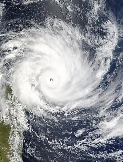
- 1994 - Cyclone Daisy weakens into a tropical storm as it affects Madagascar.
- 2016 - Hurricane Alex (pictured) reached its peak intensity as a Category 1 hurricane, which is one of the earliest tropical systems to form in the month of January in the Atlantic basin.

January 15
- 1958 - Typhoon Ophelia crashed a reconnaissance aircraft plane, killing the crew of nine.
- 1995 - A cyclone in the Mediterranean Sea (pictured) developed an eye-like structure, becoming one of the few possible Mediterranean tropical cyclones on record.
.jpg.webp)
January 16
- 1948 - Typhoon Karen intensifies into a super typhoon to the north of Palau, making it the earliest super typhoon to form in the Northwest Pacific basin.
- 2012 - Subtropical Depression Dando (pictured) made a rare landfall in southern Mozambique, washing away bridges in South Africa. The storm killed 10 people.
Did you know…


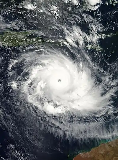
- …that the Joint Typhoon Warning Center considers that Typhoon Vera (pictured) of 1986 is actually two distinct systems, formed from two separated low-level circulations?
- …that Hurricane Agatha (pictured) was the strongest Pacific hurricane to make landfall in Mexico in May since records began in 1949?
- …that Cyclone Raquel (track pictured) travelled between the Australian and South Pacific basins between the 2014–15 and 2015–16 seasons, spanning both seasons in both basins?
- …that Cyclone Amphan (pictured) in 2020 was the first storm to be classified as a Super Cyclonic Storm in the Bay of Bengal since 1999?
General images -
 Featured list -

The 2020 Atlantic hurricane season was the most active Atlantic hurricane season on record in terms of number of named storms. Additionally, it was as an above-average season for tropical cyclones for the fifth consecutive year. The season officially began on June 1, 2020, and ended on November 30, 2020. These dates, adopted by convention, historically delimit the period each year when most Atlantic tropical systems form. However, storm formation is possible at any time of the year, as was the case this season, when its first two named storms, Tropical Storm Arthur and Tropical Storm Bertha, formed on May 16 and May 27, respectively. The final storm, Hurricane Iota, dissipated on November 18.
Altogether, the season produced 31 tropical or subtropical cyclones, all but one of which became a named storm. Of the 30 named storms, 14 became hurricanes, and seven further intensified into major hurricanes. It was the second and final season to use the Greek letter storm naming system, the first being 2005. Hurricane Laura produced catastrophic storm surge levels, heavy rainfall, and spawned over a dozen tornadoes after striking Louisiana on August 27 with winds of 150 mph (240 km/h). The storm was responsible for 81 deaths and it caused over US$19 billion in damage across the Greater Antilles and the Southern United States. Causing significant late-season loss of life and widespread destruction were November hurricanes Eta and Iota, which made landfall in Central America as Category 4 storms just two weeks apart. The storms left a toll of 184 deaths and 110 missing across the region, and thousands of families lost their homes and livelihoods. In March 2021, the names Laura, Eta and Iota were retired from reuse in the North Atlantic by the World Meteorological Organization due to the extraordinary amount of damage and number of fatalities they caused. (Full article...)Topics
Subcategories
Related WikiProjects
WikiProject Tropical cyclones is the central point of coordination for Wikipedia's coverage of tropical cyclones. Feel free to help!
WikiProject Weather is the main center point of coordination for Wikipedia's coverage of meteorology in general, and the parent project of WikiProject Tropical cyclones. Three other branches of WikiProject Weather in particular share significant overlaps with WikiProject Tropical cyclones:
- The Non-tropical storms task force coordinates most of Wikipedia's coverage on extratropical cyclones, which tropical cyclones often transition into near the end of their lifespan.
- The Floods task force takes on the scope of flooding events all over the world, with rainfall from tropical cyclones a significant factor in many of them.
- WikiProject Severe weather documents the effects of extreme weather such as tornadoes, which landfalling tropical cyclones can produce.
Things you can do
 |
Here are some tasks awaiting attention:
|
Wikimedia
The following Wikimedia Foundation sister projects provide more on this subject:
-
 Commons
Free media repository -
 Wikibooks
Free textbooks and manuals -
 Wikidata
Free knowledge base -
 Wikinews
Free-content news -
 Wikiquote
Collection of quotations -
 Wikisource
Free-content library -
 Wikiversity
Free learning tools -
 Wikivoyage
Free travel guide -
 Wiktionary
Dictionary and thesaurus
-
 List of all portals
 -

-

-

-
-

-

-

-

-

-
 Random portal
 -
 WikiProject Portals
.PNG.webp)



.jpg.webp)



.jpg.webp)


_(50).jpg.webp)




.jpg.webp)
.png.webp)


