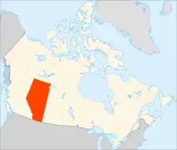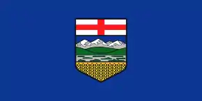
Location of Alberta
The following outline is provided as an overview of and topical guide to Alberta:
Alberta – province of Canada. It had a population of 3,645,257 in 2011,[1] making it the most populous of Canada's three prairie provinces. Alberta and its neighbour, Saskatchewan, were established as provinces on September 1, 1905.[2] Alberta is located in western Canada, bounded by the provinces of British Columbia to the west and Saskatchewan to the east, the Northwest Territories to the north, and the U.S. state of Montana to the south. Alberta is one of three Canadian provinces and territories to border only a single U.S. state and is also one of only two provinces that are landlocked.
General reference
Geography of Alberta
- Alberta is: a landlocked province of Canada
- Location:
- The regions in which Alberta is located are:
- Extreme points of Alberta
- Population of Alberta: 4,067,175 (2016)
- Area of Alberta: 661,848 km2 (255,541 sq mi)
- Atlas of Alberta
Environment of Alberta
- Protected areas of Alberta
- Wildlife of Alberta
Natural geographic features of Alberta
- Glaciers of Alberta
- Lakes of Alberta
- Mountains of Alberta
- Mountain ranges of Alberta
- Mountain passes of Alberta
- Peaks on the Alberta–British Columbia border
- Rivers of Alberta
- Valleys of Alberta
- Hot springs of Alberta
- World Heritage Sites in Alberta
Regions of Alberta
- Northern Alberta
- Alberta's Rockies
- Southern Alberta
- Calgary Region
- Edmonton Capital Region
- Central Alberta
Administrative divisions of Alberta
- Health regions of Alberta
- School authorities in Alberta
Census statistical divisions of Alberta
Communities of Alberta
- Communities in Alberta
- Municipalities (incorporated communities) in Alberta
- Unincorporated communities in Alberta
- Indian reserves in Alberta
Demographics of Alberta
Government and politics of Alberta
- Battle of Alberta – political and competitive rivalry between Edmonton and Calgary
- Capital of Alberta: Edmonton
- Form of government: Constitutional monarchy
- Elections in Alberta
- First Nations in Alberta – First Nations are the various Aboriginal peoples in Canada who are neither Inuit nor Métis
- Indian Association of Alberta – province-wide First Nations rights organization
- Political parties in Alberta
- Political scandals of Alberta
- Taxation in Canada
Federal representation
Provincial government of Alberta
Executive branch
- Head of state: King in Right of Alberta, King of Canada, King Charles III
- Head of state's representative (Viceroy): Lieutenant Governor of Alberta
- List of lieutenant governors of Alberta
- Head of government: Premier of Alberta
- List of premiers of Alberta
- Cabinet: Executive Council of Alberta
- Head of council: Lieutenant Governor in Council, as representative of the King in Right of Alberta
- List of Alberta provincial ministers
- Head of state's representative (Viceroy): Lieutenant Governor of Alberta
- Order of precedence in Alberta
- Alberta ministries
Legislative branch
- Government of Alberta, which has 2 components:
- Federal representation
Judicial branch
Law and order in Alberta
- Adult interdependent relationship in Alberta
- Capital punishment in Alberta: none.
- Alberta, as with all of Canada, does not have capital punishment.
- Canada eliminated the death penalty for murder on July 14, 1976.
- Constitution of Alberta
- Criminal justice system of Alberta
Law enforcement in Alberta
- Alberta Provincial Police (defunct)
Military in Alberta
- Canadian Forces bases in Alberta
- Military in Alberta
Local government in Alberta
History of Alberta
History of Alberta, by period
History of Alberta, by region
History of Alberta, by subject
Culture of Alberta
- Architecture of Alberta
- Cuisine of Alberta
- Festivals in Alberta
- Gambling in Alberta
- Historic places in Alberta
- Languages of Alberta
- Museums of Alberta
- People of Alberta
- Indigenous peoples of Alberta
- Symbols of Alberta
- Scouting and Guiding in Alberta
The arts in Alberta
Sports in Alberta
- Battle of Alberta – sports and competitive rivalry between Edmonton and Calgary
- Cycling in Alberta
- Curling in Alberta
- Golf in Alberta
- Ice hockey in Alberta
- Ice hockey teams in Alberta
- Junior hockey
- Minor hockey
- Soccer in Alberta
Economy and infrastructure of Alberta
- Economic rank (by nominal GDP):
- Banking in Alberta
- Communications in Alberta
- Currency of Alberta:
- Energy in Alberta
- Health care in Alberta
- Mining in Alberta
- Tourism in Alberta
- Transportation in Alberta
Education in Alberta
- Public education in Alberta
- Higher education in Alberta
- Students' associations in Alberta
- Colleges in Alberta
- University of Alberta
- Council of Alberta University Students
- Presidents of the University of Alberta
- Chancellors of the University of Alberta
- Faculties and departments of the University of Alberta
- University of Alberta Augustana Faculty
- University of Alberta Faculté Saint-Jean
- University of Alberta Faculty of Arts
- University of Alberta Faculty of Engineering
- University of Alberta Faculty of Extension
- University of Alberta Faculty of Law
- University of Alberta Faculty of Medicine and Dentistry
- University of Alberta Faculty of Pharmacy and Pharmaceutical Sciences
- List of University of Alberta people
- University of Alberta Hospital
- University of Alberta Press
- University of Alberta Protective Services
- University of Alberta School of Business
- University of Alberta Students' Union
- College & Association of Registered Nurses of Alberta
- College and Association of Respiratory Therapists of Alberta
- College of Physicians and Surgeons of Alberta
- Concordia University College of Alberta
See also
- All pages with titles beginning with Alberta
- All pages with titles containing Alberta
- All pages with titles beginning with Albertan
- All pages with titles containing Albertan
- Index of Alberta-related articles
- List of international rankings
- Outline of geography
- Provincial Archives of Alberta
- Sexual Sterilization Act of Alberta
- TUXIS Parliament of Alberta
References
- ↑ "Population and dwelling counts, for Canada, provinces and territories, 2011 and 2006 censuses". Statistics Canada. January 30, 2013. Retrieved February 14, 2013.
- ↑ "Alberta becomes a Province". Alberta Online Encyclopedia. Retrieved August 6, 2009.
External links
This article is issued from Wikipedia. The text is licensed under Creative Commons - Attribution - Sharealike. Additional terms may apply for the media files.
