Ouidah
Glexwe Whydah | |
|---|---|
.jpg.webp) Door of No Return. A memorial arch monument to the trans-atlantic slavery, on the coast of Ouidah. | |
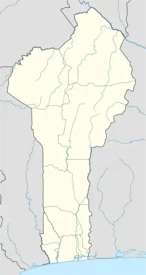
 Ouidah Location in Benin | |
| Coordinates: 6°22′N 2°05′E / 6.367°N 2.083°E | |
| Country | |
| Department | Atlantique Department |
| Area | |
| • Total | 364 km2 (141 sq mi) |
| Elevation | 65 m (213 ft) |
| Population (2012)[1] | |
| • Total | 91,688 |
| • Density | 250/km2 (650/sq mi) |
| Time zone | UTC+1 (WAT) |
Ouidah (/ˈwiːdə/) or Whydah (/ˈhwɪdə, -ɔː/; Ouidah, Juida, and Juda by the French;[2][3] Ajudá by the Portuguese;[4] and Fida by the Dutch), and known locally as Glexwe, formerly the chief port of the Kingdom of Whydah, is a city on the coast of the Republic of Benin. The commune covers an area of 364 km2 (141 sq mi) and as of 2002 had a population of 76,555 people.[5]
History
In local tradition Kpassa is supposed to have founded the town.[6] This probably happened towards the end of the sixteenth century.[7] The town was originally known as Glēxwé, literally 'Farmhouse', and was part of the Kingdom of Whydah.
Ouidah saw its role in international trade rise when the Royal African Company (RAC) constructed a fort there in 1650.[8]

Whydah troops pushed their way into the African interior, capturing millions of people through wars, and selling them to European and Arab slave traders.[9] By 1716, the Kingdom of Whydah had become the second largest slave port in the triangular trade, as noted by the crew of the slave ship Whydah Gally when it arrived to purchase 500 slaves from King Haffon to sell in Jamaica.
The Kingdom was ruled by King Haffon, who received his coronation crown as a gift from Portugal, until, in 1727, the Kingdom of Whydah was captured by the forces of King Agaja of Dahomey.[10] On 19 March 1727, The Boston News-Letter gave this report:
WHYDAH IN AFRICA: the beginning of this month, Agaja the king of Dahomey came down unexpectedly with an army, and soon became master of this place, and the country adjacent Allada; the desolation which ensued was so great, that it is impossible to be represented! The factory at Saber, once the king's town and Seat of Trade, was burnt to the ground, and in it a great quantity of merchandise. Forty Europeans were carried into captivity, to the King of Dahomey's camp at Ardrah, but after having been detained about 14 days, seven of them were released and are now returning hither; they gave a melancholy account of their treatment. This country, which was the pleasantest in all these parts, is now laid waste by fire and sword, and made a wilderness!
—
In 1860, Whydah was the port that sent the last recorded shipment of slaves to the United States, even though that country had prohibited the transatlantic slave trade in 1808. This illegal shipment was aboard the Clotilda and went to Mobile, Alabama.[11] The last shipment of slaves to Spanish Cuba occurred as late as 1873.[12]
France captured the town in 1894, by which time the town had declined due to the outlawing of the slave trade.[10] In the time frame of 1946–1949 French government estimates put the population of Ouidah at about 14,600. By then it had a railway. It was a centre for production and trade in palm kernels, palm oil, copra, coffee, manioc, beans, tomatoes and onions. It was also a centre of the fish trade and the manufacture of vegetable oil. It had Catholic, Protestant and Muslim places of worship.[13]
Fort of São João Baptista de Ajudá
The Fort of São João Baptista de Ajudá (in English Fort of St John the Baptist of Ouidah) is a small fortress built by the Portuguese in Ouidah on the coast of Dahomey (originally Ajudá, from Hweda, on the Atlantic coast of modern Benin), reached by the Portuguese in 1580, after which it grew around the slave trade, for which the Slave Coast was already renowned. In 1680 the Portuguese governor of São Tomé and Príncipe was authorized to erect a fort but nothing was done and it was only in 1721 that construction of the fort, which was named Fort of São João Baptista de Ajudá, started. The fort, built on land given to Portugal by King Haffon of Whydah, remained under Portuguese control from 1721 until 1961.
Population
The population evolution of Ouidah is as follows:
| Year | Population[14] |
|---|---|
| 1979 | 25 459 |
| 1992 | 64 433 |
| 2002 | 77 832 |
| 2008 (estimate) | 90 042 |
Notable landmarks

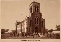
Attractions in Ouidah include a restored mansion of Brazilian slavers (the Maison du Brésil), a Vodun python temple, an early twentieth century basilica and the Sacred Forest of Kpasse, dotted with bronze statues.[10]

The Route des Esclaves, by which slaves were taken to the beach, has numerous statues and monuments, including the Door of No Return, a memorial arch.[10]
The Market Center of Ouidah, which was established by Scouts more than 20 years ago, trains young people in agricultural skills, thus helping to reverse the exodus towards the cities.
Ouidah is often considered the spiritual capital of the Vodun religion, and hosts an annual international Vodun conference.[15]
Other landmarks include:[10]
- Basilique de l'Immaculée Conception
- Ouidah Museum of History
- Zinsou Foundation Museum
World Heritage Status
This site was added to the UNESCO World Heritage Tentative List on 31 October 1996 in the Cultural category.[16]
Notable people
- Cudjoe Lewis (d. 1935), Redoshi (d. 1937), and Matilda McCrear (d, 1940), last known survivors of the Transatlantic slave trade.[17][18]
- Patrice Talon (1958), president of Benin
- Angélique Kidjo (1960), singer[19]
- Oscar Olou (1987), footballer
See also
References
- ↑ "World Gazetteer". Archived from the original on 11 January 2013.
- ↑ Tome Vingt-Cinquieme, contenant La Suite de l'Histoire d'Afrique, p. 313, at Google Books
- ↑ Kein, Sybil, Creole, p. 227.
- ↑ http://www.red.unb.br/index.php/ Archived 20 February 2015 at the Wayback Machine textos/article/viewArticle/5714
- ↑ "Communes of Benin". Statoids. Archived from the original on 24 March 2012. Retrieved 5 January 2010.
- ↑ Robin Law, Ouidah: The Social History of a West African Slaving 'Port', 1727–1892, 2004, p. 21.
- ↑ Law, Ouidah: The Social History of a West African Slaving 'Port', 1727–1892, 2004, pp. 24–25.
- ↑ national "Benin History Timeline", One World Nations Online.
- ↑ Ouidah Museum, Benin - "Depart pour D'Autres 'Ceux', Convoi De negres: homes, femmes et enfants, conduits enchaines par des metis Arabes"
- 1 2 3 4 5 Butler, Stuart (2019), Bradt Travel Guide - Benin, pp. 101–112.
- ↑ "Last Slaver from U.S. to Africa. A.D. 1860": Capt. William Foster, Journal of Clotilda, 1860, Mobile Public Library Digital Collections; accessed 28 January 2018.
- ↑ Transatlantic slavery continued for years after 1867, historian finds The Guardian
- ↑ Columbia-Lippincott Gazetteer, p. 1408.
- ↑ "Benin". World Gazetteer. Archived from the original on 9 December 2012. Retrieved 19 December 2008.
- ↑ "The Voodoo Day: Benin welcomes magicians from all over the world". Pravda. 11 January 2004. Retrieved 29 August 2008.
- ↑ La ville d'Ouidah : quartiers anciens et Route de l'Esclave – UNESCO World Heritage Centre
- ↑ Durkin, Hannah (2019). "Finding last middle passage survivor Sally 'Redoshi' Smith on the page and screen". Slavery & Abolition. 40 (4): 631–658. doi:10.1080/0144039X.2019.1596397. S2CID 150975893.
- ↑ Durkin, Hannah (19 March 2020). "Uncovering The Hidden Lives of Last Clotilda Survivor Matilda McCrear and Her Family". Slavery & Abolition. 41 (3): 431–457. doi:10.1080/0144039X.2020.1741833. ISSN 0144-039X. S2CID 216497607.
- ↑ "Angélique Kidjo - Biographie, discographie et fiche artiste". RFI Musique (in French). 3 March 2011. Retrieved 3 July 2018.
.jpg.webp)
