Opasatika | |
|---|---|
| Township of Opasatika Canton d'Opasatika | |
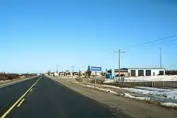
 Highway 11 through Opasatika. | |
 Opasatika | |
| Coordinates: 49°32′N 82°52′W / 49.533°N 82.867°W | |
| Country | Canada |
| Province | Ontario |
| District | Cochrane |
| Government | |
| • Mayor | Jacques Dorval |
| • MPs | Carol Hughes (NDP) |
| • MPPs | Guy Bourgouin (NDP) |
| Area | |
| • Land | 330.44 km2 (127.58 sq mi) |
| Population (2016) | |
| • Total | 226 |
| • Density | 0.7/km2 (2/sq mi) |
| [1] | |
| Time zone | UTC-5 (Eastern (EST)) |
| • Summer (DST) | UTC-4 (EDT) |
| Postal code | P0L 1Z0 |
| Area code(s) | 705, 249 |
| Website | opasatika.net |
Opasatika is a township in the Canadian province of Ontario, located in the Cochrane District on the Opasatika River, a tributary of the Missinaibi River. Its name is of First Nation origin, meaning "river lined with poplars".[2]
The main communities in the township are Opasatika and Lowther, both located along Highway 11 between Mattice and Harty. The ghost town of Reesor Siding, site of the 1963 Reesor Siding incident, is at the western edge of the township. The former Canadian Forces Station Lowther was located in the municipality.
Demographics
In the 2021 Census of Population conducted by Statistics Canada, Opasatika had a population of 200 living in 101 of its 110 total private dwellings, a change of -11.5% from its 2016 population of 226. With a land area of 327.09 km2 (126.29 sq mi), it had a population density of 0.6/km2 (1.6/sq mi) in 2021.[3]
| 2021 | 2016 | 2011 | |
|---|---|---|---|
| Population | 200 (-11.5% from 2016) | 226 (+5.6% from 2011) | 214 (-23.6% from 2006) |
| Land area | 327.09 km2 (126.29 sq mi) | 330.44 km2 (127.58 sq mi) | 329.98 km2 (127.41 sq mi) |
| Population density | 0.6/km2 (1.6/sq mi) | 0.7/km2 (1.8/sq mi) | 0.6/km2 (1.6/sq mi) |
| Median age | 57.2 (M: 58, F: 56.8) | 53.7 (M: 53.2, F: 54.5) | |
| Private dwellings | 100 (total) | 132 (total) | 120 (total) |
| Median household income | $52,096 |
- Population in 2016: 226
- Population in 2011: 214
- Population in 2006: 280
- Population in 2001: 325
- Population in 1996: 349
- Population in 1991: 388
Mother tongue:[7]
- English as first language: 12.5%
- French as first language: 83.9%
- English and French as first language: 0%
- Other as first language: 3.6%
See also
References
- 1 2 3 "Census Profile, 2016 Census: Opasatika, Township". Statistics Canada. 8 February 2017. Retrieved June 10, 2019.
- ↑ "Opasatika welcomes you". Municipalité d'Opasatika. Retrieved 2012-02-21.
- ↑ "Population and dwelling counts: Canada, provinces and territories, census divisions and census subdivisions (municipalities), Ontario". Statistics Canada. February 9, 2022. Retrieved April 2, 2022.
- ↑ "2021 Community Profiles". 2021 Canadian Census. Statistics Canada. February 4, 2022. Retrieved 2022-04-27.
- ↑ "2016 Community Profiles". 2016 Canadian Census. Statistics Canada. August 12, 2021. Retrieved 2019-06-10.
- ↑ "2011 Community Profiles". 2011 Canadian Census. Statistics Canada. March 21, 2019. Retrieved 2012-02-21.
- 1 2 "2006 Community Profiles". 2006 Canadian Census. Statistics Canada. August 20, 2019.
- ↑ "2001 Community Profiles". 2001 Canadian Census. Statistics Canada. July 18, 2021.
- ↑ Statistics Canada: 1996, 2001, 2006 census
- ↑ "Opasatika census profile". 2011 Census of Population. Statistics Canada. Retrieved 2012-02-21.
External links
