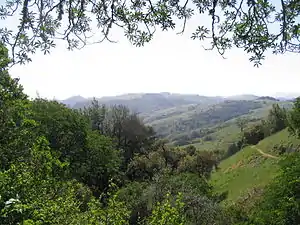
Formed in 1972 by voter initiative,[1] the Midpeninsula Regional Open Space District (MROSD) is a non-enterprise special district in the San Francisco Bay Area. It has acquired and preserved a regional green belt of open space land and provides opportunities for ecologically-sensitive public enjoyment and education.
Its stated mission is:
To acquire and preserve a regional greenbelt of open space land in perpetuity; protect and restore the natural environment; and provide opportunities for ecologically sensitive public enjoyment and education.[2]
The District, which includes parts of Santa Clara, San Mateo and Santa Cruz counties,[3] works to form a continuous green belt of permanently preserved open space by linking its lands with other public park lands. A member of the Bay Area Open Space Council,[4] the District also participates in cooperative efforts such as the San Francisco Bay Trail, Bay Area Ridge Trail, and Skyline-to-the-Sea Trail, which are regional trail systems in the Bay Area that include District lands.
The Midpeninsula Regional Open Space District has permanently preserved almost 63,500 acres (25,700 ha) of mountainous, foothill, and bayland open space, creating 26 open space preserves. Of the District's 26 preserves, 24 are open to the public free of charge, 365 days a year from dawn until one-half hour after sunset.
The District's tax and voter base consists of about 550 square miles (1,400 km2) and 741,000 people, mostly in Santa Clara and San Mateo counties. District revenues for fiscal year 2012-2013 were $33 million, with $30.3 million coming directly from a portion of property taxes. The District also occasionally receives state and federal grants, as well as private donations.
Recreation
Most of the preserves are open to recreation. Popular activities are hiking, cycling, and horseback riding. Paragliding and hang gliding are permitted at Windy Hill Open Space Preserve with a special use permit. Camping is generally prohibited, though the Monte Bello Open Space Preserve does have a backpacking camp available by permit only.[5] Of the 26 preserves, 24 are fully open to the public: Miramontes Ridge Open Space Preserve and Tunitas Creek Open Space Preserve are not open;[6] the Bear Creek Redwoods Open Space Preserve and La Honda Creek Open Space Preserve require a permit for use, and portions of Sierra Azul Open Space Preserve are closed to the public due to hazardous areas at the summit of Mount Umunhum.
In total, the District has 226 mi (364 km) of hiking trails, of which 150 mi (241 km) is open to bicycles, 182 mi (293 km) to equestrians, and 63 mi (101 km) to leashed dogs. Preserves are relatively undeveloped, with most having only a parking area, trail signs, and possibly an outhouse. All preserves are open from dawn to one-half hour after sunset.
Park Rangers patrol the District and provide a range of services. Ranger staff are peace officers but do not carry firearms. They wear tan and green uniforms; the badge is a gold metal seven-point star with an enameled California state seal in the center. Dispatch services are provided by the Mountain View Police Department under contract.
Open space preserves
The following open space preserves are managed by MROSD:[7][6]
- Bear Creek Redwoods Open Space Preserve
- Coal Creek Open Space Preserve
- El Corte de Madera Creek Open Space Preserve (see also El Corte de Madera Creek)
- El Sereno Open Space Preserve
- Foothills Open Space Preserve
- Fremont Older Open Space Preserve
- La Honda Creek Open Space Preserve, opened to the public in November 2017 [8]
- Long Ridge Open Space Preserve
- Los Trancos Open Space Preserve
- Miramontes Ridge Open Space Preserve
- Monte Bello Open Space Preserve
- Picchetti Ranch Open Space Preserve (see also Picchetti Winery)
- Pulgas Ridge Open Space Preserve
- Purisima Creek Redwoods Open Space Preserve
- Rancho San Antonio Open Space Preserve
- Ravenswood Open Space Preserve
- Russian Ridge Open Space Preserve
- St. Joseph's Hill Open Space Preserve
- Saratoga Gap Open Space Preserve
- Sierra Azul Open Space Preserve
- Skyline Ridge Open Space Preserve
- Steven's Creek Shoreline Nature Study Area Open Space Preserve
- Teague Hill Open Space Preserve
- Thornewood Open Space Preserve
- Tunitas Creek Open Space Preserve
- Windy Hill Open Space Preserve
Further reading
- Room to Breathe: The Wild Heart of the San Francisco Peninsula, Edited by Kristi Britt. Berkeley:Heyday Books (2012) ISBN 978-1-59714-199-4
- The Country in the City, Richard Walker. Seattle: University of Washington Press (2007) ISBN 978-0-29598-701-9
References
- ↑ "History". Midpeninsula Regional Open Space District. Retrieved 1 September 2018.
- ↑ "About Us". Midpeninsula Regional Open Space District. Retrieved 1 September 2018.
- ↑ "Public Information". Midpeninsula Regional Open Space District. Retrieved 1 September 2018.
- ↑ "Members & Supporters". Bay Area Open Space Council. Retrieved 1 September 2018.
- ↑ "Activities". Midpeninsula Regional Open Space District. Retrieved 1 September 2018.
- 1 2 "Explore Your Backyard" (PDF). Midpeninsula Regional Open Space District. Retrieved 1 September 2018.
- ↑ "Preserves". Midpeninsula Regional Open Space District. Retrieved 1 September 2018.
- ↑ "Huge new Bay Area open space preserve opens to public". 29 November 2017.


