Levoča | |
|---|---|
Town | |
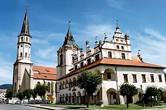 Basilica of St. James and Old Town Hall | |
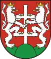 Coat of arms | |
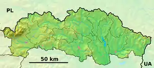 Levoča Location in Prešov Region 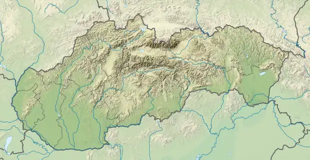 Levoča Location in Slovakia | |
| Coordinates: 49°01′31″N 20°35′17″E / 49.02528°N 20.58806°E | |
| Country | |
| Region | Prešov |
| District | Levoča |
| Earliest mention | 1249 |
| Government | |
| • Primátor (Mayor) | Miroslav Vilkovský (elected November 2018) |
| Area | |
| • Total | 114.76[1] km2 (44.31[1] sq mi) |
| Elevation | 628[2] m (2,060[2] ft) |
| Population (2021) | |
| • Total | 14,151[3] |
| Time zone | UTC+1 (CET) |
| • Summer (DST) | UTC+2 (CEST) |
| Postal code | 054 01[2] |
| Area code | +421 53[2] |
| Car plate | LE |
| Website | https://www.levoca.sk |
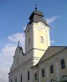
Levoča (ⓘ; Hungarian: Lőcse; Rusyn: Левоча) is a town in the Prešov Region of eastern Slovakia with a population of 14,700. The town has a historic center with a well-preserved town wall, a Gothic church with the highest wooden altar in the world, carved by Master Pavol of Levoča, and many other Renaissance buildings.
On 28 June 2009, Levoča was added by UNESCO to its World Heritage List.[4]
Etymology
The name is of Slovak origin and belongs to the oldest recorded Slovak settlement names in Spiš.[5] It was originally the name of the stream Lěvoča, a tributary of river Hornád (present-day Levočský potok). The name probably derived from the adjective lěva (left, a left tributary); the linguist Rudolf Krajčovič has also suggested as an origin the word lěvoča meaning "regularly flooded area”.[6]
History
Levoča is located in the historical region of Spiš, which was inhabited as early as the Stone Age. In the 11th century, this region was conquered and, subsequently, became part of the Kingdom of Hungary and remained such until 1918. After the Mongol invasions of 1241/1242, the area was also settled by Germans (more specifically Zipser Germans). The town became the capital of the Association of Spiš Germans, with a form of self-rule within the Kingdom of Hungary. The oldest written reference to the city of Levoča dates back to 1249. In 1317, Levoča (at that time generally known by the German name of Leutschau - see Chronology below for lists of changing names) received the status of a royal town. In 1321, a wide storing right was granted, enticing merchants, craftsmen and mine owners to settle in this town.
In the 15th century, the town, located on an intersection of trade routes between Poland and Hungary, became a rich center of commerce. It exported iron, copper, furs, leather, corn, and wine. At the same time, the town became an important cultural centre. The English humanist Leonard Cox taught around 1520 in a school in Levoča. The bookseller Brewer from Wittenberg transformed his bookstore into a prolific printing plant, that lasted for 150 years. Finally, one of the best-known medieval woodcarvers Master Pavol of Levoča settled here.
The town kept this cultural and economic status until the end of the 16th century, in spite of two damaging fires : the first in 1550 destroyed nearly all of the Gothic architecture and another in 1599. In this period of prosperity, several churches were built, and the town had a school, library, pharmacy, and physicians. There was a printing press as early as 1624. Levoča was a center of the Protestant Reformation. The town started to decline during the anti-Habsburg uprisings in the 17th century.
In a lurid sequence of events in 1700, the mayor of the town was accidentally wounded by a local nobleman during a hunt, generating a series of revenge attacks, finally resulting in the murder of the mayor, Karol Kramler, a Saxon magistrate. The mayor's arm was then cut off, embalmed, and preserved in the town hall as a call to further revenge. This became the subject of a Hungarian novel about the town, The Black City, by the writer Kálmán Mikszáth.[7]
At the southern end of the main square, the Evangelical Church, Levoča was constructed from 1823 onwards, and consecrated in 1832. It replaced an earlier articular church outside the walls of the city.[8]
Compared to other places in the region, Jewish settlement began comparatively late in Levoča. The city's census data from 1768 and 1828 indicated a lack of Jewish presence, suggesting a prohibition against Jewish settlement until around 1840. The 1840s marked the beginning of Jewish migration to Levoča, mainly from Huncovce and other parts of Eastern Slovakia. This wave of migration led to the establishment of the first Jewish households and sparked the formation of a Jewish community (kehila).[9]
In the late 1860s, Jews in Hungary were ideologically split about issues that came with the wide social, political and cultural changes. These changes were primarily caused by the Industrial Revolution, the Haskalah and the full legal emancipation of Jews that was consolidated in 1867 after it was repealed by the Habsburgs subsequently to their cooperative victory with Russia over Hungary.[10] The main groups that emerged were Orthodox Jews, who sought to maintain strict adherence to traditional Jewish law and customs, and Neolog Jews, a uniquely Hungarian movement that sought ways to modernize Judaism while retaining a strong connection to Jewish tradition. The Jewish community of Levoča decided to define themselves as “status quo”, which meant that they would be a Jewish community that sought to uphold traditional Jewish customs and practices without aligning explicitly with Reform or Orthodox Judaism.
During the 1870s, the kehila saw considerable expansion, leading to the incorporation of additional structures, like a cemetery, in the 1880s.[9]
The economic importance of the town was further diminished in 1871 when the important new Košice–Bohumín Railway was built just 8 km (5.0 mi) to the south, bypassing Levoča and going through the nearby town of Spišská Nová Ves. Later, in 1892, only a spur line was built from Spišská Nová Ves railway station to Levoča. Erwin Raisz, a famed cartographer who immigrated to the United States after earning a degree in engineering and architecture from the University of Hungary and after serving in WWI, was born in Levoča in 1893. Raisz learned about map making from his father, also a civil engineer, and was no doubt inspired by the topography of his homeland to create a unique hand-drawn method of portraying physiographic features. He taught at Harvard University and wrote the first cartography textbook in English.
In 1899, the kehila of Levoča inaugurated an expansive synagogue, designed in an Oriental architectural style, situated beyond the city's perimeter.[11] Accompanying this significant structure, a school and a ritual bath, known as a mikveh, were constructed nearby.[9]
After the Treaty of Trianon and the dismantling of the Kingdom of Hungary, the city became part of the newly formed Czechoslovakia and its Slovak name Levoča was formally adopted. A list of business licenses from 1921 shows, that 45 out of the 65 businesses in town were owned by Jews.
Following Slovakia's attainment of autonomy in October 1938, the Jewish population began to face increasing discrimination. On 4 November 1938, 55 Jewish individuals from Levoča, who lacked citizenship, were forcefully relocated to an unclaimed region along the Slovakia-Hungary border, near Plešivec. Held for several weeks without adequate shelter and under challenging conditions, the majority were able to return to their homes only through the concerted efforts of Jewish organizations.[9]
Upon the formation of the Slovak Republic on March 14, 1939, Jewish homes and businesses were subjected to rampant looting and destruction by the Nazi-aligned German minority. A repeat of these incidents occurred on March 23, with further devastation in August when a Hashomer Hatzair summer camp was attacked and subsequently dissolved. That same year saw the revocation of licenses for numerous Jewish professionals, the closure of Jewish taverns, and dismissals from community service roles.
During World War II, 981 local Jews were deported. The first deportations began in March 1942, at first primarily targeting young women, who were sent to a transit camp in Poprad and then to Auschwitz. More young people were sent to Majdanek, via a transit camp in Žilina.
Starting in March 1942, Jews from Levoča were systematically deported to concentration and extermination camps, beginning with a group of young women sent to Auschwitz. Despite escape attempts, further rounds of deportation included families, hospital patients, and psychiatric care patients, with about 80% of the Jewish population being deported by the end of the year.[9]
Following this wave, a small number of Jews remained in the district, some possessing exemption letters or having converted to escape deportation. However, with the German capture of Levoča in September 1944, the remaining Jews faced intensified persecution. Many were deported or executed, while others found refuge in remote areas or joined partisan groups. Despite resistance, the synagogue, mikveh, school building, and cemetery were desecrated, and widespread hunting of Jews and partisans led to further deportations and executions.
On 27 January 1945, Levoča was taken by Soviet troops of the 18th Army.
Post-war, some surviving Jews returned to Levoča, reviving kehila life and repairing public buildings. Zionist activities resumed until most Jews immigrated to Israel in 1949. By the 1960s, a small kehila of about 60 people remained, with the once-desecrated cemetery left neglected. As of 1990, only a few Jewish families resided in Levoča.
On July 3, 1995, Levoča was visited by Pope John Paul II. He celebrated a Mass for 650,000 worshippers at the traditional pilgrim site of Mariánska hora, a hill about 2 kilometres (1 mile) north of Levoča with views of the town.
In 2016, the historic Jewish cemetery was cleared of rubbish and tidied up thanks to the collaborative efforts of local Catholic youth organization Spoločenstvo Pavol, the Slovak Association of Christian Youth Movements, the Union of Slovak Jewish Communities, and the Town of Levoča.[11]

Geography
Levoča lies at an altitude of 570 metres (1,870 feet) above sea level and covers an area of 64.042 square kilometres (24.727 sq mi).[12] It is located in the northern part of the Hornád Basin at the foothills of the Levoča Hills, at the stream Levočský potok, a tributary of Hornád. Poprad is 25 kilometres (16 miles) away to the west, Prešov 50 km (31 miles) to the east, Košice 90 km (56 miles) to the southeast and Bratislava 370 km (230 mi) to the southwest.
Historical features
The old town is picturesquely sited and still surrounded by most of its ancient walls. In associating the town with Spiš Castle and Žehra in June 2009 as the renamed World Heritage Site of “Levoča, Spišský Hrad, and the Associated Cultural Monuments”, UNESCO cites the town's historic center, its fortifications, and the works of Master Paul of Levoča preserved in the town.
The main entrance to the old town is via the monumental Košice Gate (15th century) behind which is located the ornate baroque Church of the Holy Spirit and the New Minorite Monastery (c. 1750).
The town square (Námestie Majstra Pavla - Master Paul's Square) boasts three major monuments; the quaint Old Town Hall (15th-17th century) which now contains a museum, the domed Evangelical Lutheran Church (1837) and the 14th century of Basilica of St. James (in Slovak: Bazilika svätého Jakuba, often mistakenly referred to in English as St. Jacob's). It houses a magnificently carved and painted wooden Gothic altar, the largest in Europe, (18.62 m (61.09 ft) in height), created by Master Paul around 1520. The square is very well-preserved (despite one or two modern incursions) and contains a number of striking buildings which were the townhouses of the local nobility in the late Middle Ages. Also notable in the square is the wrought iron “Cage of Shame”, dating back to the 17th century, used for public punishment of miscreants. A plaque on one of the houses records the printing and publication in the town of the most famous work of Comenius, the Orbis Pictus. Other buildings on the square house a historical museum and a museum dedicated to the work of Master Paul.
Behind the square on Kláštorská Street are the 14th-century church and remains of the old monastery of the Minorites, now incorporated into a Church grammar school. Nearby is the town's Polish Gate, a Gothic construction of the 15th century.
From the 16th century to the end of 1922, Levoča was the administrative center of the province of Szepes (Spiš). Between 1806 – 1826, the Hungarian architect from Eger Antal Povolny built a grandiose administration building, the Large Provincial House, as the seat of the town's administration. He adjusted its Classicist style to Levoča's Renaissance character by emphasizing the building's horizontal lines. The House is considered among the most beautiful Provincial Houses in the former Kingdom of Hungary. Today, it is reconstructed and it is a seat of the administration.
The State Regional Archives (Štátny oblastný archív) are in a tan stone building on the north side of the square at nám. Majstra Pavla 60.
Demographics
Levoča has a population of 14,677 (as of December 31, 2005). According to the 2001 census, out of 14,366 inhabitants 87.07% were Slovaks 11.20% Romani, 0.33% Czechs and 0.31% Rusyns.[12] The religious make-up was 79.54% Roman Catholics, 9.01% people with no religious affiliation, 3.87% Greek Catholics and 1.61% Lutherans.[12]
Town and nearby settlements
- Levoča (main town)
- Levočská Dolina (=English: Levoča Valley). About 4 km (2 mi) out of town, on the way to Závada.
- Levočské Lúky (=English: Levoča Fields). Settlement on the road to Spišska Nová Ves.
- Závada. Village in the hills above Levočská Dolina.
Listing of town names
Below is a listing of names by which the town of Levoča has been known or recorded. The names were not necessarily at any time mutually exclusive, and often reflect minor linguistic differences:[13][14]
- 1249: Leucha
- 1268: Lyucha
- 1271: Lewcha
- 1277: Lyucha
- 1284: Leuche, Lyuche, Leiuche
- 1408: Lewscen
- 1479: Lewcsouia
- 1497: Leutschaw
- 1773: Lewucža
- 1786: Lewoče, Lőcse (Hungarian), Leutschau (German), Leuchovia (Latin), Leutschovia, Leutsaria
- 1808: Leutsovia, Lőcse, Leutschau, Lewoča
- 1863 – 1913: official name: Lőcse
- since 1918: official name: Levoča
Twin towns — Sister cities
Gallery
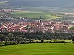 Levoča from Mariánska hora
 Levoča - Town hall from above
 Levoča main square
 The Large Provincial House
 Levoča main square
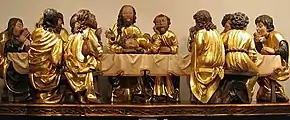 Sculptures from Master Paul's altar in St. James
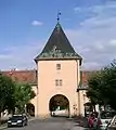 The Košice Gate
 Doorway of the New Minorite Cloisters
See also
References
Notes
- 1 2 "Hustota obyvateľstva - obce [om7014rr_ukaz: Rozloha (Štvorcový meter)]". www.statistics.sk (in Slovak). Statistical Office of the Slovak Republic. 2022-03-31. Retrieved 2022-03-31.
- 1 2 3 4 "Základná charakteristika". www.statistics.sk (in Slovak). Statistical Office of the Slovak Republic. 2015-04-17. Retrieved 2022-03-31.
- ↑ "Počet obyvateľov podľa pohlavia - obce (ročne)". www.statistics.sk (in Slovak). Statistical Office of the Slovak Republic. 2022-03-31. Retrieved 2022-03-31.
- ↑ UNESCO Newswebsite
- ↑ Štefánik, Martin; Lukačka, Ján, eds. (2010). Lexikón stredovekých miest na Slovensku [Lexicon of Medieval Towns in Slovakia] (PDF) (in Slovak). Bratislava: Historický ústav SAV. p. 252. ISBN 978-80-89396-11-5. Archived from the original (PDF) on 2014-03-02. Retrieved 2016-11-06.
- ↑ Krško, Jaromír (2015). "Lexikálne východiská starej slovenskej hydronymie z povodia Hornádu v slovanskom kontexte" [Lexical origin of the old Slovak hydronymy from the Hornád river basin in the Slavonic context] (PDF). Slavica Slovaca (in Slovak). Slavistický ústav Jána Stanislava SAV (1): 10.
- ↑ Jan Lácika, Spiš, 1999, p. 57
- ↑ Jan Lácika, Spiš, 1999, p. 60
- 1 2 3 4 5 "Encyclopaedia of Jewish communities, Slovakia". www.jewishgen.org. Retrieved 2023-05-18.
- ↑ "Jewish emancipation", Wikipedia, 2023-04-01, retrieved 2023-05-18
- 1 2 jhe (2016-08-26). "Slovakia: Clean-up at Jewish cemetery Levoča (& video)". Jewish Heritage Europe. Retrieved 2023-05-18.
- 1 2 3 "Municipal Statistics". Statistical Office of the Slovak republic. Archived from the original on 2006-12-30. Retrieved 2007-01-08.
- ↑ Vlastivedný Slovník Obcí na Slovensku, VEDA, vydavateľstvo Slovenskej akadémie vied, Bratislava 1978.
- ↑ Milan Majtán (1998). Názvy Obcí Slovenskej republiky (Vývin v rokoch 1773-1997), VEDA, vydavateľstvo Slovenskej akadémie vied, Bratislava, ISBN 80-224-0530-2.
- ↑ "Partnerské mestá". levoca.sk (in Slovak). Levoča. Retrieved 2019-09-08.