Altenkirchen | |
|---|---|
 Flag  Coat of arms | |
| Country | Germany |
| State | Rhineland-Palatinate |
| Capital | Altenkirchen |
| Area | |
| • Total | 642 km2 (248 sq mi) |
| Population (31 December 2021)[1] | |
| • Total | 129,261 |
| • Density | 200/km2 (520/sq mi) |
| Time zone | UTC+01:00 (CET) |
| • Summer (DST) | UTC+02:00 (CEST) |
| Vehicle registration | AK |
| Website | kreis-altenkirchen.de |
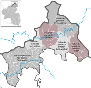
Altenkirchen (German pronunciation: [ˈaltn̩ˌkɪʁçn̩] ⓘ) is a district in Rhineland-Palatinate, Germany. It is bounded by (from the north and clockwise) the North Rhine-Westphalian districts Rhein-Sieg, Oberbergischer Kreis, Olpe and Siegen-Wittgenstein, and the districts of Westerwaldkreis and Neuwied.
History
The history of the district is linked with the Westerwald region.
The district was established in 1816 by the Prussian administration. It combined the county of Wildenburg and the two counties of Sayn. The former had been part of Berg, the latter ones had belonged to the duchy of Nassau.
The county used to be divided into nine mayoralties, including the Bürgermeisterei Weyerbusch.
Geography
Altenkirchen is the northernmost district of Rhineland-Palatinate. It is occupied by the northern portions of the Westerwald mountains. The valley of the river Sieg borders the Westerwald on the north. The lands north of the Sieg are called Wildenburgisches Land, after the tiny county of Wildenburg, that once existed here.
Coat of arms
The coat of arms displays:
- Top left: The golden lion of the county of Sayn, which occupied the territory in the 12th century
- Top right: The symbol of the tiny county of Wildenburg, which existed until 1806 in the very north of the district
- Bottom: The black and red cross is a combination of the bishops' emblems of Cologne and Trier
Towns and municipalities

References
External links
- Official website (German)