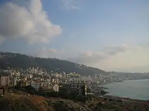
Keserwan District
قضاء كسروان | |
|---|---|
District | |
 Jounieh Bay | |
| Motto: "The Christians' Castle" | |
 Location in Lebanon | |
| Country | |
| Governorate | Keserwan-Jbeil |
| Capital | Jounieh |
| Area | |
| • Total | 336 km2 (130 sq mi) |
| Population | |
| • Total | 182,834 |
| • Density | 544/km2 (1,410/sq mi) |
| Time zone | UTC+2 (EET) |
| • Summer (DST) | UTC+3 (EEST) |
Keserwan District (Arabic: قضاء كسروان, transliteration: Qaḍā' Kisrawān) is a district (qadaa) in Keserwan-Jbeil Governorate, Lebanon, to the northeast of Lebanon's capital Beirut. The capital, Jounieh, is overwhelmingly Maronite Christian. The area is home to the Jabal Moussa Biosphere Reserve.
Etymology
The name of Keserwan is most probably that of a Persian clan named the Kesra, who were early Persian settlers of the region. Kesra (Arabicized version of Khosro) has always been a common Persian name. Keserwan is its plural form.[1]
Demographics
According to voter registration data, the population is overwhelmingly Christian–the highest percentage-wise in the nation–with 97.95% of voters being Christian.[2] Of those, Maronites are the predominant denomination, comprising 92.16% of all voters in the district. The remaining Christians are Greek Melkite Catholics (2.14%), "minority Christians" (1.26%), Orthodox Christians (0.89%), Armenian Orthodox Christians (0.72%), Armenian Catholics (0.66%), and Evangelicals (0.11%). The Muslim population (2.05%) are divided between Shi'as (1.80%), Sunnis (0.25%), and Alawis (0.01%).
The number of registered voters by sect is as follows (with a total of 94200):

- 86,044 Maronites
- 1,995 Greek Melkite Catholics
- 1,682 Shia Muslims
- 1,176 Minority Christians
- 832 Greek Orthodox Christians
- 668 Armenian Orthodox Christians
- 619 Armenian Catholic Christians
- 230 Sunni Muslims
- 99 Evangelical Christians
- 14 Alawites
- 7 Druze
Electoral constituency
The district is part of the Keserwan-Byblos electoral district, with the district of Keserwan being allocated 5 Maronite seats (and the overall constituency having 7 Maronites and 1 Shi'ia).

Cities, towns, and villages
- Aazra
- Adma
- Ain El Delbeh
- Ain el-Rihaneh
- Aintoura
- Ajaltoun
- Aramoun
- Ashqout
- Attine
- Ballouneh
- Batha
- Bekaata Ashqout
- Bekaata Kenaan
- Bezhel
- Bkerké
- Bouar
- Bqaatouta (Bkaatouta)
- Bzoummar
- Chahtoul
- Chnaniir
- Daraoun
- Daraya
- Dlebta
- Faitroun
- Faraya
- Fatqa
- Ghadir
- Ghbaleh
- Ghidras
- Ghineh
- Ghosta
- Harissa
- Hrajel
- Jdaidet Ghazir
- Jeita
- Jounieh
- Jouret Bedran
- Jouret Mhad
- Jouret el-Termos
- Jwar El Hous
- Kaslik
- Kfardebian
- Kfaryassine
- Kfour
- Kleiat
- Maarab
- Mayrouba
- Nammoura
- Okaibe
- Rayfoun
- Safra
- Sahel Alma
- Sarba
- Sehaileh
- Tabarja
- Wata El Jawz
- Yahchouch
- Zouk Mikael
- Zouk Mosbeh
See also
References
- ↑ Salibi, Kamal (2003). A house of many mansions : the history of Lebanon reconsidered (Repr. ed.). London: I.B. Tauris. p. 139. ISBN 1860649122.
- ↑ https://elections.lebanese-forces.com/wp-content/uploads/2018/02/KESERWAN-JBEIL-1.pdf
33°58′11″N 35°36′56″E / 33.96972°N 35.61556°E