Ixtlán District | |
|---|---|
District | |
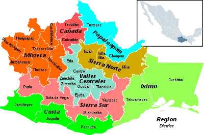
 Oaxaca regions and districts: Sierra Norte to the Northeast | |
| Coordinates: 17°19′50″N 96°29′14″W / 17.33056°N 96.48722°W | |
| Country | |
| State | Oaxaca |
Ixtlán District is located in the Sierra Norte region, in the northeastern area of the State of Oaxaca, Mexico.
The district includes 26 municipalities, bringing together a total of 161 settlements. At the 2000 census, they contained a total of 40,218 inhabitants, the majority of whom were indigenous Zapotec speakers.[1]
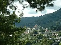
 Scenery near Santo Domingo Cacalotepec
 Entrance to church in Capulalpam de Méndez
 Main street of Guelatao de Juarez
 General view of Ixtlan de Juárez
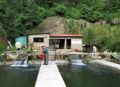
 An economically sustainable, community-owned fish farm, located near Ixtlan.
 The Cloud Forest of Santiago Comaltepec is some of the best conserved in the world
Municipalities

Municipalities of Ixtlán District
The district includes the following municipalities:[2]
- Abejones
- Capulalpam de Méndez
- Evangelista Analco
- Guelatao de Juárez
- Ixtlán de Juárez
- Natividad
- Nuevo Zoquiapam
- San Juan Atepec
- San Juan Chicomezúchil
- San Juan Quiotepec
- San Miguel Aloápam
- San Miguel Amatlán
- San Miguel del Río
- San Miguel Yotao
- San Pablo Macuiltianguis
- San Pedro Yaneri
- San Pedro Yólox
- Santa Ana Yareni
- Santa Catarina Ixtepeji
- Santa Catarina Lachatao
- Santa María Jaltianguis
- Santa María Yavesía
- Santiago Comaltepec
- Santiago Laxopa
- Santiago Xiacuí
- Teococuilco de Marcos Pérez
See also
References
- ↑ El Premio Gobierno y Gestión Local. "Associatióon de Municipios del Distrito de Ixtlán de Juárez". Archived from the original on 2009-12-28. Retrieved 2010-07-08. (in Spanish)
- ↑ "Enciclopedia de los Municipios de México: Estado de Oaxaca". Archived from the original on 2010-07-10. Retrieved 2010-07-08.
This article is issued from Wikipedia. The text is licensed under Creative Commons - Attribution - Sharealike. Additional terms may apply for the media files.