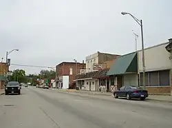
Illinois Route 170 | ||||
|---|---|---|---|---|
IL 170 highlighted in red | ||||
| Route information | ||||
| Maintained by IDOT | ||||
| Length | 25.00 mi[1] (40.23 km) | |||
| Existed | 1946[2]–present | |||
| Major junctions | ||||
| South end | ||||
| North end | ||||
| Location | ||||
| Country | United States | |||
| State | Illinois | |||
| Counties | Livingston, LaSalle | |||
| Highway system | ||||
| ||||
Illinois Route 170 is a north–south state road in north-central Illinois. It runs from Illinois Route 23 well north of Pontiac to U.S. Route 6 in Seneca. This is a distance of 25.00 miles (40.23 km).[1]
Route description

Illinois 170 is a rural, two-lane surface road for its entire length. The road crosses Illinois River via a four-span truss bridge.[3] As of May 5, 2006, the Illinois Department of Transportation is looking to replace the 74-year-old bridge.[4] The old bridge was imploded on November 18, 2010.
History
SBI Route 160 originally ran from Red Bud to Sparta; this became Illinois Route 154 in 1937. In 1946, it replaced Illinois Route 186 (previously Illinois Route 70A) from Seneca south to Illinois Route 17 near Budd.[5][6][7] In 1995 Illinois 170 was extended further south to Illinois 23.[2]
Major Intersections
| County | Location | mi[8] | km | Destinations | Notes |
|---|---|---|---|---|---|
| Livingston | | 0.0 | 0.0 | ||
| | 7.2 | 11.6 | |||
| LaSalle | Seneca | 25.00 | 40.23 | ||
| 1.000 mi = 1.609 km; 1.000 km = 0.621 mi | |||||
References
- 1 2 Illinois Technology Transfer Center (2006). "T2 GIS Data". Retrieved 2007-11-08.
- 1 2 Carlson, Rich (2005-04-15). "Illinois Highways Page: Routes 161 through 180". Retrieved 2006-08-14.
- ↑ Baughn, James; et al. (2006-01-09). "Historic Bridges of the U.S. – Seneca Bridge, LaSalle County, Illinois". Retrieved 2006-08-15.
- ↑ Illinois Department of Transportation (2006-05-05). "Open House Public Hearing Meeting: For Removal And Replacement Of The Illinois 170 Bridge Over The Illinois River In Seneca". Retrieved 2006-08-15.
- ↑ Illinois Secretary of State; Rand McNally (1936). Road Map Illinois (Map). [c. 1:950,000 and c. 1:1,110,000]. Springfield: Illinois Secretary of State – via Illinois Digital Archives.
- ↑ Illinois Secretary of State; Rand McNally (1939). Illinois Road Map (Map) (1939–1940 ed.). c. 1:918,720. Springfield: Illinois Secretary of State – via Illinois Digital Archives.
- ↑ Illinois Secretary of State; Rand McNally (1946). Illinois Road Map (Map). c. 1:918,720. Springfield: Illinois Secretary of State – via Illinois Digital Archives.
- ↑ Google (March 9, 2017). "Overview Map of IL 170" (Map). Google Maps. Google. Retrieved March 9, 2017.
