Huishui County
惠水县 | |
|---|---|
.jpg.webp) | |
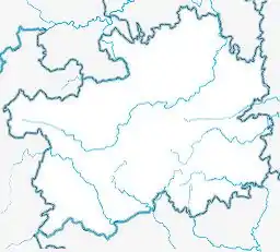
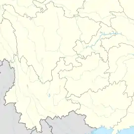
 Huishui Location of the seat in Guizhou  Huishui Huishui (Southwest China) | |
| Coordinates (Huishui County government): 26°07′55″N 106°39′25″E / 26.1320°N 106.6570°E | |
| Country | People's Republic of China |
| Province | Guizhou |
| Autonomous prefecture | Qiannan |
| Area | |
| • Total | 2,463.8 km2 (951.3 sq mi) |
| Highest elevation [1] (Longtanshan (龙塘山)) | 1,690.7 m (5,546.9 ft) |
| Lowest elevation [1] (Dachang River) | 666 m (2,185 ft) |
| Population (2010) | |
| • Total | 476,900 |
| • Density | 190/km2 (500/sq mi) |
| Time zone | UTC+8 (China Standard) |
| Website | www |
Huishui (Chinese: 惠水; pinyin: Huìshuǐ) is a county of south-central Guizhou province, China. It is under the administration of the Qiannan Buyei and Miao Autonomous Prefecture. 61% of its 476,900 population are minorities, including Bouyei, Miao, Hui, Zhuang, Sui, Bai, and Maonan.[2] In 1372 it was the seat of the historic Chengfan commandery (程番府).[3]
Within Guizhou it is noted for its orange cultivation.
The gecko species Hemiphyllodactylus huishuiensis was first discovered in, and named after Huishui.[4] A locally distributed species of Gesneriaceae plants was only found in Huishui.[5]
Administrative divisions
Huizhou governs 8 towns and 3 subdistricts:[6]
- Lianjiang subdistrict (涟江街道)
- Mengjiang subdistrict (濛江街道)
- Mingtian subdistrict (明田街道)
- Haohuahong town (好花红镇)
- Baijin town (摆金镇)
- Yashui town (雅水镇)
- Duanshan town (断杉镇)
- Lushan town (芦山镇)
- Wangyou town (王佑镇)
- Xiantang town (羡塘镇)
- Gangdu town (岗度镇)
Climate
| Climate data for Huishui (1991–2020 normals, extremes 1981–2010) | |||||||||||||
|---|---|---|---|---|---|---|---|---|---|---|---|---|---|
| Month | Jan | Feb | Mar | Apr | May | Jun | Jul | Aug | Sep | Oct | Nov | Dec | Year |
| Record high °C (°F) | 23.4 (74.1) |
29.9 (85.8) |
31.6 (88.9) |
33.7 (92.7) |
35.0 (95.0) |
34.2 (93.6) |
34.8 (94.6) |
35.3 (95.5) |
34.8 (94.6) |
31.3 (88.3) |
28.2 (82.8) |
27.0 (80.6) |
35.3 (95.5) |
| Mean daily maximum °C (°F) | 10.0 (50.0) |
13.4 (56.1) |
17.8 (64.0) |
23.0 (73.4) |
25.6 (78.1) |
27.3 (81.1) |
29.0 (84.2) |
29.2 (84.6) |
26.6 (79.9) |
21.5 (70.7) |
17.7 (63.9) |
12.2 (54.0) |
21.1 (70.0) |
| Daily mean °C (°F) | 6.1 (43.0) |
8.8 (47.8) |
12.6 (54.7) |
17.5 (63.5) |
20.6 (69.1) |
22.8 (73.0) |
24.2 (75.6) |
23.8 (74.8) |
21.2 (70.2) |
17.0 (62.6) |
12.9 (55.2) |
7.9 (46.2) |
16.3 (61.3) |
| Mean daily minimum °C (°F) | 3.7 (38.7) |
5.7 (42.3) |
9.1 (48.4) |
13.7 (56.7) |
16.8 (62.2) |
19.6 (67.3) |
21.0 (69.8) |
20.2 (68.4) |
17.5 (63.5) |
14.0 (57.2) |
9.6 (49.3) |
5.1 (41.2) |
13.0 (55.4) |
| Record low °C (°F) | −5.1 (22.8) |
−3.5 (25.7) |
−2.9 (26.8) |
3.0 (37.4) |
6.0 (42.8) |
11.5 (52.7) |
12.0 (53.6) |
13.8 (56.8) |
7.9 (46.2) |
2.6 (36.7) |
−2.1 (28.2) |
−6.9 (19.6) |
−6.9 (19.6) |
| Average precipitation mm (inches) | 24.1 (0.95) |
20.3 (0.80) |
43.5 (1.71) |
73.8 (2.91) |
195.8 (7.71) |
267.9 (10.55) |
222.0 (8.74) |
135.3 (5.33) |
100.5 (3.96) |
86.8 (3.42) |
39.5 (1.56) |
18.8 (0.74) |
1,228.3 (48.38) |
| Average precipitation days (≥ 0.1 mm) | 13.3 | 11.2 | 13.9 | 14.4 | 17.1 | 18.0 | 17.1 | 15.0 | 11.6 | 14.6 | 10.3 | 10.2 | 166.7 |
| Average snowy days | 2.3 | 0.8 | 0.3 | 0 | 0 | 0 | 0 | 0 | 0 | 0 | 0 | 0.5 | 3.9 |
| Average relative humidity (%) | 80 | 77 | 76 | 75 | 77 | 81 | 81 | 80 | 79 | 81 | 79 | 78 | 79 |
| Mean monthly sunshine hours | 36.6 | 55.6 | 78.3 | 107.9 | 115.4 | 91.4 | 139.0 | 158.9 | 128.9 | 82.1 | 81.0 | 58.0 | 1,133.1 |
| Percent possible sunshine | 11 | 18 | 21 | 28 | 28 | 22 | 33 | 40 | 35 | 23 | 25 | 18 | 25 |
| Source: China Meteorological Administration[7][8] | |||||||||||||
Transport
References
- 1 2 "惠水县人民政府-自然地理".
- ↑ "惠水县人口民族情况".
- ↑ 牛平汉 (1997). 明代政区沿革综表 (in Chinese). 中国地图出版社. ISBN 978-7-5031-1540-0.
- ↑ Yan, Jie; Lin, Yubo; Guo, Weibo; Li, Peng; Zhou, Kaiya (2016-06-02). "A new species of Hemiphyllodactylus Bleeker, 1860 (Squamata: Gekkonidae) from Guizhou, China". Zootaxa. 4117 (4): 543–554. doi:10.11646/zootaxa.4117.4.6. ISSN 1175-5334. PMID 27395192.
- ↑ Wen, Fang; Maciejewski, Stephen E.; He, Xiang-Qian; Han, Jing; Wei, Yi-Gang (2015-03-06). "Briggsia leiophylla , a new species of Gesneriaceae from southern Guizhou, China". Phytotaxa. 202 (1): 51–56. doi:10.11646/phytotaxa.202.1.6. ISSN 1179-3163.
- ↑ "2020年统计用区划代码". www.stats.gov.cn. Retrieved 2021-02-15.
- ↑ 中国气象数据网 – WeatherBk Data (in Simplified Chinese). China Meteorological Administration. Retrieved 28 April 2023.
- ↑ 中国气象数据网 (in Simplified Chinese). China Meteorological Administration. Retrieved 28 April 2023.
This article is issued from Wikipedia. The text is licensed under Creative Commons - Attribution - Sharealike. Additional terms may apply for the media files.