Hrianykivka
Гряниківка | |
|---|---|
 Hrianykivka  Hrianykivka | |
| Coordinates: 49°50′44″N 37°42′50″E / 49.84556°N 37.71389°E | |
| Country | |
| Oblast | |
| Raion | |
| Founded | 1825 |
| Government | |
| • Type | Dvorichna settlement hromada |
| Area | |
| • Total | 0.737 km2 (0.285 sq mi) |
| Elevation | 82 m (269 ft) |
| Population | |
| • Total | 607 |
| • Density | 820/km2 (2,100/sq mi) |
| Time zone | UTC+2 (EET) |
| • Summer (DST) | UTC+3 (EEST) |
| Postal code | 62731 |
| Area code | +380 5750 |
| KOATUU code | 6321885503 |
| KATOTTH code | UA63080050110044547[2] |
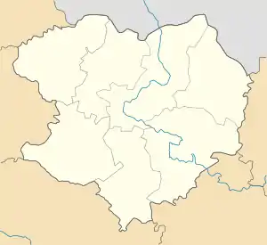
Hrianykivka (Ukrainian: Гряниківка; Russian: Гряниковка, romanized: Gryanikovka) is a village in Kupiansk Raion, Kharkiv Oblast, Ukraine. It is 105 km (65 mi) east of the centre of Kharkiv city.
The village came under attack by Russian forces in 2022, during the Russian invasion of Ukraine;[3] Ukrainian forces recaptured it in September 2022, before it was again captured by Russian forces in February 2023.[4][5]
See also
- List of nearby settlements
References
- ↑ Distribution of the population by native language on ukrcensus.gov.ua
- ↑ "Дворічанська територіальна громада" [Dvorichan territorial community] (in Ukrainian). Decentralisation in Ukraine. 2022. p. 1. Retrieved 6 June 2023.
- ↑ Kateryna Stepanenko; Katherine Lawlor; Grace Mappes; George Barros; Frederick W. Kagan (15 September 2022). "Russian Offensive Campaign Assessment, September 15". understandingwar.org. ISW. Retrieved 16 September 2022.
A confirmed Ukrainian position in Hryanykivka would indicate that the Russian frontline east of the Oskil River is weak and/or that Russian forces' lines in this area are farther east of the Oskil River than previously assessed.
- ↑ "Russia says its forces capture village in Ukraine's Kharkiv region". Reuters. 18 February 2023. Retrieved 10 May 2023.
- ↑ See the detailed map.
This article is issued from Wikipedia. The text is licensed under Creative Commons - Attribution - Sharealike. Additional terms may apply for the media files.