Isla Holbox | |
|---|---|
Island community | |
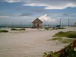
 Isla Holbox in June, 2008 | |
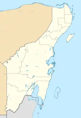
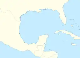
 Isla Holbox Location of Isla Holbox  Isla Holbox Isla Holbox (Mexico)  Isla Holbox Isla Holbox (Gulf of Mexico) | |
| Coordinates: 21°32′16″N 87°13′12″W / 21.53778°N 87.22000°W | |
| Country | |
| State | Quintana Roo |
| Municipality | Lázaro Cárdenas |
| Town Founded[1] | 1854 |
| Area | |
| • Land | 55.948 km2 (21.602 sq mi) |
| Elevation | 1 m (3 ft) |
| Population (2005)[3] | |
| • Total | 1,198 |
| Demonym | Holboxeños[1] |
| Time zone | UTC-6 (Central Standard Time) |
| • Summer (DST) | UTC-5 (Central Daylight Time) |
| Area code | 984 |
Holbox (Spanish pronunciation: [xolˈβoʃ], "black hole" in Yucatec Maya) is an island in the Mexican state of Quintana Roo, located on the north coast of the Yucatán Peninsula. It is approximately 41.84 kilometres (26.00 miles) long and 1.5 kilometres (0.9 miles) wide, and it is separated from the mainland by 10 km of shallow lagoon that is home to flamingos, pelicans and other rich birdlife. Holbox Island is part of the Municipality of Lázaro Cárdenas and also part of the Yum Balam Biosphere Reserve.
The island's main industry is fishing. However, the island is developing a growing tourist industry in the form of whale shark viewing. Lobster is the main product of this fishing and many of the dishes made on the island center around lobster or other seafood.
.jpg.webp)
The island is accessed by ferry from the mainland town of Chiquilá,[4] and has virtually no cars, with transport by most residents and tourists by golf cart or moped. A few charter airlines fly to Holbox from Cancún and Playa del Carmen; there is a small airstrip called Holbox Aerodrome that can accommodate five-seater and 13-seater Cessna aircraft.
Vehicle entry is not allowed at Holbox in order to protect the environment and to prevent the streets from accumulating sand.
Holbox has several alternatives to enjoy nature, but the one that attracts most visitors is the experience of swimming with the impressive whale shark from June to September, an opportunity found in very few parts of the world. During hurricane season, the island is often evacuated as it can get directly damaged by hurricane winds.
History
The first written mentions of the island were in 1852 from a document sent by Don Bartolomé Magaña to the Governor of Yucatán. The adjacent mainland was frequently attacked by the Maya therefore people sought refuge on this island. The government wanted to keep people from living on this island but the citizens refused to leave their homes. Hurricanes in 1886 completely destroyed the island, but the island was rebuilt afterward.[5]
Kiteboarding in Holbox
Holbox has one of the safest beaches for learning how to kiteboard. Conditions are ideal for beginners, as the beach has shallow waters, no big obstacles on the wide and long beach, many days of wind during the winter months, and a nearby school with professional instructors. Advanced riders can find also very good conditions when the north or south winds reach 25 knots or more. The climate is subhumid warm, creating a stable and consistent temperature year-round.
Bioluminescence
At the western tip of the island, there is a lagoon called Punta Cocos, where bioluminescence can be observed on dark nights.[6] See the ![]() Holbox travel guide from Wikivoyage.
Holbox travel guide from Wikivoyage.
Gallery
.jpg.webp) Palms, Beach and the Sea
Palms, Beach and the Sea.jpg.webp) Holbox city aerial
Holbox city aerial.jpg.webp) Sandy streets of Holbox
Sandy streets of Holbox.jpg.webp) Aerial view of Holbox
Aerial view of Holbox Holbox beaches
.jpg.webp) Sunset in Holbox, Mexico
Sunset in Holbox, Mexico Aerial view of Holbox
 Sandbank in Holbox
References
- 1 2 "History of Holbox Island in spanish". Archived from the original on 2009-10-01. Retrieved 2009-11-14.
- ↑ Land area of islands in Mexico Archived 2011-07-22 at the Wayback Machine INEGI
- ↑ Census Results by Locality, 2005 Archived 2011-07-22 at the Wayback Machine INEGI.
- ↑ "How to get to Isla Holbox? used". wavesnbackpack. Retrieved 28 March 2017.
- ↑ Administrator. "History". www.holbox.gob.mx. Retrieved 2017-05-01.
- ↑ "Sights in Isla Holbox". Lonely Planet.
